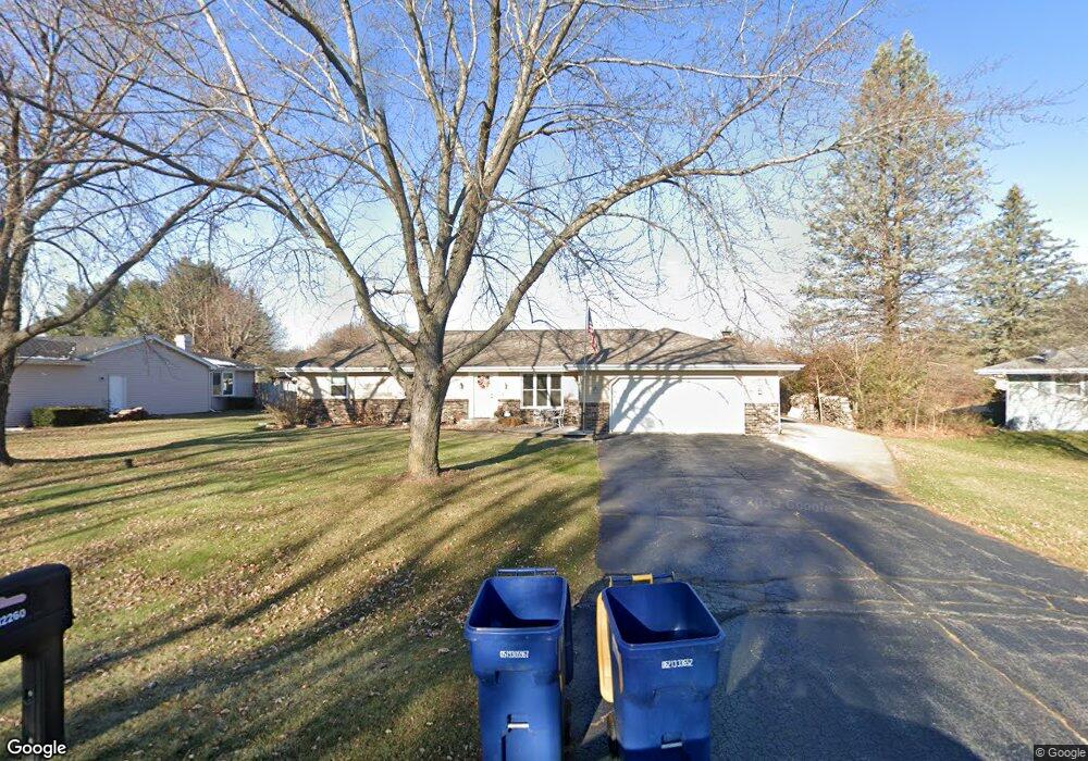
12260 Rae Ann Rd Roscoe, IL 61073
Estimated Value: $277,000 - $297,000
3
Beds
2
Baths
1,596
Sq Ft
$180/Sq Ft
Est. Value
About This Home
This home is located at 12260 Rae Ann Rd, Roscoe, IL 61073 and is currently estimated at $287,764, approximately $180 per square foot. 12260 Rae Ann Rd is a home located in Winnebago County with nearby schools including Ledgewood Elementary School, Kinnikinnick School, and Stone Creek School.
Ownership History
Date
Name
Owned For
Owner Type
Purchase Details
Closed on
Jul 8, 2019
Sold by
Pixler Family Revocable Trust
Bought by
Bumber Shane and Bumber Theresa
Current Estimated Value
Home Financials for this Owner
Home Financials are based on the most recent Mortgage that was taken out on this home.
Original Mortgage
$125,000
Outstanding Balance
$109,913
Interest Rate
4%
Mortgage Type
New Conventional
Estimated Equity
$177,851
Purchase Details
Closed on
Feb 1, 2019
Sold by
Swanson Andrew W and Swanson Carol J
Bought by
Pixler Family Trust
Purchase Details
Closed on
Jan 21, 2019
Sold by
Swanson Andrew W and Swanson Carol J
Bought by
Pixler Family Trust
Purchase Details
Closed on
Feb 16, 2000
Bought by
Pixler Shawn M and Pixler Kimberly
Create a Home Valuation Report for This Property
The Home Valuation Report is an in-depth analysis detailing your home's value as well as a comparison with similar homes in the area
Home Values in the Area
Average Home Value in this Area
Purchase History
| Date | Buyer | Sale Price | Title Company |
|---|---|---|---|
| Bumber Shane | $174,000 | None Listed On Document | |
| Pixler Family Trust | -- | Tua | |
| Pixler Family Trust | -- | Tua | |
| Pixler Family Revocable Trust | -- | Meason James E | |
| Pixler Shawn M | $115,500 | -- |
Source: Public Records
Mortgage History
| Date | Status | Borrower | Loan Amount |
|---|---|---|---|
| Open | Bumber Shane | $125,000 |
Source: Public Records
Tax History
| Year | Tax Paid | Tax Assessment Tax Assessment Total Assessment is a certain percentage of the fair market value that is determined by local assessors to be the total taxable value of land and additions on the property. | Land | Improvement |
|---|---|---|---|---|
| 2024 | $6,265 | $81,962 | $12,654 | $69,308 |
| 2022 | $5,526 | $67,241 | $10,381 | $56,860 |
| 2021 | $5,269 | $63,167 | $9,752 | $53,415 |
| 2020 | $5,165 | $60,872 | $9,398 | $51,474 |
| 2019 | $5,020 | $58,145 | $8,977 | $49,168 |
| 2018 | $4,721 | $55,871 | $8,626 | $47,245 |
| 2017 | $4,858 | $53,888 | $8,320 | $45,568 |
| 2016 | $4,657 | $0 | $0 | $0 |
| 2015 | $4,457 | $51,509 | $7,953 | $43,556 |
| 2014 | $4,106 | $50,858 | $7,852 | $43,006 |
Source: Public Records
Map
Nearby Homes
- 4338 Honey Locust Ln
- 11818 Balsa Ln
- 4361 Pfister Ln
- 4593 Woodcrest Ln
- 9.41 Acres Bluestem Rd
- 11740 River Hills Pkwy
- 1245 Aldrin Rd
- 11578 Edgemere Terrace
- 11216 Lemon Grass Ln
- 11870 River Hills Pkwy Unit 29
- 11392 Edgemere Terrace
- 10458 Main St
- 10853 Lemon Grass Ln
- 4564 E Rockton Rd
- 549 Bayfield Rd
- 10662 Chicory Ridge Way
- 614 Bayfield Rd
- 13699 Chevron Dr
- 5683 Oak Village Dr Unit 5683
- 617 Queens Ct Unit 7617
- 12248 Rae Ann Rd
- 4127 Valerie Rd
- 12222 Rae Ann Rd
- 4093 Valerie Rd
- 4163 Valerie Rd
- 12255 Rae Ann Rd
- 12180 Rae Ann Rd
- 12237 Rae Ann Rd
- 4118 Valerie Rd
- 3767 Doreen Dr
- 4134 Valerie Rd
- 4104 Valerie Rd
- 4075 Valerie Rd
- 12223 Rae Ann Rd
- 4158 Valerie Rd
- 4082 Valerie Rd
- 12205 Rae Ann Rd
- 4176 Valerie Rd
- 12195 Rae Ann Rd
- 12140 Tresemer Rd
Your Personal Tour Guide
Ask me questions while you tour the home.