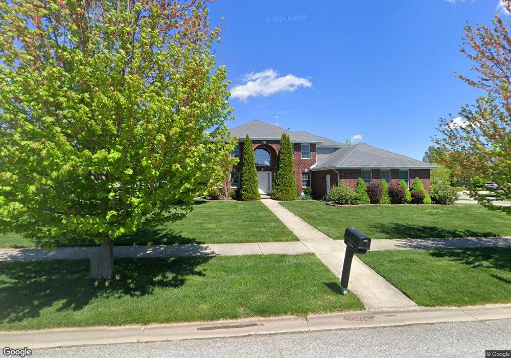
12260 W 105th Cir Saint John, IN 46373
Saint John NeighborhoodEstimated Value: $523,000 - $593,000
4
Beds
4
Baths
2,994
Sq Ft
$182/Sq Ft
Est. Value
About This Home
This home is located at 12260 W 105th Cir, Saint John, IN 46373 and is currently estimated at $544,148, approximately $181 per square foot. 12260 W 105th Cir is a home located in Lake County with nearby schools including Lincoln Elementary School, Hanover Central Middle School, and Hanover Central High School.
Ownership History
Date
Name
Owned For
Owner Type
Purchase Details
Closed on
Jul 15, 2008
Sold by
First National Bank Of Illinois
Bought by
Anderson Mark S and Anderson Lisa M
Current Estimated Value
Home Financials for this Owner
Home Financials are based on the most recent Mortgage that was taken out on this home.
Original Mortgage
$267,000
Outstanding Balance
$174,764
Interest Rate
6.36%
Mortgage Type
Purchase Money Mortgage
Estimated Equity
$369,384
Purchase Details
Closed on
Jul 18, 2005
Sold by
Peoples Bank Sb
Bought by
K & D Development Co Inc
Create a Home Valuation Report for This Property
The Home Valuation Report is an in-depth analysis detailing your home's value as well as a comparison with similar homes in the area
Home Values in the Area
Average Home Value in this Area
Purchase History
| Date | Buyer | Sale Price | Title Company |
|---|---|---|---|
| Anderson Mark S | -- | Ticor Title Insurance | |
| K & D Development Co Inc | -- | Ticor |
Source: Public Records
Mortgage History
| Date | Status | Borrower | Loan Amount |
|---|---|---|---|
| Open | Anderson Mark S | $267,000 |
Source: Public Records
Tax History Compared to Growth
Tax History
| Year | Tax Paid | Tax Assessment Tax Assessment Total Assessment is a certain percentage of the fair market value that is determined by local assessors to be the total taxable value of land and additions on the property. | Land | Improvement |
|---|---|---|---|---|
| 2024 | $10,142 | $433,000 | $98,000 | $335,000 |
| 2023 | $4,950 | $427,500 | $98,000 | $329,500 |
| 2022 | $4,950 | $407,700 | $98,000 | $309,700 |
| 2021 | $4,949 | $401,000 | $98,000 | $303,000 |
| 2020 | $4,960 | $393,300 | $98,000 | $295,300 |
| 2019 | $4,522 | $384,800 | $98,000 | $286,800 |
| 2018 | $5,106 | $373,900 | $98,000 | $275,900 |
| 2017 | $5,440 | $376,400 | $98,000 | $278,400 |
| 2016 | $5,157 | $368,300 | $98,000 | $270,300 |
| 2014 | $4,544 | $360,300 | $98,000 | $262,300 |
| 2013 | $4,710 | $359,100 | $98,000 | $261,100 |
Source: Public Records
Map
Nearby Homes
- 10717 Maloian Dr
- 10746 Knickerbocker Ct
- 12268 W 107th Ln
- 10788 Knickerbocker Ct
- 10837 Maloian Dr
- 10888 Wachter Ct
- 10043 Northcote Ct
- 12904 W 109th Ave
- 12914 W 109th Ave
- 13001 109th Ave
- 13351 W 107th Ave
- 9966 Olcott Ave
- 11031 Delta Dr
- 13071 W 109th Ave
- 12957 109th Place
- 13085 109th Ave
- 10919 Huron St
- 11009 W 105th Place
- 11324 Valley Dr
- The Torbet Plan at The Preserve
- 10530 Northcote Dr
- 10515 Northcote Dr
- 12300 W 105th Cir
- 12255 W 105th Cir
- 12305 W 105th Cir
- 10551 Northcote Dr
- 10520 Northcote Dr
- 10520 Northcote Dr
- 12330 W 105th Cir
- 10547 Northcote Dr
- 10561 Northcote Dr
- 12315 W 105th Cir
- 10571 Northcote Dr
- 12233 W 105th St
- 10510 Northcote Dr
- 12245 W 105th St
- 12221 W 105th St
- 12423 W 105th Cir
- 12360 W 105th Cir
- 12415 W 105th Cir