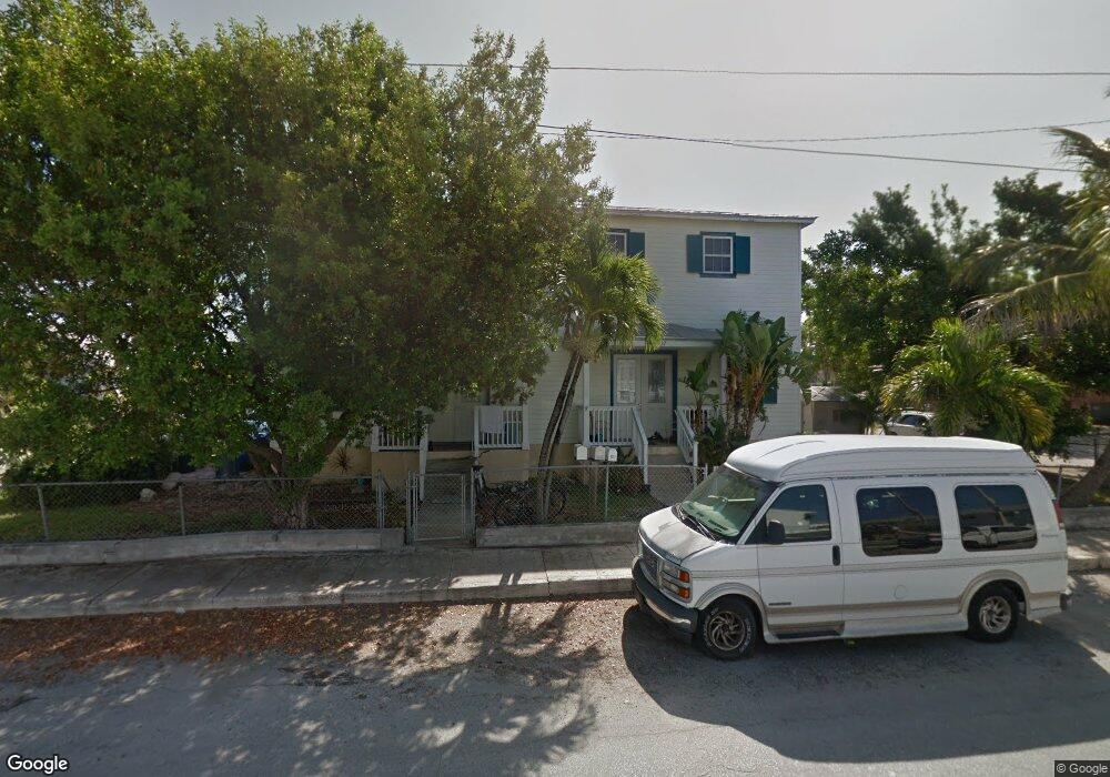
1227 1st St Key West, FL 33040
Mid Town NeighborhoodEstimated Value: $1,394,000 - $1,589,000
3
Beds
6
Baths
3,692
Sq Ft
$403/Sq Ft
Est. Value
About This Home
This home is located at 1227 1st St, Key West, FL 33040 and is currently estimated at $1,488,333, approximately $403 per square foot. 1227 1st St is a home located in Monroe County with nearby schools including Horace O'Bryant School, Key West High School, and May Sands Montessori School.
Ownership History
Date
Name
Owned For
Owner Type
Purchase Details
Closed on
Oct 1, 1988
Bought by
Romo Jesus G and Romo Karen W
Current Estimated Value
Purchase Details
Closed on
Feb 1, 1975
Bought by
Romo Jesus G and Romo Karen W
Create a Home Valuation Report for This Property
The Home Valuation Report is an in-depth analysis detailing your home's value as well as a comparison with similar homes in the area
Home Values in the Area
Average Home Value in this Area
Purchase History
| Date | Buyer | Sale Price | Title Company |
|---|---|---|---|
| Romo Jesus G | $43,000 | -- | |
| Romo Jesus G | $28,900 | -- |
Source: Public Records
Tax History
| Year | Tax Paid | Tax Assessment Tax Assessment Total Assessment is a certain percentage of the fair market value that is determined by local assessors to be the total taxable value of land and additions on the property. | Land | Improvement |
|---|---|---|---|---|
| 2025 | $8,588 | $874,381 | $446,278 | $428,103 |
| 2024 | $8,252 | $868,372 | $423,274 | $445,098 |
| 2023 | $8,252 | $856,052 | $418,673 | $437,379 |
| 2022 | $7,563 | $801,517 | $358,862 | $442,655 |
| 2021 | $7,074 | $661,236 | $273,748 | $387,488 |
| 2020 | $6,951 | $663,456 | $271,447 | $392,009 |
| 2019 | $6,409 | $584,748 | $205,886 | $378,862 |
| 2018 | $6,798 | $617,840 | $230,040 | $387,800 |
| 2017 | $6,792 | $606,258 | $0 | $0 |
| 2016 | $6,825 | $582,342 | $0 | $0 |
| 2015 | $6,624 | $567,454 | $0 | $0 |
| 2014 | $6,180 | $473,945 | $0 | $0 |
Source: Public Records
Map
Nearby Homes
- 1920 Patterson Ave
- 1925 Fogarty Ave
- 2004 Patterson Ave
- 2016 Fogarty Ave
- 1830 Fogarty Ave Unit 4
- 2012 Roosevelt Dr
- 2016 Roosevelt Dr
- 2105 Fogarty Ave
- 1718 United St
- 1708 Duncan St
- 1704 Duncan St
- 1706 Seminary St
- 1719 Washington St
- 1703 South St
- 2007 Flagler Ave
- 1609 United St
- 1705 von Phister St
- 1229 5th St
- 2119 Flagler Ave
- 1610 South St
- 1909 Patterson Ave
- 1907 Patterson Ave
- 1223 1st St
- 1223 First St
- 1221 1st St
- 1908 Roosevelt Dr
- 1911 Patterson Ave
- 1906 Roosevelt Dr
- 1913 Patterson Ave
- 1902 Patterson Ave
- 1900 Patterson Ave
- 1908 Patterson Ave
- 1912 Roosevelt Dr
- 1912 Patterson Ave
- 1917 Patterson Ave
- 1916 Patterson Ave
- 1901 Roosevelt Dr Unit 104N
- 1277 1st St Unit 1
- 1277 1st St Unit 201
- 1909 Roosevelt Dr
Your Personal Tour Guide
Ask me questions while you tour the home.