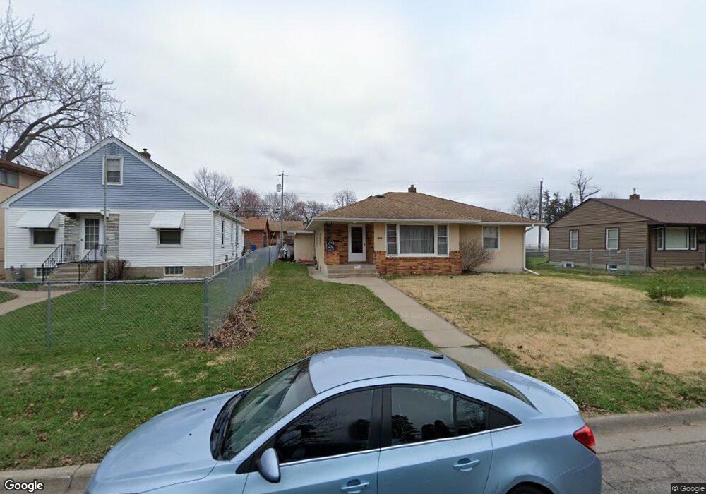
1227 6th Ave S South St. Paul, MN 55075
Estimated Value: $309,000 - $331,072
3
Beds
2
Baths
1,532
Sq Ft
$209/Sq Ft
Est. Value
About This Home
This home is located at 1227 6th Ave S, South St. Paul, MN 55075 and is currently estimated at $320,018, approximately $208 per square foot. 1227 6th Ave S is a home located in Dakota County with nearby schools including Kaposia Education Center Elementary, South St. Paul Secondary, and Discovery Charter School.
Ownership History
Date
Name
Owned For
Owner Type
Purchase Details
Closed on
Feb 28, 2005
Sold by
Rosario Daniel S
Bought by
Her Aaron Lee and Yang Kao Doua
Current Estimated Value
Purchase Details
Closed on
May 29, 2002
Sold by
Knudson Catherine
Bought by
Rosario Daniel S
Create a Home Valuation Report for This Property
The Home Valuation Report is an in-depth analysis detailing your home's value as well as a comparison with similar homes in the area
Home Values in the Area
Average Home Value in this Area
Purchase History
| Date | Buyer | Sale Price | Title Company |
|---|---|---|---|
| Her Aaron Lee | $213,000 | -- | |
| Rosario Daniel S | $179,900 | -- |
Source: Public Records
Tax History Compared to Growth
Tax History
| Year | Tax Paid | Tax Assessment Tax Assessment Total Assessment is a certain percentage of the fair market value that is determined by local assessors to be the total taxable value of land and additions on the property. | Land | Improvement |
|---|---|---|---|---|
| 2024 | $4,638 | $334,500 | $65,600 | $268,900 |
| 2023 | $4,638 | $331,400 | $66,000 | $265,400 |
| 2022 | $3,626 | $315,600 | $64,600 | $251,000 |
| 2021 | $3,640 | $260,500 | $56,100 | $204,400 |
| 2020 | $3,388 | $256,300 | $53,500 | $202,800 |
| 2019 | $3,036 | $256,800 | $50,900 | $205,900 |
| 2018 | $2,918 | $224,100 | $46,300 | $177,800 |
| 2017 | $2,543 | $208,400 | $44,100 | $164,300 |
| 2016 | $2,436 | $188,800 | $40,100 | $148,700 |
| 2015 | $2,272 | $154,055 | $33,532 | $120,523 |
| 2014 | -- | $152,420 | $33,462 | $118,958 |
| 2013 | -- | $129,312 | $28,435 | $100,877 |
Source: Public Records
Map
Nearby Homes
- 1215 8th Ave S
- 233 Richmond St W
- 1127 9th Ave S
- 1436 5th Ave S
- 101 Frost St W
- 5472 Bryce Ave
- 1456 6th Ave S
- 1434 8th Ave S
- 100 W Warburton St
- 928 8th Ave S
- 151 Park St W
- 235 9th St S
- 137 South St E
- 5938 Burke Trail
- 4970 Boyd Ave
- 5903 Bryant Ln
- 6050 Cahill Ave
- 5870 Blackberry Bridge Path
- 1403 Concord St S Unit 1
- 4898 Bitterman Path Unit 9101
- 1227 6th Ave S
- 1219 6th Ave S
- 1233 6th Ave S
- 1215 6th Ave S
- 1215 6th Ave S Unit 1217
- 1227 1227 6th-Avenue-s
- 1228 1228 6th Ave S
- 1237 6th Ave S
- 1213 6th Ave S
- 1228 5th Ave S
- 1222 5th Ave S
- 1228 1228 5th Ave S
- 1241 6th Ave S
- 1241 1241 6th-Avenue-s
- 1218 5th Ave S
- 1218 1218 5th-Avenue-
- 1218 1218 5th-Avenue-s
- 1234 5th Ave S
- 1210 1210 6th Ave S
- 1210 1210 6th-Avenue-s