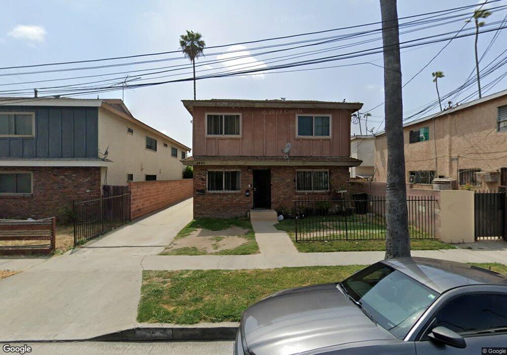
1227 S Flower St Unit A Inglewood, CA 90301
Estimated Value: $785,000 - $1,187,000
2
Beds
2
Baths
1,200
Sq Ft
$794/Sq Ft
Est. Value
About This Home
This home is located at 1227 S Flower St Unit A, Inglewood, CA 90301 and is currently estimated at $953,364, approximately $794 per square foot. 1227 S Flower St Unit A is a home located in Los Angeles County with nearby schools including Payne (Beulah) Elementary School, Crozier (George W.) Middle School, and Morningside High School.
Ownership History
Date
Name
Owned For
Owner Type
Purchase Details
Closed on
Sep 20, 2024
Sold by
Reynolds Bobby and Reynolds Nathelene
Bought by
Bobby C Reynolds And Nathelene D Reynolds Liv
Current Estimated Value
Purchase Details
Closed on
Oct 2, 1998
Sold by
Bankers Trust Company
Bought by
Reynolds Bobby and Reynolds Nathelene
Home Financials for this Owner
Home Financials are based on the most recent Mortgage that was taken out on this home.
Original Mortgage
$193,000
Interest Rate
10.5%
Purchase Details
Closed on
Jun 17, 1998
Sold by
Mitchell Dodd M
Bought by
Salomon Brothers Securities Vii Inc Mtg
Purchase Details
Closed on
Feb 9, 1994
Sold by
Mitchell Dodd M
Bought by
Mitchell Murphy D and Mitchell Shirley J
Create a Home Valuation Report for This Property
The Home Valuation Report is an in-depth analysis detailing your home's value as well as a comparison with similar homes in the area
Home Values in the Area
Average Home Value in this Area
Purchase History
| Date | Buyer | Sale Price | Title Company |
|---|---|---|---|
| Bobby C Reynolds And Nathelene D Reynolds Liv | -- | None Listed On Document | |
| Reynolds Bobby | $193,000 | -- | |
| Salomon Brothers Securities Vii Inc Mtg | $118,933 | First American Title Ins Co | |
| Mitchell Murphy D | -- | -- |
Source: Public Records
Mortgage History
| Date | Status | Borrower | Loan Amount |
|---|---|---|---|
| Previous Owner | Reynolds Bobby | $193,000 |
Source: Public Records
Tax History Compared to Growth
Tax History
| Year | Tax Paid | Tax Assessment Tax Assessment Total Assessment is a certain percentage of the fair market value that is determined by local assessors to be the total taxable value of land and additions on the property. | Land | Improvement |
|---|---|---|---|---|
| 2025 | $4,281 | $302,545 | $203,791 | $98,754 |
| 2024 | $4,281 | $296,614 | $199,796 | $96,818 |
| 2023 | $4,240 | $290,799 | $195,879 | $94,920 |
| 2022 | $4,310 | $285,098 | $192,039 | $93,059 |
| 2021 | $4,260 | $279,509 | $188,274 | $91,235 |
| 2019 | $4,016 | $271,221 | $182,691 | $88,530 |
| 2018 | $3,951 | $265,904 | $179,109 | $86,795 |
| 2016 | $3,727 | $255,581 | $172,155 | $83,426 |
| 2015 | $3,693 | $251,743 | $169,570 | $82,173 |
| 2014 | $3,695 | $246,813 | $166,249 | $80,564 |
Source: Public Records
Map
Nearby Homes
- 511 E 99th St
- 509 E 97th St
- 4077 W 103rd St
- 415 E 97th St
- 4040 W 103rd St
- 4203 W 104th St
- 1035 Myrtle Ave
- 1210 S La Brea Ave
- 1049 Larch St Unit 4
- 316 E Hardy St
- 757 Daniel Freeman Cir
- 4341 W 106th St
- 4322 W 106th St
- 10311 S Grevillea Ave
- 823 Java Ave Unit 11
- 400 E Buckthorn St
- 724 S Flower St
- 3751 W 106th St
- 1022 S Fir Ave
- 3724 W 105th St
- 1231 S Flower St Unit 3
- 1223 S Flower St
- 548 E 99th St
- 1237 S Flower St
- 1241 S Flower St
- 1222 S Flower St
- 1230 S Flower St
- 1220 S Flower St
- 1236 S Flower St
- 4115 W Century Blvd Unit 10
- 4115 W Century Blvd Unit 5
- 4115 W Century Blvd Unit 3
- 4115 W Century Blvd Unit 9
- 4115 W Century Blvd Unit 11
- 4115 W Century Blvd Unit 8
- 4115 W Century Blvd
- 4115 W Century Blvd Unit 7
- 4115 W Century Blvd Unit 1
- 4115 W Century Blvd Unit 6
- 4115 W Century Blvd Unit 4