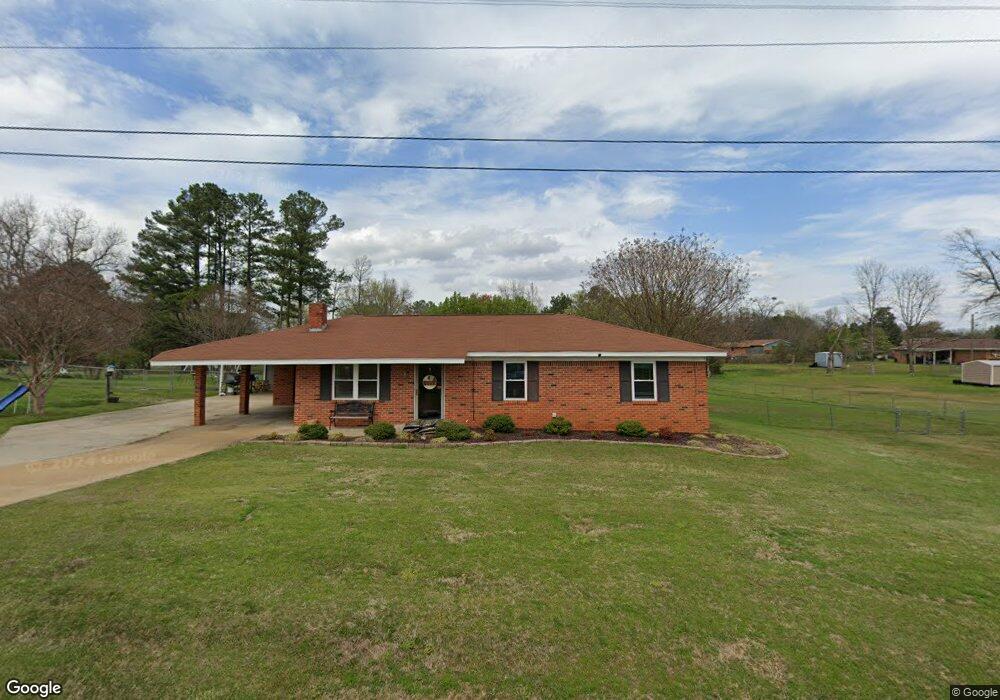
1228 Lacy Rd Columbus, MS 39702
Estimated Value: $134,715 - $175,000
Studio
1
Bath
1,423
Sq Ft
$113/Sq Ft
Est. Value
About This Home
This home is located at 1228 Lacy Rd, Columbus, MS 39702 and is currently estimated at $160,929, approximately $113 per square foot. 1228 Lacy Rd is a home.
Ownership History
Date
Name
Owned For
Owner Type
Purchase Details
Closed on
Oct 17, 2025
Sold by
Price Travis M and Price Melissa W
Bought by
Youngblood Caleb Alan and Youngblood Courtney Reagan
Current Estimated Value
Home Financials for this Owner
Home Financials are based on the most recent Mortgage that was taken out on this home.
Original Mortgage
$180,000
Outstanding Balance
$179,509
Interest Rate
6.5%
Mortgage Type
New Conventional
Estimated Equity
-$18,580
Purchase Details
Closed on
Oct 16, 2012
Sold by
Stephens Diane W and Stephens Tracy G
Bought by
Price Travis M and Price Melissa W
Purchase Details
Closed on
Nov 26, 2008
Sold by
Whaley Hazel R
Bought by
Stephens Diane W
Create a Home Valuation Report for This Property
The Home Valuation Report is an in-depth analysis detailing your home's value as well as a comparison with similar homes in the area
Purchase History
| Date | Buyer | Sale Price | Title Company |
|---|---|---|---|
| Youngblood Caleb Alan | -- | None Listed On Document | |
| Price Travis M | -- | -- | |
| Stephens Diane W | -- | -- | |
| Stephens Diane W | -- | -- |
Source: Public Records
Mortgage History
| Date | Status | Borrower | Loan Amount |
|---|---|---|---|
| Open | Youngblood Caleb Alan | $180,000 | |
| Previous Owner | Stephens Diane W | $0 | |
| Closed | Stephens Diane W | $0 |
Source: Public Records
Tax History
| Year | Tax Paid | Tax Assessment Tax Assessment Total Assessment is a certain percentage of the fair market value that is determined by local assessors to be the total taxable value of land and additions on the property. | Land | Improvement |
|---|---|---|---|---|
| 2025 | $6 | $7,558 | $0 | $0 |
| 2024 | $6 | $7,558 | $0 | $0 |
| 2023 | $0 | $6,473 | $0 | $0 |
| 2022 | $362 | $6,473 | $0 | $0 |
| 2021 | $339 | $6,473 | $0 | $0 |
| 2020 | $306 | $6,473 | $0 | $0 |
| 2019 | $341 | $6,427 | $0 | $0 |
| 2018 | $341 | $6,737 | $0 | $0 |
| 2017 | $314 | $6,737 | $0 | $0 |
| 2016 | $314 | $6,737 | $0 | $0 |
| 2015 | $324 | $6,986 | $0 | $0 |
| 2014 | $324 | $6,986 | $0 | $0 |
Source: Public Records
Map
Nearby Homes
- 7014 Highway 50 E
- 406 Pleasant Hill Rd
- 114 Crestview Cir
- 2362 Tabernacle Rd
- 72 Colby Ln
- 72 N Colby Ln
- 24 Lacy Rd
- 98 Alisha Ln
- 2746 Phillips Hill Rd
- 0 Gunshoot Rd
- 127 E Cherry St
- 83 Bowling Green Cir
- 159 Lenox Ln
- 142 Lenox Ln
- 29 Lenox Ln
- 0 Sand Rd
- 432 Old Country Ln
- 3816 Sand Rd
- 0 Pierce Rd
- 0 Poole Rd
- 1248 Lacy Rd
- 1262 Lacy Rd
- 15 Liberty Dr
- 41 Liberty Dr
- 51 Liberty Dr
- 70 Constitution Dr
- 1300 Lacy Rd
- 1185 Pleasant Hill Rd
- 77 Liberty Dr
- 14 Liberty Dr
- 77 Constitution Dr
- 40 Liberty Dr
- 52 Constitution Dr
- 1173 Pleasant Hill Rd
- 89 Liberty Dr
- 50 Liberty Dr
- 78 Liberty Dr
- 22 Constitution Dr
- 107 Liberty Dr
- 75 Constitution Dr
Your Personal Tour Guide
Ask me questions while you tour the home.