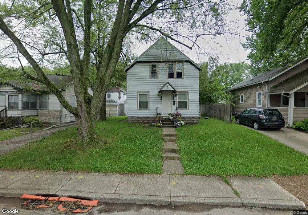
1228 Lane Blvd Kalamazoo, MI 49001
Edison NeighborhoodEstimated Value: $130,195 - $180,000
5
Beds
2
Baths
1,356
Sq Ft
$118/Sq Ft
Est. Value
About This Home
This home is located at 1228 Lane Blvd, Kalamazoo, MI 49001 and is currently estimated at $159,549, approximately $117 per square foot. 1228 Lane Blvd is a home located in Kalamazoo County with nearby schools including Milwood Elementary School, Milwood Magnet School, and Loy Norrix High School.
Ownership History
Date
Name
Owned For
Owner Type
Purchase Details
Closed on
Nov 11, 2009
Sold by
The Barker Group Llc
Bought by
Hernandez Enrique Sandoval
Current Estimated Value
Purchase Details
Closed on
Oct 30, 2009
Sold by
Stonecrest Income & Opportunity Fund I L
Bought by
The Barker Group Llc
Purchase Details
Closed on
Aug 26, 2009
Sold by
Federal National Mortgage Association
Bought by
Stonecrest Income & Opportunity Fund 1 L
Purchase Details
Closed on
Jul 7, 2008
Sold by
Everhome Mortgage Co
Bought by
Federal National Mortgage Association
Purchase Details
Closed on
Jul 3, 2008
Sold by
Clarkson Nicholas V
Bought by
Everhome Mortgage Co
Purchase Details
Closed on
Jul 15, 2004
Sold by
Felkey James and Felkey Beverly
Bought by
Clarkston Nicholas V
Create a Home Valuation Report for This Property
The Home Valuation Report is an in-depth analysis detailing your home's value as well as a comparison with similar homes in the area
Home Values in the Area
Average Home Value in this Area
Purchase History
| Date | Buyer | Sale Price | Title Company |
|---|---|---|---|
| Hernandez Enrique Sandoval | $17,000 | Chicago Title | |
| The Barker Group Llc | $1,000 | Chicago Title | |
| Stonecrest Income & Opportunity Fund 1 L | $8,342 | None Available | |
| Federal National Mortgage Association | -- | None Available | |
| Everhome Mortgage Co | $78,060 | None Available | |
| Clarkston Nicholas V | $69,900 | Metropolitan Title |
Source: Public Records
Tax History Compared to Growth
Tax History
| Year | Tax Paid | Tax Assessment Tax Assessment Total Assessment is a certain percentage of the fair market value that is determined by local assessors to be the total taxable value of land and additions on the property. | Land | Improvement |
|---|---|---|---|---|
| 2025 | $1,383 | $52,600 | $0 | $0 |
| 2024 | $573 | $41,700 | $0 | $0 |
| 2023 | $623 | $37,100 | $0 | $0 |
| 2022 | $1,381 | $31,600 | $0 | $0 |
| 2021 | $1,213 | $27,000 | $0 | $0 |
| 2020 | $1,251 | $24,500 | $0 | $0 |
| 2019 | $1,146 | $20,300 | $0 | $0 |
| 2018 | $821 | $17,300 | $0 | $0 |
| 2017 | $842 | $17,700 | $0 | $0 |
| 2016 | $842 | $17,300 | $0 | $0 |
| 2015 | $842 | $17,000 | $0 | $0 |
| 2014 | $842 | $15,800 | $0 | $0 |
Source: Public Records
Map
Nearby Homes
- 1224 Lane Blvd
- 1118 Lane Blvd
- 1939 March St
- 1118 E Alcott St
- 1424 Lay Blvd
- 1510 Palmer Ave
- 1028 Clinton Ave
- 915 Hays Park Ave
- 1719 Palmer Ave
- 1512 Race St
- 1002 Egleston Ave
- 1803 Portage St
- 1303 E Stockbridge Ave
- 1517 E Stockbridge Ave
- 923 E Stockbridge Ave
- 910 Miller Rd
- 1212 Washington Ave
- 117 E Stockbridge Ave
- 1707 E Stockbridge Ave
- 607 Reed Ave