Estimated Value: $240,000 - $290,000
2
Beds
3
Baths
1,502
Sq Ft
$179/Sq Ft
Est. Value
About This Home
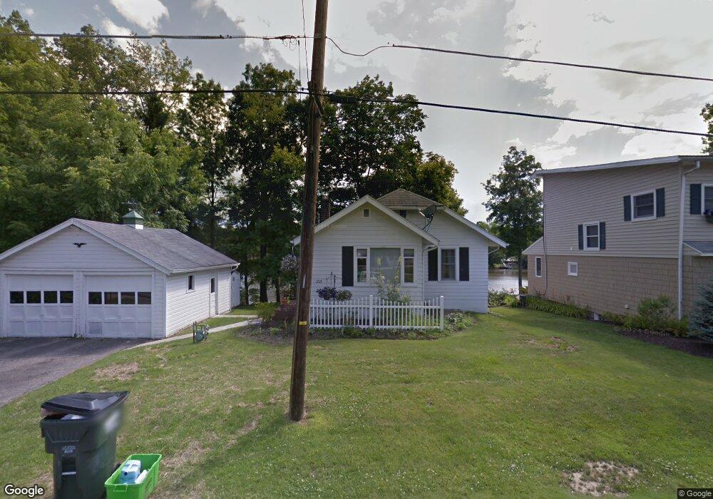
This home is located at 1228 Mac Dr, Stow, OH 44224 and is currently estimated at $268,639, approximately $178 per square foot. 1228 Mac Dr is a home located in Summit County with nearby schools including Stow-Munroe Falls High School, Primrose School of Hudson, and Cuyahoga Valley Christian Academy.
Ownership History
Date
Name
Owned For
Owner Type
Purchase Details
Closed on
Jul 31, 2021
Sold by
Heidi Der
Bought by
Der John and Der Heidi
Current Estimated Value
Purchase Details
Closed on
Jul 11, 2006
Sold by
Perrine Kay A and Perrine Dave
Bought by
Devore Heidi
Home Financials for this Owner
Home Financials are based on the most recent Mortgage that was taken out on this home.
Original Mortgage
$109,600
Interest Rate
6.73%
Mortgage Type
Purchase Money Mortgage
Purchase Details
Closed on
Jun 5, 2000
Sold by
Estate Of Frank D Sholler
Bought by
Spencer Joy A and Perrine Kay A
Create a Home Valuation Report for This Property
The Home Valuation Report is an in-depth analysis detailing your home's value as well as a comparison with similar homes in the area
Home Values in the Area
Average Home Value in this Area
Purchase History
| Date | Buyer | Sale Price | Title Company |
|---|---|---|---|
| Der John | -- | None Listed On Document | |
| Devore Heidi | $137,000 | Choice 1 Title | |
| Spencer Joy A | -- | -- |
Source: Public Records
Mortgage History
| Date | Status | Borrower | Loan Amount |
|---|---|---|---|
| Previous Owner | Devore Heidi | $109,600 |
Source: Public Records
Tax History
| Year | Tax Paid | Tax Assessment Tax Assessment Total Assessment is a certain percentage of the fair market value that is determined by local assessors to be the total taxable value of land and additions on the property. | Land | Improvement |
|---|---|---|---|---|
| 2025 | $4,653 | $82,460 | $9,583 | $72,877 |
| 2024 | $4,653 | $82,460 | $9,583 | $72,877 |
| 2023 | $4,653 | $82,460 | $9,583 | $72,877 |
| 2022 | $3,910 | $61,082 | $7,098 | $53,984 |
| 2021 | $3,664 | $61,082 | $7,098 | $53,984 |
| 2020 | $3,574 | $61,080 | $7,100 | $53,980 |
| 2019 | $3,248 | $53,850 | $7,100 | $46,750 |
| 2018 | $2,412 | $37,760 | $7,100 | $30,660 |
| 2017 | $2,169 | $37,760 | $7,100 | $30,660 |
| 2016 | $2,231 | $35,200 | $7,100 | $28,100 |
| 2015 | $2,169 | $35,200 | $7,100 | $28,100 |
| 2014 | $2,171 | $35,200 | $7,100 | $28,100 |
| 2013 | $2,512 | $41,160 | $7,100 | $34,060 |
Source: Public Records
Map
Nearby Homes
- 0 Hibbard Dr
- 1525 Spruce Hill Dr
- 5123 Sodalite Dr
- 4623 Cox Dr
- V/L Housley Rd
- 5091 Ridge Meadow Dr
- 2279 Becket Cir
- 2352 Becket Cir
- V/L Norton Rd
- 734 Barlow Rd
- 5150 Bayside Lake Blvd
- 1961 Arndale Rd
- 1953 Arndale Rd
- 2221 Crockett Cir
- 5163 Beckett Ridge
- 4424 Timberdale Dr Unit 4428
- 1995 Weston Dr
- V/L Diplomat Dr
- 5469 Sullivan Rd
- 5866 Ogilby Dr
Your Personal Tour Guide
Ask me questions while you tour the home.