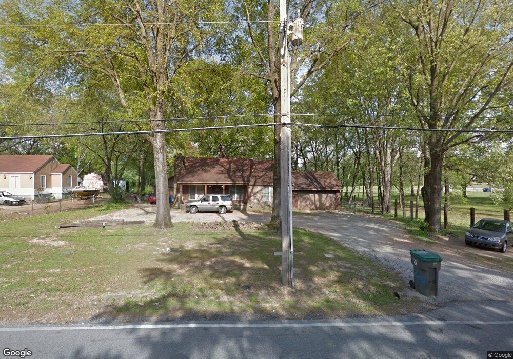
1228 Mullins Station Rd Memphis, TN 38134
Cordova NeighborhoodEstimated Value: $160,000 - $177,000
2
Beds
2
Baths
1,492
Sq Ft
$112/Sq Ft
Est. Value
About This Home
This home is located at 1228 Mullins Station Rd, Memphis, TN 38134 and is currently estimated at $167,491, approximately $112 per square foot. 1228 Mullins Station Rd is a home located in Shelby County with nearby schools including Dexter Elementary School, White Station Middle, and White Station High.
Ownership History
Date
Name
Owned For
Owner Type
Purchase Details
Closed on
Nov 15, 2018
Sold by
Parks Misty
Bought by
Longstreth Caleb and Longstreth Kaitlyn
Current Estimated Value
Purchase Details
Closed on
Aug 11, 2017
Sold by
Gaston Jo Ann
Bought by
Parks Misty
Purchase Details
Closed on
Apr 9, 2010
Sold by
Dempsey Diane
Bought by
Gaston Jo Ann
Create a Home Valuation Report for This Property
The Home Valuation Report is an in-depth analysis detailing your home's value as well as a comparison with similar homes in the area
Home Values in the Area
Average Home Value in this Area
Purchase History
| Date | Buyer | Sale Price | Title Company |
|---|---|---|---|
| Longstreth Caleb | $73,000 | None Available | |
| Parks Misty | $55,000 | None Available | |
| Gaston Jo Ann | -- | None Available |
Source: Public Records
Mortgage History
| Date | Status | Borrower | Loan Amount |
|---|---|---|---|
| Closed | Longstreth Caleb | $0 |
Source: Public Records
Tax History Compared to Growth
Tax History
| Year | Tax Paid | Tax Assessment Tax Assessment Total Assessment is a certain percentage of the fair market value that is determined by local assessors to be the total taxable value of land and additions on the property. | Land | Improvement |
|---|---|---|---|---|
| 2025 | $781 | $34,125 | $4,500 | $29,625 |
| 2024 | $781 | $23,025 | $4,400 | $18,625 |
| 2023 | $1,403 | $23,025 | $4,400 | $18,625 |
| 2022 | $1,403 | $23,025 | $4,400 | $18,625 |
| 2021 | $1,419 | $23,025 | $4,400 | $18,625 |
| 2020 | $1,413 | $19,500 | $4,400 | $15,100 |
| 2019 | $1,413 | $19,500 | $4,400 | $15,100 |
| 2018 | $1,413 | $19,500 | $4,400 | $15,100 |
| 2017 | $801 | $19,500 | $4,400 | $15,100 |
| 2016 | $780 | $17,850 | $0 | $0 |
| 2014 | $780 | $17,850 | $0 | $0 |
Source: Public Records
Map
Nearby Homes
- 1339 Mullins Station Rd
- 1289 Heathcliff Dr
- 0 Mullins Station Rd
- 1472 Kinilwood St
- 6378 Limewood Ave
- 6690 Whitten Pine Dr
- 6774 Whitten Pine Dr
- 1461 Phillips Rd
- 6830 Garmin Ln
- 6840 Kamali Ave
- 6838 Lagrange Cir N
- 6880 Wrigley Dr
- 6840 Lagrange Pines Rd
- 6916 Lagrange Pines Rd
- 6925 Raleigh Lagrange Rd
- 7004 Presmond Rd
- 6990 Parkbrook Ln
- 7035 S Estacada Way
- 7020 Wynne Ridge Rd N
- 7115 Lindsey Leaf Cove
- 1236 Mullins Station Rd
- 6369 Mullins Station Cove
- 6368 Mullins Station Cove
- 1246 Mullins Station Rd
- 1217 Mullins Station Rd
- 1247 Mullins Station Rd
- 6401 Oak Park Dr
- 1207 Mullins Station Rd
- 6369 Thornfield Dr
- 6355 Mullins Station Cove
- 6356 Mullins Station Cove
- 1256 Mullins Station Rd
- 6407 Oak Park Dr Unit 6409
- 6407 Oak Park Dr
- 6360 Thrushcross Dr
- 6359 Thornfield Dr
- 6415 Oak Park Dr
- 6347 Mullins Station Cove
- 6348 Mullins Station Cove
- 6354 Thrushcross Dr