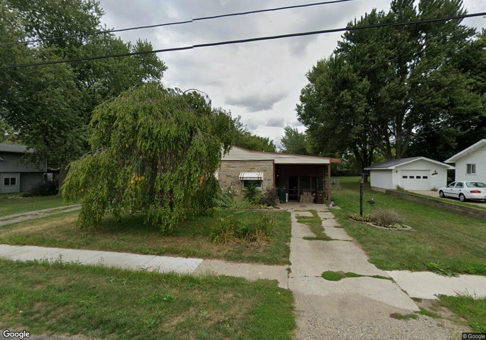
1228 Pierce Rd Lansing, MI 48910
Pleasant Grove NeighborhoodEstimated Value: $133,434 - $156,000
Studio
--
Bath
1,144
Sq Ft
$126/Sq Ft
Est. Value
About This Home
This home is located at 1228 Pierce Rd, Lansing, MI 48910 and is currently estimated at $144,109, approximately $125 per square foot. 1228 Pierce Rd is a home located in Ingham County with nearby schools including Reo Elementary School, Attwood School, and Everett High School.
Ownership History
Date
Name
Owned For
Owner Type
Purchase Details
Closed on
Feb 3, 2021
Sold by
Keyes Randall T
Bought by
Davis Keyes Shelly L and Davis Carol J
Current Estimated Value
Home Financials for this Owner
Home Financials are based on the most recent Mortgage that was taken out on this home.
Original Mortgage
$55,000
Interest Rate
3.1%
Mortgage Type
New Conventional
Create a Home Valuation Report for This Property
The Home Valuation Report is an in-depth analysis detailing your home's value as well as a comparison with similar homes in the area
Home Values in the Area
Average Home Value in this Area
Purchase History
| Date | Buyer | Sale Price | Title Company |
|---|---|---|---|
| Davis Keyes Shelly L | -- | None Available |
Source: Public Records
Mortgage History
| Date | Status | Borrower | Loan Amount |
|---|---|---|---|
| Closed | Davis Keyes Shelly L | $55,000 |
Source: Public Records
Tax History
| Year | Tax Paid | Tax Assessment Tax Assessment Total Assessment is a certain percentage of the fair market value that is determined by local assessors to be the total taxable value of land and additions on the property. | Land | Improvement |
|---|---|---|---|---|
| 2025 | $2,377 | $64,500 | $10,700 | $53,800 |
| 2024 | $19 | $54,200 | $10,700 | $43,500 |
| 2023 | $2,230 | $47,700 | $10,700 | $37,000 |
| 2022 | $2,037 | $43,400 | $9,200 | $34,200 |
| 2021 | $1,970 | $37,300 | $5,500 | $31,800 |
| 2020 | $1,958 | $35,600 | $5,500 | $30,100 |
| 2019 | $1,801 | $32,700 | $5,500 | $27,200 |
| 2018 | $1,690 | $28,700 | $5,500 | $23,200 |
| 2017 | $1,617 | $28,700 | $5,500 | $23,200 |
| 2016 | $1,548 | $28,300 | $5,500 | $22,800 |
| 2015 | $1,548 | $27,400 | $11,012 | $16,388 |
| 2014 | $1,548 | $27,000 | $16,152 | $10,848 |
Source: Public Records
Map
Nearby Homes
- 4414 S Martin Luther King jr Blvd
- 1429 Pierce Rd
- 1420 Reo Rd
- 1113 Eaton Ct
- 1319 Hillcrest St
- VL Hillcrest St
- 1321 Pompton Cir
- 1729 Reo Rd
- 1715 Hillcrest St
- 1215 S Briarfield Dr
- 1301 S Briarfield Dr
- 3815 Walton Dr
- 4125 Lowcroft Ave
- 0 Burchfield Dr
- 1904 Hillcrest St
- 1941 Reo Rd
- 0 W Jolly Rd
- 4907 Burchfield Ave
- 3705 Burchfield Dr
- 4926 Burchfield Ave
- 1220 Pierce Rd
- 1230 Pierce Rd
- 1308 Pierce Rd
- 1225 Pierce Rd
- 1212 Pierce Rd
- 1217 Pierce Rd
- 1309 Pierce Rd
- 1231 Pierce Rd
- 1318 Pierce Rd
- 0 Pierce Rd
- 1204 Pierce Rd
- 1213 Pierce Rd
- 1324 Pierce Rd
- 1126 Pierce Rd
- 1321 Pierce Rd
- 1327 Pierce Rd
- 1328 Pierce Rd
- 1118 Pierce Rd
- 1404 Pierce Rd
- 4300 S Martin Luther King jr Blvd
Your Personal Tour Guide
Ask me questions while you tour the home.