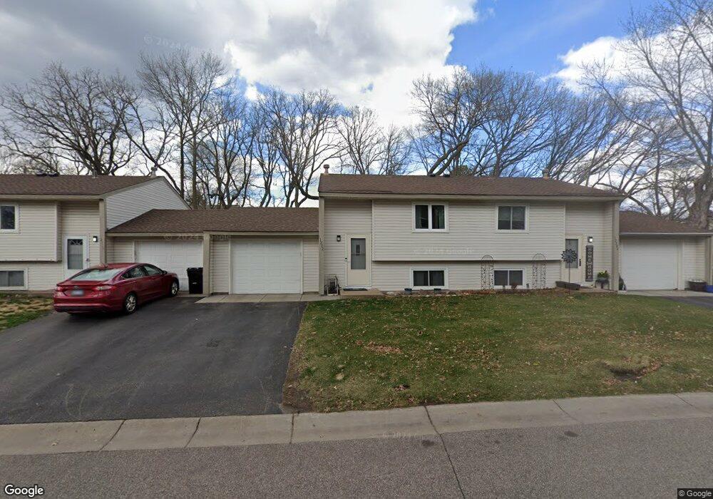
12282 Eagle St NW Coon Rapids, MN 55448
Estimated Value: $205,272 - $217,000
2
Beds
1
Bath
613
Sq Ft
$345/Sq Ft
Est. Value
About This Home
This home is located at 12282 Eagle St NW, Coon Rapids, MN 55448 and is currently estimated at $211,568, approximately $345 per square foot. 12282 Eagle St NW is a home located in Anoka County with nearby schools including Lucile Bruner Elementary School, Sand Creek Elementary School, and Laughlin Junior/Senior High School.
Ownership History
Date
Name
Owned For
Owner Type
Purchase Details
Closed on
Mar 10, 2017
Sold by
Nv Group Llc
Bought by
Robinson James J and Robinson Lisa G
Current Estimated Value
Purchase Details
Closed on
Jul 20, 2000
Sold by
Wawers Ellen M
Bought by
Robinson James I and Robinson Lisa G
Purchase Details
Closed on
Apr 1, 1996
Sold by
Cole Margaret E
Bought by
Wawers Ellen M
Create a Home Valuation Report for This Property
The Home Valuation Report is an in-depth analysis detailing your home's value as well as a comparison with similar homes in the area
Home Values in the Area
Average Home Value in this Area
Purchase History
| Date | Buyer | Sale Price | Title Company |
|---|---|---|---|
| Robinson James J | -- | None Available | |
| Robinson James I | $95,500 | -- | |
| Wawers Ellen M | $61,788 | -- |
Source: Public Records
Tax History Compared to Growth
Tax History
| Year | Tax Paid | Tax Assessment Tax Assessment Total Assessment is a certain percentage of the fair market value that is determined by local assessors to be the total taxable value of land and additions on the property. | Land | Improvement |
|---|---|---|---|---|
| 2025 | $1,806 | $182,600 | $40,000 | $142,600 |
| 2024 | $1,806 | $181,800 | $40,000 | $141,800 |
| 2023 | $1,801 | $173,600 | $40,000 | $133,600 |
| 2022 | $1,781 | $171,200 | $35,000 | $136,200 |
| 2021 | $1,717 | $142,200 | $38,000 | $104,200 |
| 2020 | $1,680 | $139,800 | $25,000 | $114,800 |
| 2019 | $1,541 | $130,600 | $25,000 | $105,600 |
| 2018 | $1,523 | $115,300 | $0 | $0 |
| 2017 | $1,267 | $109,900 | $0 | $0 |
| 2016 | $1,244 | $84,200 | $0 | $0 |
| 2015 | $1,081 | $84,200 | $16,200 | $68,000 |
| 2014 | -- | $67,100 | $6,000 | $61,100 |
Source: Public Records
Map
Nearby Homes
- 12463 Drake St NW
- 1625 124th Ave NW
- 12010 Eagle St NW
- 1727 121st Ln NW
- 12365 Jay St NW
- 1449 119th Ln NW
- 1450 126th Ln NW
- 1593 126th Ln NW
- 12554 Grouse St NW
- 11852 Yellow Pine St NW
- 12488 Unity St NW
- 11923 Wintergreen St NW
- 12796 Bluebird St NW
- 1234 128th Cir NW
- 2068 124th Ln NW
- 899 123rd Ln NW
- 1520 129th Ave NW
- 1930 127th Cir NW
- 1660 Northdale Blvd NW
- 2147 125th Ln NW
- 12278 Eagle St NW
- 12286 Eagle St NW
- 12274 Eagle St NW
- 12283 Eagle St NW
- 12279 Eagle St NW
- 12287 Eagle St NW
- 12264 Drake St NW
- 12260 Drake St NW
- 12275 Eagle St NW
- 12266 Drake St NW
- 12258 Drake St NW
- 12268 Drake St NW
- 12262 Drake St NW
- 12270 Eagle St NW
- 12266 Eagle St NW
- 12270 Drake St NW
- 12262 Eagle St NW
- 12258 Eagle St NW
- 12254 Eagle St NW
- 12250 Eagle St NW