Estimated Value: $233,000 - $285,006
4
Beds
3
Baths
2,592
Sq Ft
$101/Sq Ft
Est. Value
About This Home
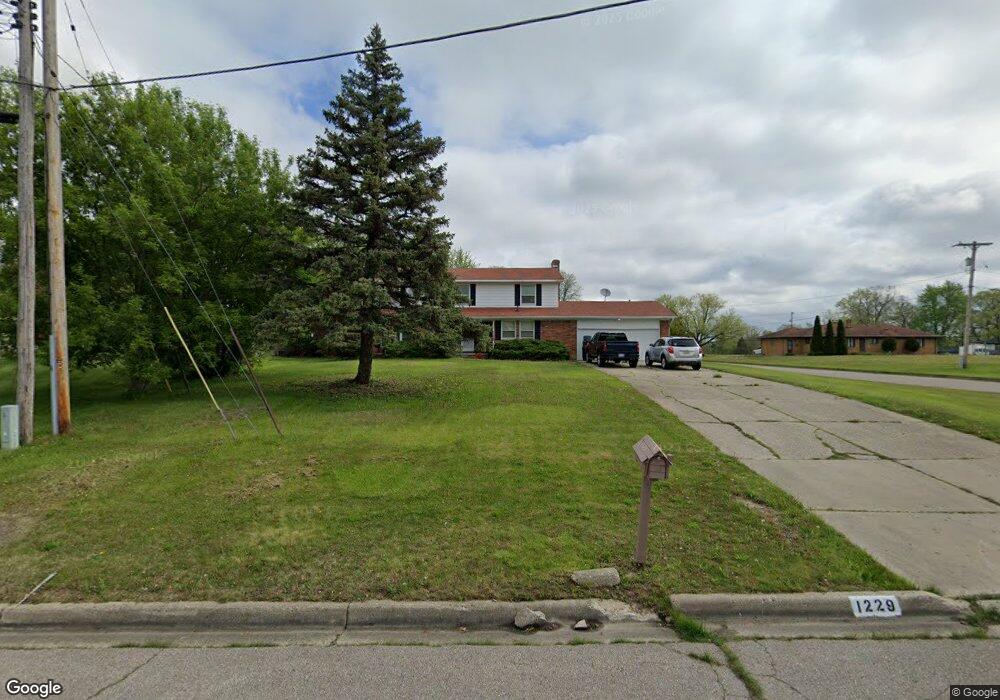
This home is located at 1229 Carter Dr, Flint, MI 48532 and is currently estimated at $263,002, approximately $101 per square foot. 1229 Carter Dr is a home located in Genesee County with nearby schools including Carman-Ainsworth High School, Genesee STEM Academy, and St. Paul Lutheran School.
Ownership History
Date
Name
Owned For
Owner Type
Purchase Details
Closed on
Oct 10, 2016
Sold by
Al Rifaiey Mohmoud Shakir
Bought by
Churbaji Maher
Current Estimated Value
Purchase Details
Closed on
Jan 11, 2016
Sold by
Genesee County Land Bank Authority
Bought by
Al Rifaiey Mahmoud
Purchase Details
Closed on
Dec 17, 2015
Sold by
Genesee County
Bought by
Genesee County Land Bank
Purchase Details
Closed on
Sep 22, 2009
Sold by
Federal Deposit Insurance Corporation
Bought by
Deutsche Bank National Trust Company
Purchase Details
Closed on
Apr 15, 2009
Sold by
Bowling Anthony G and Bowling Shavonnah L
Bought by
Indymac Federal Bank Fsb
Purchase Details
Closed on
May 25, 2001
Sold by
Alex Thomas J and Alex Blanche M
Bought by
Bowling Anthony G and Bowling Shavonnah L
Purchase Details
Closed on
Jul 9, 1999
Sold by
Alex Thomas J and Alex Blanche M
Bought by
Alex Thomas J and Alex Blanche M
Purchase Details
Closed on
Jun 23, 1999
Sold by
Alex Thomas J and Alex Blanche M
Bought by
Ale Thomas J and Ale Alex Blanche
Create a Home Valuation Report for This Property
The Home Valuation Report is an in-depth analysis detailing your home's value as well as a comparison with similar homes in the area
Home Values in the Area
Average Home Value in this Area
Purchase History
| Date | Buyer | Sale Price | Title Company |
|---|---|---|---|
| Churbaji Maher | -- | None Available | |
| Al Rifaiey Mahmoud | $6,000 | None Available | |
| Genesee County Land Bank | -- | None Available | |
| Deutsche Bank National Trust Company | -- | None Available | |
| Indymac Federal Bank Fsb | $99,278 | None Available | |
| Bowling Anthony G | $169,900 | Metropolitan Title Company | |
| Alex Thomas J | -- | -- | |
| Ale Thomas J | -- | -- |
Source: Public Records
Tax History Compared to Growth
Tax History
| Year | Tax Paid | Tax Assessment Tax Assessment Total Assessment is a certain percentage of the fair market value that is determined by local assessors to be the total taxable value of land and additions on the property. | Land | Improvement |
|---|---|---|---|---|
| 2025 | $2,980 | $147,000 | $0 | $0 |
| 2024 | $1,684 | $140,900 | $0 | $0 |
| 2023 | $1,871 | $115,600 | $0 | $0 |
| 2022 | $1,424 | $92,000 | $0 | $0 |
| 2021 | $3,764 | $82,300 | $0 | $0 |
| 2020 | $1,246 | $73,900 | $0 | $0 |
| 2019 | $1,228 | $62,100 | $0 | $0 |
| 2018 | $3,903 | $52,700 | $0 | $0 |
| 2017 | $3,138 | $52,700 | $0 | $0 |
| 2016 | $2,875 | $48,700 | $0 | $0 |
| 2015 | $1,851 | $48,700 | $0 | $0 |
| 2014 | $1,098 | $46,500 | $0 | $0 |
| 2012 | -- | $50,100 | $50,100 | $0 |
Source: Public Records
Map
Nearby Homes
- 1058 Cora Dr
- 4022 Beecher Rd
- Graham Rd N Graham Rd
- 1068 S Graham Rd
- 3528 Beecher Rd
- 1136 Gilbert St
- 1090 Cabot Dr
- 2174 Mill Rd
- 3360 Beecher Rd
- 3350 Beecher Rd
- 1260 Gilbert St
- 2051 Lavelle Rd
- 1112 Lask Dr
- 1193 Normandy Terrace Dr
- 3309 Beecher Rd
- 1159 N Linden Rd
- 3522 Ridgecliffe Dr
- 3493 Ridgecliffe Dr
- 3288 Tall Oaks Ct
- 5021 Forest Side Dr
- 1219 Carter Dr
- 1240 Carter Dr
- 4157 Beecher Rd
- 1208 Carter Dr
- 1273 Carter Dr
- 4147 Beecher Rd
- 4197 Beecher Rd
- 1172 Cora Dr
- 1194 Carter Dr
- 4135 Beecher Rd
- 1162 Cora Dr
- 4211 Beecher Rd
- G4110 Beecher Rd
- 1207 Carter Dr
- 1154 Cora Dr
- 1193 Carter Dr
- 4121 Beecher Rd
- 4146 Beecher Rd
- 1183 Cora Dr
- 1185 Carter Dr