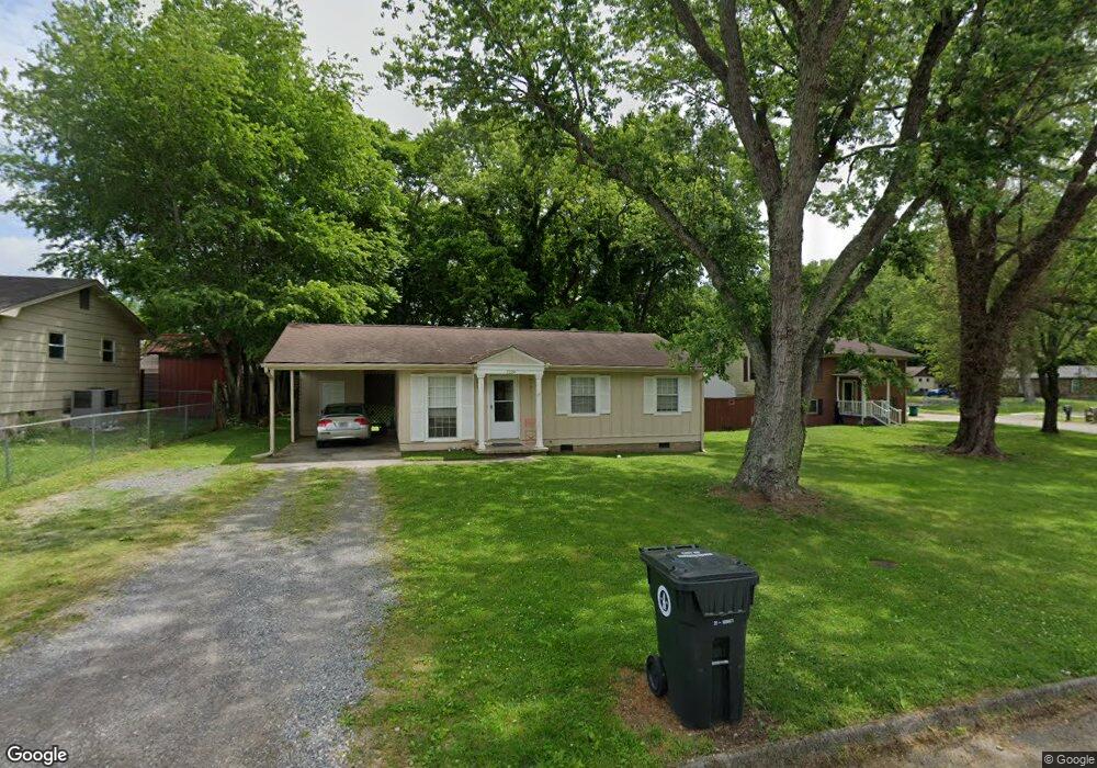
1229 Debi Cir Morristown, TN 37813
Estimated Value: $126,887 - $191,000
--
Bed
1
Bath
910
Sq Ft
$169/Sq Ft
Est. Value
About This Home
This home is located at 1229 Debi Cir, Morristown, TN 37813 and is currently estimated at $153,972, approximately $169 per square foot. 1229 Debi Cir is a home located in Hamblen County with nearby schools including Hillcrest Elementary School, Meadowview Middle School, and Morristown East High School.
Ownership History
Date
Name
Owned For
Owner Type
Purchase Details
Closed on
Dec 28, 2009
Sold by
Taylor Bean
Bought by
Clinch Powell Resource Conserv
Current Estimated Value
Purchase Details
Closed on
Jul 8, 2008
Sold by
Secretary Of Veterans Affa
Bought by
Taylor Bean Whitaker Mtg Corp
Purchase Details
Closed on
Mar 13, 2008
Sold by
Skyles Matthew L
Bought by
Secretary Of Veterans Affairs
Purchase Details
Closed on
Nov 10, 2006
Bought by
Greene Thomas J and Greene Andrew
Purchase Details
Closed on
Oct 12, 1984
Bought by
Greene Thomas J
Purchase Details
Closed on
Oct 11, 1984
Bought by
Southern Finance Co
Purchase Details
Closed on
May 21, 1973
Bought by
Mccoige Mary M
Create a Home Valuation Report for This Property
The Home Valuation Report is an in-depth analysis detailing your home's value as well as a comparison with similar homes in the area
Home Values in the Area
Average Home Value in this Area
Purchase History
| Date | Buyer | Sale Price | Title Company |
|---|---|---|---|
| Clinch Powell Resource Conserv | $40,000 | -- | |
| Taylor Bean Whitaker Mtg Corp | -- | -- | |
| Secretary Of Veterans Affairs | $54,158 | -- | |
| Greene Thomas J | -- | -- | |
| Greene Thomas J | $22,000 | -- | |
| Southern Finance Co | $18,800 | -- | |
| Mccoige Mary M | $15,500 | -- |
Source: Public Records
Tax History Compared to Growth
Tax History
| Year | Tax Paid | Tax Assessment Tax Assessment Total Assessment is a certain percentage of the fair market value that is determined by local assessors to be the total taxable value of land and additions on the property. | Land | Improvement |
|---|---|---|---|---|
| 2024 | $288 | $16,375 | $3,250 | $13,125 |
| 2023 | $288 | $16,375 | $0 | $0 |
| 2022 | $517 | $16,375 | $3,250 | $13,125 |
| 2021 | $517 | $16,375 | $3,250 | $13,125 |
| 2020 | $517 | $16,375 | $3,250 | $13,125 |
| 2019 | $517 | $15,225 | $2,975 | $12,250 |
| 2018 | $479 | $15,225 | $2,975 | $12,250 |
| 2017 | $482 | $15,550 | $2,975 | $12,575 |
| 2016 | $461 | $15,550 | $2,975 | $12,575 |
| 2015 | $428 | $15,550 | $2,975 | $12,575 |
| 2014 | -- | $15,550 | $2,975 | $12,575 |
| 2013 | -- | $16,125 | $0 | $0 |
Source: Public Records
Map
Nearby Homes
- 000 Bacon Ln
- 1205 Ledford Ave
- 1200 Liberty Hall Dr
- 0 Joe Hall Rd Unit 703714
- 816 Choctaw St
- 819 Choctaw St
- 808 Gaston St
- 0 Russell Cir
- Lot 101 Geneva Ln
- Lot 99 Geneva Ln
- 98 Geneva Ln
- Lot 100 Geneva Ln
- 423 Hayter Dr
- 915 Forgey Ave
- 108 Annie Ln
- 109 Annie Ln
- 831 Cave St
- 712 Williams St
- 828 Overlook Dr
- 525 S Liberty Hill Rd