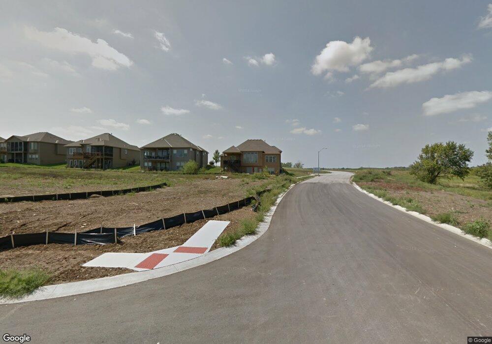
1229 Kettering Ln Raymore, MO 64083
Estimated Value: $500,670 - $563,000
3
Beds
3
Baths
1,648
Sq Ft
$328/Sq Ft
Est. Value
About This Home
This home is located at 1229 Kettering Ln, Raymore, MO 64083 and is currently estimated at $540,668, approximately $328 per square foot. 1229 Kettering Ln is a home located in Cass County with nearby schools including Creekmoor Elementary School, Raymore-Peculiar East Middle School, and Raymore-Peculiar Senior High School.
Ownership History
Date
Name
Owned For
Owner Type
Purchase Details
Closed on
Dec 17, 2008
Sold by
Prestige Home Builders Inc
Bought by
Topps Arvin J and Topps Melitta W
Current Estimated Value
Home Financials for this Owner
Home Financials are based on the most recent Mortgage that was taken out on this home.
Original Mortgage
$266,400
Outstanding Balance
$175,096
Interest Rate
6.19%
Mortgage Type
New Conventional
Estimated Equity
$365,572
Purchase Details
Closed on
May 21, 2007
Sold by
Cooper Land Development Inc
Bought by
Prestigage Home Builders Inc
Create a Home Valuation Report for This Property
The Home Valuation Report is an in-depth analysis detailing your home's value as well as a comparison with similar homes in the area
Home Values in the Area
Average Home Value in this Area
Purchase History
| Date | Buyer | Sale Price | Title Company |
|---|---|---|---|
| Topps Arvin J | -- | -- | |
| Prestigage Home Builders Inc | -- | -- |
Source: Public Records
Mortgage History
| Date | Status | Borrower | Loan Amount |
|---|---|---|---|
| Open | Topps Arvin J | $266,400 |
Source: Public Records
Tax History Compared to Growth
Tax History
| Year | Tax Paid | Tax Assessment Tax Assessment Total Assessment is a certain percentage of the fair market value that is determined by local assessors to be the total taxable value of land and additions on the property. | Land | Improvement |
|---|---|---|---|---|
| 2025 | $5,458 | $75,350 | $13,760 | $61,590 |
| 2024 | $5,458 | $67,070 | $12,500 | $54,570 |
| 2023 | $5,451 | $67,070 | $12,500 | $54,570 |
| 2022 | $4,850 | $59,280 | $12,500 | $46,780 |
| 2021 | $4,851 | $59,280 | $12,500 | $46,780 |
| 2020 | $5,119 | $61,450 | $12,500 | $48,950 |
| 2019 | $4,942 | $61,450 | $12,500 | $48,950 |
| 2018 | $4,916 | $59,040 | $12,500 | $46,540 |
| 2017 | $4,543 | $59,040 | $12,500 | $46,540 |
| 2016 | $4,543 | $56,630 | $12,500 | $44,130 |
| 2015 | $4,546 | $56,630 | $12,500 | $44,130 |
| 2014 | $4,726 | $58,840 | $14,710 | $44,130 |
| 2013 | -- | $58,840 | $14,710 | $44,130 |
Source: Public Records
Map
Nearby Homes
- 1225 Kingsland Cir
- 933 Bridgeshire Dr
- 819 Bridgeshire Dr
- 821 Bridgeshire Dr
- 707 Hampstead Dr
- 512 Turnbridge Dr
- 1407 Kensington Ln
- 778 Creekmoor Dr
- 810 Glenn Cir
- 805 Glenn Cir
- 1303 Cross Creek Dr
- 703 Hampstead Dr
- 1415 Lewis Cir
- 1624 Hanover Ln
- 1363 Brompton Ln
- 1406 Upton Ct
- 708 SW Glenn Cir
- 773 Creekmoor Dr
- 1620 Hanover Ln
- 709 SW Glenn Cir
- 1227 Kettering Ln
- 1228 Kingsland Cir
- 1100 Lakecrest Cir
- 1225 Kettering Ln
- 1228 Kettering Ln
- 1226 Kingsland Cir
- 1230 Kettering Ln
- 1226 Kettering Ln
- 1223 Kettering Ln
- 1224 Kettering Ln
- 1101 Lakecrest Cir
- 1224 Kingsland Cir
- 1102 Lakecrest Cir
- 1222 Kettering Ln
- 1221 Kettering Ln
- 1016 Bridgeshire Dr
- 1227 Kingsland Cir
- 1222 Kingsland Cir
- 1104 Lakecrest Cir
- 1103 Lakecrest Cir
