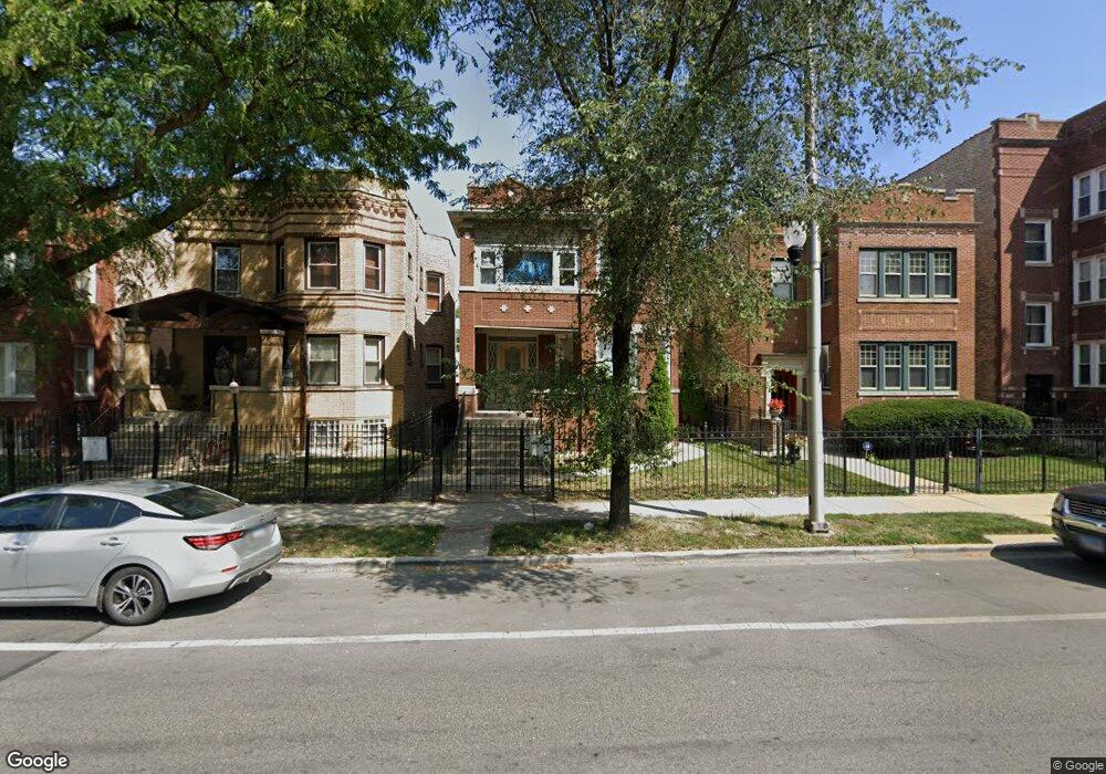
1229 N Austin Blvd Unit 2 Chicago, IL 60651
Austin NeighborhoodEstimated Value: $152,000 - $266,000
3
Beds
2
Baths
1,200
Sq Ft
$185/Sq Ft
Est. Value
About This Home
This home is located at 1229 N Austin Blvd Unit 2, Chicago, IL 60651 and is currently estimated at $221,984, approximately $184 per square foot. 1229 N Austin Blvd Unit 2 is a home located in Cook County with nearby schools including Ella Flagg Young School, St Angela Elementary School, and St Paul Lutheran School.
Ownership History
Date
Name
Owned For
Owner Type
Purchase Details
Closed on
Aug 12, 2011
Sold by
Torruella Alejandro and Torruella Maria G
Bought by
Ocana Isabel
Current Estimated Value
Purchase Details
Closed on
Oct 12, 2005
Sold by
Orban Gyula
Bought by
Torruella Alejandro and Torruella Maria G
Home Financials for this Owner
Home Financials are based on the most recent Mortgage that was taken out on this home.
Original Mortgage
$155,200
Interest Rate
6.75%
Mortgage Type
Unknown
Create a Home Valuation Report for This Property
The Home Valuation Report is an in-depth analysis detailing your home's value as well as a comparison with similar homes in the area
Home Values in the Area
Average Home Value in this Area
Purchase History
| Date | Buyer | Sale Price | Title Company |
|---|---|---|---|
| Ocana Isabel | $45,000 | Pntn | |
| Torruella Alejandro | $194,000 | Multiple |
Source: Public Records
Mortgage History
| Date | Status | Borrower | Loan Amount |
|---|---|---|---|
| Previous Owner | Torruella Alejandro | $155,200 |
Source: Public Records
Tax History Compared to Growth
Tax History
| Year | Tax Paid | Tax Assessment Tax Assessment Total Assessment is a certain percentage of the fair market value that is determined by local assessors to be the total taxable value of land and additions on the property. | Land | Improvement |
|---|---|---|---|---|
| 2024 | $2,102 | $29,912 | $1,772 | $28,140 |
| 2023 | $2,049 | $9,965 | $1,382 | $8,583 |
| 2022 | $2,049 | $9,965 | $1,382 | $8,583 |
| 2021 | $2,004 | $9,964 | $1,382 | $8,582 |
| 2020 | $3,868 | $17,362 | $1,382 | $15,980 |
| 2019 | $3,875 | $19,286 | $1,382 | $17,904 |
| 2018 | $3,810 | $19,286 | $1,382 | $17,904 |
| 2017 | $1,300 | $6,041 | $1,204 | $4,837 |
| 2016 | $1,210 | $6,041 | $1,204 | $4,837 |
| 2015 | $1,107 | $6,041 | $1,204 | $4,837 |
| 2014 | $1,634 | $8,804 | $1,204 | $7,600 |
| 2013 | $1,601 | $8,804 | $1,204 | $7,600 |
Source: Public Records
Map
Nearby Homes
- 910 N Humphrey Ave
- 7211 W Division St Unit C2
- 921 N Humphrey Ave
- 1322 N Austin Blvd
- 1122 N Mason Ave
- 1001 N Taylor Ave
- 1346 N Monitor Ave
- 1418 N Mayfield Ave
- 1118 N Monitor Ave
- 802 N Taylor Ave
- 1318 N Menard Ave
- 1032 N Austin Blvd Unit 2N
- 1115 N Taylor Ave
- 1338 N Massasoit Ave
- 1448 N Menard Ave
- 1108 N Massasoit Ave
- 1133 N Massasoit Ave
- 1308 N Waller Ave
- 1003 Mapleton Ave
- 102 Le Moyne Pkwy
- 1229 N Austin Blvd Unit 1
- 1229 N Austin Blvd Unit G
- 1231 N Austin Blvd Unit 1
- 1225 N Austin Blvd Unit 2
- 1235 N Austin Blvd Unit 2
- 1223 N Austin Blvd
- 1239 N Austin Blvd
- 1219 N Austin Blvd Unit 1
- 1241 N Austin Blvd
- 1215 N Austin Blvd
- 1215 N Austin Blvd
- 1228 N Mason Ave
- 1245 N Austin Blvd
- 1224 N Mason Ave
- 1213 N Austin Blvd
- 1213 N Austin Blvd
- 1234 N Mason Ave
- 1230 N Mason Ave
- 1226 N Austin Blvd
- 1224 N Austin Blvd