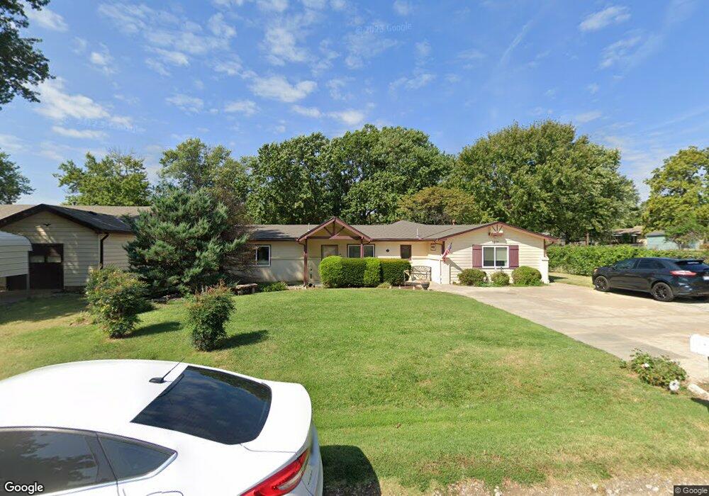
1229 S Byron Rd Wichita, KS 67209
West Wichita NeighborhoodEstimated Value: $276,058 - $300,000
5
Beds
3
Baths
2,945
Sq Ft
$98/Sq Ft
Est. Value
About This Home
This home is located at 1229 S Byron Rd, Wichita, KS 67209 and is currently estimated at $288,029, approximately $97 per square foot. 1229 S Byron Rd is a home located in Sedgwick County with nearby schools including Apollo Elementary School, Discovery Intermediate School, and Dwight D. Eisenhower Middle School.
Ownership History
Date
Name
Owned For
Owner Type
Purchase Details
Closed on
Jun 30, 2017
Sold by
Dierks Lioyd R and Dierks Cathy L
Bought by
Warden Froup 1229 Llc
Current Estimated Value
Home Financials for this Owner
Home Financials are based on the most recent Mortgage that was taken out on this home.
Original Mortgage
$160,000
Outstanding Balance
$133,405
Interest Rate
4.02%
Mortgage Type
Future Advance Clause Open End Mortgage
Estimated Equity
$154,624
Purchase Details
Closed on
Jan 10, 2017
Sold by
Dierks Lloyd R and Dierks Cathy L
Bought by
Dierks Lloyd R and Dierks Cathy L
Create a Home Valuation Report for This Property
The Home Valuation Report is an in-depth analysis detailing your home's value as well as a comparison with similar homes in the area
Home Values in the Area
Average Home Value in this Area
Purchase History
| Date | Buyer | Sale Price | Title Company |
|---|---|---|---|
| Warden Froup 1229 Llc | -- | Security 1 St Title Llc | |
| Dierks Lloyd R | -- | None Available | |
| Dierks Lloyd R | -- | None Available |
Source: Public Records
Mortgage History
| Date | Status | Borrower | Loan Amount |
|---|---|---|---|
| Open | Warden Froup 1229 Llc | $160,000 |
Source: Public Records
Tax History Compared to Growth
Tax History
| Year | Tax Paid | Tax Assessment Tax Assessment Total Assessment is a certain percentage of the fair market value that is determined by local assessors to be the total taxable value of land and additions on the property. | Land | Improvement |
|---|---|---|---|---|
| 2025 | $2,643 | $23,897 | $5,037 | $18,860 |
| 2024 | $2,643 | $23,898 | $4,175 | $19,723 |
| 2023 | $2,735 | $23,898 | $4,175 | $19,723 |
| 2022 | $2,450 | $21,368 | $3,945 | $17,423 |
| 2021 | $2,407 | $20,689 | $3,945 | $16,744 |
| 2020 | $2,233 | $18,953 | $3,945 | $15,008 |
| 2019 | $2,040 | $17,228 | $3,945 | $13,283 |
| 2018 | $1,952 | $16,262 | $1,944 | $14,318 |
| 2017 | $1,976 | $0 | $0 | $0 |
| 2016 | $1,966 | $0 | $0 | $0 |
| 2015 | -- | $0 | $0 | $0 |
| 2014 | -- | $0 | $0 | $0 |
Source: Public Records
Map
Nearby Homes
- 408 S Turquoise St
- 525 S Woodchuck Ln
- 9109 W Douglas Ave
- 9111 W Douglas Ave
- 115 N Westfield St
- 133 N Arcadia St
- 10114 W Carr St
- 229 S Gleneagles Ct
- 10029 W Dora St
- 10322 W Merton Ct
- 300 N Wood Ave
- 10318 W Dora St
- 1300 S Fieldcrest St
- 1441 S Lark Ln
- 31 W Rolling Hills Ct
- 324 N Fairway Ave
- 141 N Muirfield St
- 10756 W Carr Ave
- 10416 W Jewell Cir
- 105 S Brownthrush Cir
- 1239 S Byron Rd
- 1221 S Byron Rd
- 1301 S Byron Rd
- 1226 S Byron Rd
- 1238 S Byron Rd
- 1207 S Byron Rd
- 9029 W Belview Ave
- 1200 S Byron Rd
- 1307 S Byron Rd
- 9107 W Belview Ave
- 8929 W Belview Ave
- 1238 S Westfield St
- 1224 S Westfield St
- 1230 S Westfield St
- 650 S Tippecanoe Ave
- 651 S Tippecanoe Ave
- 1300 S Westfield St
- 9109 W Belview Ave
- 1312 S Westfield St
- 631 S Byron Rd