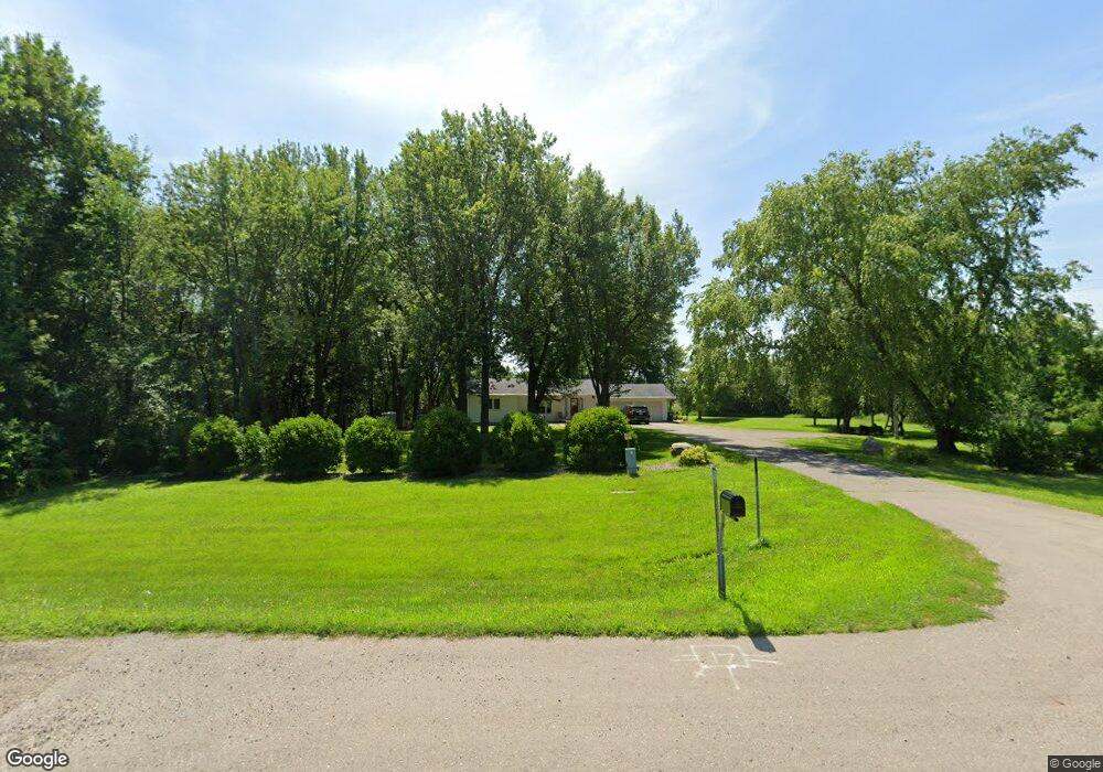
1229 State Highway 60 Elysian, MN 56028
Estimated Value: $321,000 - $385,000
2
Beds
3
Baths
1,351
Sq Ft
$264/Sq Ft
Est. Value
About This Home
This home is located at 1229 State Highway 60, Elysian, MN 56028 and is currently estimated at $356,383, approximately $263 per square foot. 1229 State Highway 60 is a home located in Le Sueur County with nearby schools including Waterville Elementary School, Morristown Elementary School, and Waterville-Elysian-Morristown Junior High School.
Ownership History
Date
Name
Owned For
Owner Type
Purchase Details
Closed on
Jul 9, 2015
Sold by
Muellerleile Alicia and Muellerleile Mark
Bought by
Schmahl Braidon G
Current Estimated Value
Home Financials for this Owner
Home Financials are based on the most recent Mortgage that was taken out on this home.
Original Mortgage
$145,800
Interest Rate
3.86%
Mortgage Type
Future Advance Clause Open End Mortgage
Create a Home Valuation Report for This Property
The Home Valuation Report is an in-depth analysis detailing your home's value as well as a comparison with similar homes in the area
Home Values in the Area
Average Home Value in this Area
Purchase History
| Date | Buyer | Sale Price | Title Company |
|---|---|---|---|
| Schmahl Braidon G | -- | None Available |
Source: Public Records
Mortgage History
| Date | Status | Borrower | Loan Amount |
|---|---|---|---|
| Closed | Schmahl Braidon G | $145,800 |
Source: Public Records
Tax History Compared to Growth
Tax History
| Year | Tax Paid | Tax Assessment Tax Assessment Total Assessment is a certain percentage of the fair market value that is determined by local assessors to be the total taxable value of land and additions on the property. | Land | Improvement |
|---|---|---|---|---|
| 2025 | $2,398 | $290,900 | $90,000 | $200,900 |
| 2024 | $2,162 | $285,000 | $90,000 | $195,000 |
| 2023 | $2,114 | $263,600 | $85,000 | $178,600 |
| 2022 | $1,872 | $246,500 | $75,000 | $171,500 |
| 2021 | $1,918 | $192,100 | $65,000 | $127,100 |
| 2020 | $1,748 | $192,100 | $65,000 | $127,100 |
| 2019 | $1,760 | $155,500 | $52,771 | $102,729 |
| 2018 | $1,745 | $149,100 | $52,316 | $96,784 |
| 2017 | $1,503 | $147,000 | $52,189 | $94,811 |
| 2016 | $1,548 | $147,000 | $52,189 | $94,811 |
| 2015 | $1,533 | $148,400 | $52,284 | $96,116 |
| 2014 | $1,253 | $138,900 | $51,572 | $87,328 |
| 2013 | $1,280 | $138,900 | $51,572 | $87,328 |
Source: Public Records
Map
Nearby Homes
- 0 Xx Lewis Ln Unit 7025397
- 0 Xx Lewis Ln Unit 7025381
- xx Lewis Ln
- xxxxxx Lewis Ln
- -XX Jason Dr
- 4 Egret Ln
- 3271 425th Ave
- 49279 Sportsmans Ln
- 49189 Sportsmans Ln
- 20232 Tetonka Lake Rd
- 47096 Maple Leaf Ln
- 605 Northwood Place
- 611 Northwood Place
- 0 Lake View Rd
- 523 Allyn Cir
- 0 Tbd Oriole Rd
- 24352 474th Ln
- 24352 474 Ln
- 500 N Main St
- 20 Lake Ave
- 1174 State Highway 60
- 1097 State Highway 60
- 1015 State Highway 60
- 24232 474th Ln
- 47308 Jason Adam Ct
- 47308 Jason Adam Ct
- 47308 Jason Adam Ct Unit By German Jefferson
- 47308 Jason Adam Ct
- 915 State Highway 60
- 0 Tbd Bluebay Ln Unit 7029113
- 21790 516th St
- 1439 State Highway 60
- 1439 State Highway 60
- 209 Tustin Cir S
- 0 Tbd Lot 12 S Tustin Cir Unit 7019982
- XXX W Hwy 60
- 0 Tbd Lot 8 S Tustin Cir Unit 7019981
- 212 Tustin Cir S
- 0 Tbd Lot 11 S Tustin Cir Unit 7019980
- 0 Tbd Lot 13 S Tustin Cir Unit 7019979