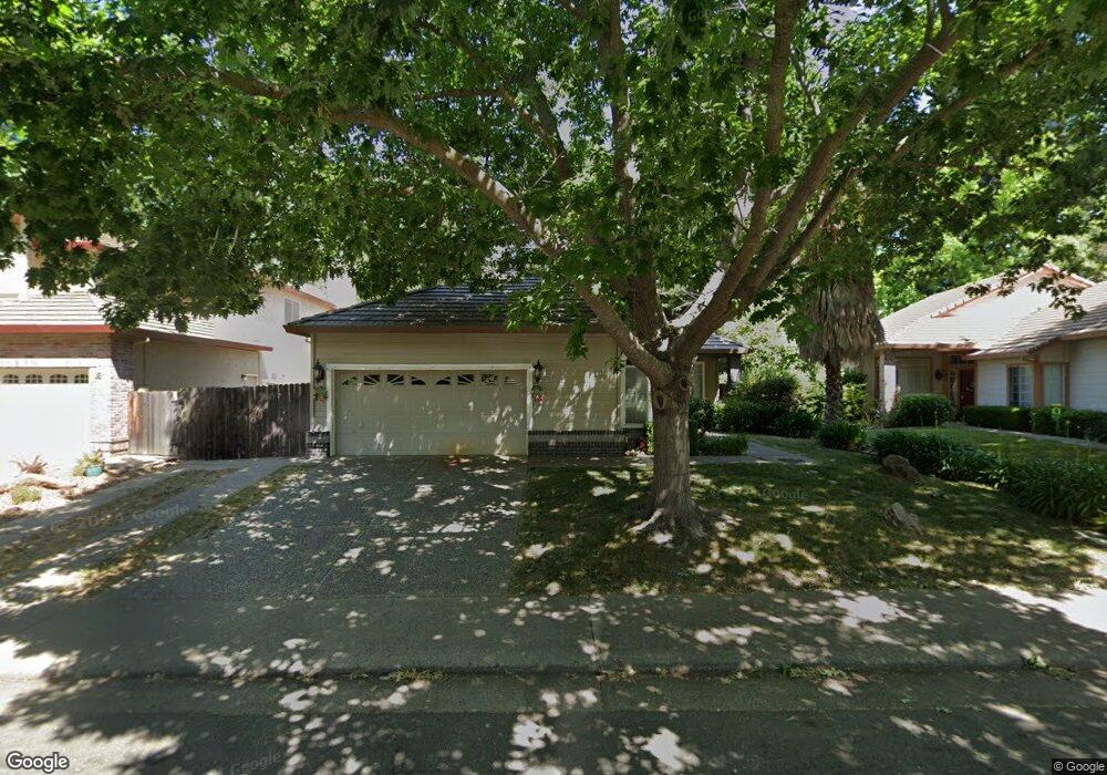
123 Ashcat Way Folsom, CA 95630
Natoma Station NeighborhoodEstimated Value: $671,980 - $743,000
About This Home
This home is located at 123 Ashcat Way, Folsom, CA 95630 and is currently estimated at $704,745, approximately $384 per square foot. 123 Ashcat Way is a home located in Sacramento County with nearby schools including Natoma Station Elementary School, Sutter Middle School, and Folsom High School.
Ownership History
We collect this data history from publicly available records. To have your information removed, we recommend requesting removal directly through your county’s website.
Purchase Details
Purchase Details
Home Financials for this Owner
Home Financials are based on the most recent Mortgage that was taken out on this home.Home Values in the Area
Average Home Value in this Area
Purchase History
We collect this data history from publicly available records. To have your information removed, we recommend requesting removal directly through your county’s website.
| Date | Buyer | Sale Price | Title Company |
|---|---|---|---|
| -- | None Available | ||
| -- | Financial Title Company |
Mortgage History
We collect this data history from publicly available records. To have your information removed, we recommend requesting removal directly through your county’s website.
| Date | Status | Borrower | Loan Amount |
|---|---|---|---|
| Closed | $231,000 |
Tax History
We collect this data history from publicly available records. To have your information removed, we recommend requesting removal directly through your county’s website.
| Year | Tax Paid | Tax Assessment Tax Assessment Total Assessment is a certain percentage of the fair market value that is determined by local assessors to be the total taxable value of land and additions on the property. | Land | Improvement |
|---|---|---|---|---|
| 2025 | $4,126 | $376,850 | $135,261 | $241,589 |
| 2024 | $4,041 | $369,461 | $132,609 | $236,852 |
| 2023 | $3,970 | $362,217 | $130,009 | $232,208 |
| 2022 | $3,912 | $355,115 | $127,460 | $227,655 |
| 2021 | $3,859 | $348,153 | $124,961 | $223,192 |
| 2020 | $3,812 | $344,584 | $123,680 | $220,904 |
| 2019 | $3,749 | $337,828 | $121,255 | $216,573 |
| 2018 | $4,037 | $331,205 | $118,878 | $212,327 |
| 2017 | $3,820 | $324,712 | $116,548 | $208,164 |
| 2016 | $3,967 | $318,346 | $114,263 | $204,083 |
| 2015 | $4,005 | $313,565 | $112,547 | $201,018 |
| 2014 | $3,833 | $307,424 | $110,343 | $197,081 |
Map
- 110 Conductor Way
- 391 Coventry Cir
- 401 Seaton Dr
- 396 Seaton Dr
- 146 Orange Blossom Cir Unit C
- 1001 Ferry Cir Unit 101
- 919 Blue Rapids Dr
- 600 Fisher Cir
- 130 Royalton Cir
- 131 Royalton Cir
- 124 Sutcliffe Cir
- 673 Silo St
- 708 Taylor St
- 732 Silo St
- 756 Silo St
- 611 Willow Ridge Ct
- 493 Williams St
- 447 Gem Smith Place
- 450 Baguette Place
- 451 Jewel Stone Way
- 125 Ashcat Way
- 114 Ballast Way
- 112 Ballast Way
- 129 Ashcat Way
- 118 Ballast Way
- 121 Ashcat Way
- 126 Ashcat Way
- 102 Rigney Ct
- 108 Ballast Way
- 124 Ashcat Way
- 128 Ashcat Way
- 131 Ashcat Way
- 120 Ballast Way
- 130 Ashcat Way
- 122 Ashcat Way
- 104 Ballast Way
- 100 Ballast Way
- 133 Ashcat Way
- 132 Ashcat Way
- 120 Ashcat Way
Ask me questions while you tour the home.