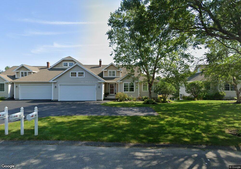
123 Brydon Way Westbrook, ME 04092
Estimated Value: $596,000 - $654,000
2
Beds
3
Baths
1,530
Sq Ft
$408/Sq Ft
Est. Value
About This Home
This home is located at 123 Brydon Way, Westbrook, ME 04092 and is currently estimated at $623,743, approximately $407 per square foot. 123 Brydon Way is a home located in Cumberland County with nearby schools including Westbrook High School, St. Brigid School, and Breakwater School.
Ownership History
Date
Name
Owned For
Owner Type
Purchase Details
Closed on
Jul 17, 2007
Sold by
Tremblay Michael D and Tremblay Christine M
Bought by
Steele Robert J and Steele Lois K
Current Estimated Value
Purchase Details
Closed on
Feb 7, 2005
Sold by
Brydon Farms Llc
Bought by
Tremblay Michael D and Tremblay Christine M
Home Financials for this Owner
Home Financials are based on the most recent Mortgage that was taken out on this home.
Original Mortgage
$255,200
Interest Rate
5%
Mortgage Type
Adjustable Rate Mortgage/ARM
Create a Home Valuation Report for This Property
The Home Valuation Report is an in-depth analysis detailing your home's value as well as a comparison with similar homes in the area
Home Values in the Area
Average Home Value in this Area
Purchase History
| Date | Buyer | Sale Price | Title Company |
|---|---|---|---|
| Steele Robert J | -- | -- | |
| Tremblay Michael D | -- | -- |
Source: Public Records
Mortgage History
| Date | Status | Borrower | Loan Amount |
|---|---|---|---|
| Previous Owner | Tremblay Michael D | $255,200 |
Source: Public Records
Tax History Compared to Growth
Tax History
| Year | Tax Paid | Tax Assessment Tax Assessment Total Assessment is a certain percentage of the fair market value that is determined by local assessors to be the total taxable value of land and additions on the property. | Land | Improvement |
|---|---|---|---|---|
| 2023 | $6,474 | $388,100 | $122,400 | $265,700 |
| 2022 | $5,982 | $330,500 | $102,000 | $228,500 |
| 2021 | $5,893 | $330,500 | $102,000 | $228,500 |
| 2020 | $5,919 | $331,400 | $102,000 | $229,400 |
| 2019 | $5,919 | $331,400 | $102,000 | $229,400 |
| 2018 | $5,791 | $290,300 | $85,000 | $205,300 |
| 2017 | $5,481 | $290,300 | $85,000 | $205,300 |
| 2016 | $5,342 | $290,300 | $85,000 | $205,300 |
| 2015 | $5,214 | $290,300 | $85,000 | $205,300 |
| 2014 | $4,895 | $284,600 | $85,000 | $199,600 |
| 2013 | $4,534 | $263,600 | $85,000 | $178,600 |
Source: Public Records
Map
Nearby Homes
- 290 Bridgton Rd Unit 1
- 128 Grandview Dr Unit 8
- 155 Bridgton Rd
- 0 Reed St
- 42 Villa Rd
- 375 Bridgton Rd Unit 43
- 145 Brooks Edge Farm Rd Unit 66
- 151 Brooks Edge Farm Rd Unit 68
- 20 Elmwood Ave
- 317 Austin St Unit 7
- 171 Brook St Unit 41
- 171 Brook St Unit 45
- 171 Brook St Unit 65
- 171 Brook St Unit 76
- 3 Calla Lilly Ln Unit 91
- 7 Calla Lilly Ln Unit 92
- 18 Calla Lilly Ln Unit 95
- 384 Austin St
- 300 Brook St
- 21 Virginia St
- 123 Brydon Way Unit 123
- 123 Brydon Way Unit 64
- 127 Brydon Way
- 127 Brydon Way Unit 63
- 113 Brydon Way
- 113 Brydon Way Unit 113
- 113 Brydon Way Unit 66
- 25 Brydon Way
- 25 Brydon Way Unit 61
- 126 Brydon Way
- 126 Brydon Way Unit 32
- 116 Brydon Way
- 116 Brydon Way Unit 34
- 112 Brydon Way
- 112 Brydon Way Unit 33
- 122 Brydon Way
- 122 Brydon Way Unit 31
- 117 Brydon Way
- 117 Brydon Way Unit 65
- 21 Brydon Way