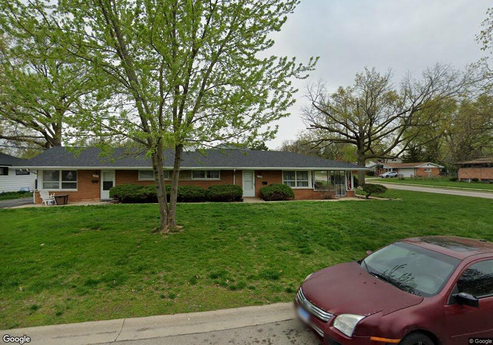
123 Dee Rd Unit 125 North Aurora, IL 60542
Estimated Value: $526,000 - $554,000
8
Beds
--
Bath
3,267
Sq Ft
$164/Sq Ft
Est. Value
About This Home
This home is located at 123 Dee Rd Unit 125, North Aurora, IL 60542 and is currently estimated at $535,728, approximately $163 per square foot. 123 Dee Rd Unit 125 is a home located in Kane County with nearby schools including Schneider Elementary School, Herget Middle School, and West Aurora High School.
Ownership History
Date
Name
Owned For
Owner Type
Purchase Details
Closed on
Feb 4, 2021
Sold by
Drafke Robert
Bought by
123 Dee Rd Llc
Current Estimated Value
Purchase Details
Closed on
Oct 30, 2017
Sold by
Prairie View Properties Llc
Bought by
Drafke Robert
Home Financials for this Owner
Home Financials are based on the most recent Mortgage that was taken out on this home.
Original Mortgage
$262,500
Interest Rate
3.83%
Mortgage Type
New Conventional
Purchase Details
Closed on
Sep 19, 2014
Sold by
Alderson Carol and Mack Jeffrey
Bought by
Prairie View Properties Llc
Purchase Details
Closed on
Oct 28, 2013
Sold by
Mack Jeffrey E and Alderson Carol J
Bought by
Mack Jeffrey E and Alderson Carol J
Home Financials for this Owner
Home Financials are based on the most recent Mortgage that was taken out on this home.
Original Mortgage
$230,000
Interest Rate
4.5%
Mortgage Type
New Conventional
Purchase Details
Closed on
Mar 17, 2003
Sold by
Mack Jeffrey E and Alderson Carol J
Bought by
Prairie View Properties Llc
Home Financials for this Owner
Home Financials are based on the most recent Mortgage that was taken out on this home.
Original Mortgage
$272,000
Interest Rate
6%
Purchase Details
Closed on
Feb 26, 2003
Sold by
Network Financial Corp
Bought by
Mack Jeffrey E and Alderson Carol J
Home Financials for this Owner
Home Financials are based on the most recent Mortgage that was taken out on this home.
Original Mortgage
$272,000
Interest Rate
6%
Purchase Details
Closed on
Aug 29, 2002
Sold by
Mollohan William H
Bought by
Network Financial Corp
Home Financials for this Owner
Home Financials are based on the most recent Mortgage that was taken out on this home.
Original Mortgage
$202,400
Interest Rate
4.75%
Purchase Details
Closed on
Dec 22, 2000
Sold by
Streit Edward F
Bought by
Mollohan William H
Home Financials for this Owner
Home Financials are based on the most recent Mortgage that was taken out on this home.
Original Mortgage
$216,000
Interest Rate
10.5%
Purchase Details
Closed on
Feb 19, 1999
Sold by
Mollohan William H
Bought by
Streit Edward F
Home Financials for this Owner
Home Financials are based on the most recent Mortgage that was taken out on this home.
Original Mortgage
$284,000
Interest Rate
6.92%
Mortgage Type
Purchase Money Mortgage
Purchase Details
Closed on
Nov 10, 1998
Sold by
Mollohan Deborah J
Bought by
Mollohan William H
Create a Home Valuation Report for This Property
The Home Valuation Report is an in-depth analysis detailing your home's value as well as a comparison with similar homes in the area
Home Values in the Area
Average Home Value in this Area
Purchase History
| Date | Buyer | Sale Price | Title Company |
|---|---|---|---|
| 123 Dee Rd Llc | -- | None Available | |
| Drafke Robert | $350,000 | Chicago Title | |
| Prairie View Properties Llc | -- | None Available | |
| Mack Jeffrey E | -- | Liberty Title & Escrow Compa | |
| Prairie View Properties Llc | -- | -- | |
| Mack Jeffrey E | $340,000 | First American Title Co | |
| Network Financial Corp | $253,000 | Law Title Insurance Co Inc | |
| Mollohan William H | $288,000 | Law Title Insurance Co Inc | |
| Streit Edward F | $235,000 | Law Title Insurance Co Inc | |
| Mollohan William H | -- | Chicago Title Insurance Co |
Source: Public Records
Mortgage History
| Date | Status | Borrower | Loan Amount |
|---|---|---|---|
| Previous Owner | Drafke Robert | $262,500 | |
| Previous Owner | Mack Jeffrey E | $230,000 | |
| Previous Owner | Mack Jeffrey E | $272,000 | |
| Previous Owner | Network Financial Corp | $202,400 | |
| Previous Owner | Mollohan William H | $216,000 | |
| Previous Owner | Streit Edward F | $284,000 |
Source: Public Records
Tax History Compared to Growth
Tax History
| Year | Tax Paid | Tax Assessment Tax Assessment Total Assessment is a certain percentage of the fair market value that is determined by local assessors to be the total taxable value of land and additions on the property. | Land | Improvement |
|---|---|---|---|---|
| 2024 | $11,679 | $155,364 | $20,735 | $134,629 |
| 2023 | $11,474 | $141,009 | $18,819 | $122,190 |
| 2022 | $10,890 | $131,784 | $17,588 | $114,196 |
| 2021 | $10,626 | $124,985 | $16,681 | $108,304 |
| 2020 | $10,603 | $122,582 | $16,360 | $106,222 |
| 2019 | $10,749 | $118,243 | $15,781 | $102,462 |
| 2018 | $10,691 | $113,739 | $15,180 | $98,559 |
| 2017 | $10,643 | $109,988 | $14,679 | $95,309 |
| 2016 | $10,647 | $106,784 | $14,251 | $92,533 |
| 2015 | -- | $96,132 | $13,927 | $82,205 |
| 2014 | -- | $93,106 | $13,489 | $79,617 |
| 2013 | -- | $91,290 | $13,226 | $78,064 |
Source: Public Records
Map
Nearby Homes
- 114 Briar Ln Unit 2
- 215 Dee Rd
- 105 April Ln Unit 2
- 203 Lilac Ln
- 202 Linn Ct Unit C
- 302 Dee Rd
- 254 Ridge Rd
- 273 Ridley St
- 122 E State St
- 148 N Lincolnway
- 925 Darwin St
- 12 N Lincolnway
- 24 S Grant St
- 355 Hilltop Dr
- 218 Timber Oaks Dr
- 344 Hilltop Dr
- 719 Pinecreek Dr
- 451 Pheasant Hill Dr
- 616 Pinehurst Dr
- 509 Wingfoot Dr