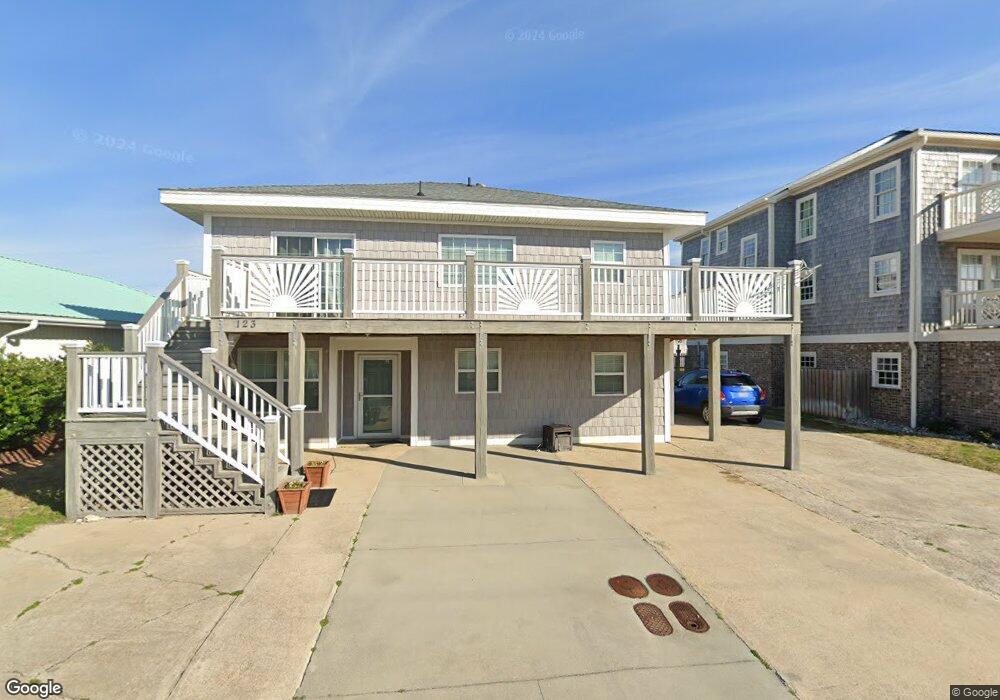
123 E Atlantic Blvd Atlantic Beach, NC 28512
Estimated Value: $853,000 - $1,543,000
3
Beds
1
Bath
1,200
Sq Ft
$913/Sq Ft
Est. Value
About This Home
This home is located at 123 E Atlantic Blvd, Atlantic Beach, NC 28512 and is currently estimated at $1,095,850, approximately $913 per square foot. 123 E Atlantic Blvd is a home located in Carteret County with nearby schools including Morehead City Primary School, Morehead Elementary School at Camp Glenn, and Morehead City Middle School.
Ownership History
Date
Name
Owned For
Owner Type
Purchase Details
Closed on
Jul 11, 2011
Sold by
Branch Banking & Trust Company
Bought by
Penny Ronald R and Penny Dianne B
Current Estimated Value
Purchase Details
Closed on
Oct 25, 2010
Sold by
Hardison Ricky Lynn and Hardison Anne Beasley
Bought by
Branch Banking & Trust Company
Purchase Details
Closed on
Jan 8, 2009
Sold by
Hardison Ricky L
Bought by
Sound Banking Company
Purchase Details
Closed on
Jan 9, 2006
Sold by
Wells Allen Y and Wells Donna K
Bought by
Hardison Ricky L and Hardison Anne B
Home Financials for this Owner
Home Financials are based on the most recent Mortgage that was taken out on this home.
Original Mortgage
$599,500
Interest Rate
6.22%
Mortgage Type
Purchase Money Mortgage
Purchase Details
Closed on
Dec 12, 2002
Create a Home Valuation Report for This Property
The Home Valuation Report is an in-depth analysis detailing your home's value as well as a comparison with similar homes in the area
Home Values in the Area
Average Home Value in this Area
Purchase History
| Date | Buyer | Sale Price | Title Company |
|---|---|---|---|
| Penny Ronald R | $205,000 | None Available | |
| Branch Banking & Trust Company | $176,800 | None Available | |
| Sound Banking Company | $1,175,000 | None Available | |
| Hardison Ricky L | $600,000 | None Available | |
| -- | $165,000 | -- |
Source: Public Records
Mortgage History
| Date | Status | Borrower | Loan Amount |
|---|---|---|---|
| Previous Owner | Hardison Ricky L | $599,500 |
Source: Public Records
Tax History Compared to Growth
Tax History
| Year | Tax Paid | Tax Assessment Tax Assessment Total Assessment is a certain percentage of the fair market value that is determined by local assessors to be the total taxable value of land and additions on the property. | Land | Improvement |
|---|---|---|---|---|
| 2025 | $2,168 | $919,906 | $286,426 | $633,480 |
| 2024 | $1,908 | $532,237 | $272,160 | $260,077 |
| 2023 | $1,825 | $532,237 | $272,160 | $260,077 |
| 2022 | $1,771 | $532,237 | $272,160 | $260,077 |
| 2021 | $1,771 | $532,237 | $272,160 | $260,077 |
| 2020 | $1,771 | $532,237 | $272,160 | $260,077 |
| 2019 | $1,391 | $443,907 | $217,728 | $226,179 |
| 2017 | $1,391 | $443,907 | $217,728 | $226,179 |
| 2016 | $1,391 | $443,907 | $217,728 | $226,179 |
| 2015 | $1,347 | $443,907 | $217,728 | $226,179 |
| 2014 | -- | $473,483 | $261,630 | $211,853 |
Source: Public Records
Map
Nearby Homes
- 208 Beaufort Ave Unit 1
- 111 E Terminal Blvd
- 217 W Atlantic Blvd
- 104 Atlantic Beach Causeway
- 119 Center Dr Unit 1
- 119 Center Dr Unit 3
- 108 N Kinston Ave
- 209 W Terminal Blvd
- 121 Old Causeway Rd Unit 12
- 115 Bowen St
- 121 Sound Dr
- 408 Caswell St Unit B
- 503 W Bogue Blvd
- 519 Atlantic Beach Causeway
- 602 Ft MacOn Rd W Unit 231
- 602 W Fort MacOn Rd Unit 109
- 602 Ft MacOn Rd W Unit 249
- 602 Fort MacOn Rd
- 602 W Fort MacOn Rd Unit 242
- 602 Ft MacOn Rd W Unit 148
- 127 E Atlantic Blvd
- 121 E Atlantic Blvd
- 119 E Atlantic Blvd
- 129 Atlantic Blvd
- 117 E Atlantic Blvd
- 126 Terminal Blvd
- 119 East Boardwalk
- 120 E Terminal Blvd
- 124 E Terminal Blvd
- 120 E Atlantic Blvd
- 122 E Terminal Blvd
- 128 E Terminal Blvd
- 115 E Atlantic Blvd
- 115 E Atlantic Blvd Unit A-3 Crystal Coast
- 115 E Atlantic Blvd Unit 2
- 118 E Terminal Blvd
- 116 E Atlantic Blvd
- 114 E Atlantic Blvd
- 115 E Boardwalk Blvd
- 115 East Boardwalk