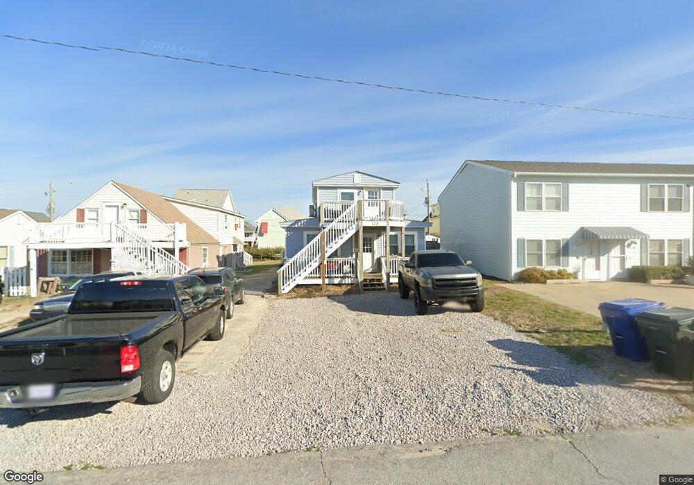
123 E Terminal Blvd Atlantic Beach, NC 28512
Estimated Value: $446,000 - $786,000
4
Beds
2
Baths
1,638
Sq Ft
$364/Sq Ft
Est. Value
About This Home
This home is located at 123 E Terminal Blvd, Atlantic Beach, NC 28512 and is currently estimated at $595,872, approximately $363 per square foot. 123 E Terminal Blvd is a home located in Carteret County with nearby schools including Morehead City Primary School, Morehead Elementary School at Camp Glenn, and Morehead City Middle School.
Ownership History
Date
Name
Owned For
Owner Type
Purchase Details
Closed on
Oct 9, 2024
Sold by
Fitzula Properties Llc
Bought by
A & B Property Management Llc
Current Estimated Value
Purchase Details
Closed on
Mar 10, 2011
Sold by
L & D Of Ab Llc
Bought by
Fitzula Properties Llc
Home Financials for this Owner
Home Financials are based on the most recent Mortgage that was taken out on this home.
Original Mortgage
$75,000
Interest Rate
4.76%
Mortgage Type
Seller Take Back
Create a Home Valuation Report for This Property
The Home Valuation Report is an in-depth analysis detailing your home's value as well as a comparison with similar homes in the area
Home Values in the Area
Average Home Value in this Area
Purchase History
| Date | Buyer | Sale Price | Title Company |
|---|---|---|---|
| A & B Property Management Llc | $475,000 | None Listed On Document | |
| A & B Property Management Llc | $475,000 | None Listed On Document | |
| Fitzula Properties Llc | $150,000 | None Available |
Source: Public Records
Mortgage History
| Date | Status | Borrower | Loan Amount |
|---|---|---|---|
| Previous Owner | Fitzula Properties Llc | $75,000 |
Source: Public Records
Tax History
| Year | Tax Paid | Tax Assessment Tax Assessment Total Assessment is a certain percentage of the fair market value that is determined by local assessors to be the total taxable value of land and additions on the property. | Land | Improvement |
|---|---|---|---|---|
| 2025 | $1,159 | $471,562 | $275,324 | $196,238 |
| 2024 | $769 | $197,374 | $120,656 | $76,718 |
| 2023 | $686 | $197,374 | $120,656 | $76,718 |
| 2022 | $666 | $197,374 | $120,656 | $76,718 |
| 2021 | $666 | $197,374 | $120,656 | $76,718 |
| 2020 | $666 | $197,374 | $120,656 | $76,718 |
| 2019 | $463 | $144,515 | $70,638 | $73,877 |
| 2017 | $463 | $144,515 | $70,638 | $73,877 |
| 2016 | $463 | $144,515 | $70,638 | $73,877 |
| 2015 | $449 | $144,515 | $70,638 | $73,877 |
| 2014 | $529 | $171,427 | $102,142 | $69,285 |
Source: Public Records
Map
Nearby Homes
- 208 Beaufort Ave Unit 1
- 115 E Bogue Blvd
- 303 E Atlantic Blvd
- 310 E Terminal Blvd
- 215 E Fort MacOn Rd
- 104 Atlantic Beach Causeway
- 108 N Kinston Ave
- 202 Glenn St
- 108 W Terminal Blvd Unit B
- 400 Atlantic Beach Causeway Unit Slip 2
- 404 Dobbs St
- 121 Old Causeway Rd Unit 12
- 121 Sound Dr
- 203 Old Causeway Rd
- 519 Atlantic Beach Causeway
- 107 Ocean Ridge Dr
- 247 Bayview Blvd
- 602 Ft MacOn Rd W Unit 231
- 602 Ft MacOn Rd W Unit 249
- 602 W Fort MacOn Rd Unit 116
- 125 E Terminal Blvd Unit B
- 125 E Terminal Blvd Unit A
- 121 E Terminal Blvd
- 127 E Terminal Blvd Unit B
- 127 E Terminal Blvd Unit A
- 119 E Terminal Blvd
- 118 E Bogue
- 122 E Terminal Blvd
- 206 Beaufort Ave Unit 2
- 206 Beaufort Ave Unit B
- 208 Beaufort Ave
- 124 E Terminal Blvd
- 120 E Bogue Blvd
- 204 Beaufort Ave Unit 3
- 204 Beaufort Ave Unit U3
- 120 E Terminal Blvd
- 116 E Bogue Blvd
- 128 E Terminal Blvd
- 200 Beaufort Ave
- 118 E Terminal Blvd
Your Personal Tour Guide
Ask me questions while you tour the home.