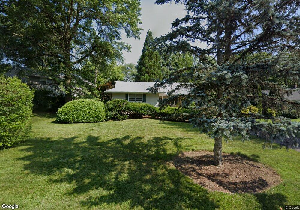
123 Hawthorne Dr New Providence, NJ 07974
Estimated Value: $647,529 - $888,000
--
Bed
--
Bath
1,247
Sq Ft
$622/Sq Ft
Est. Value
About This Home
This home is located at 123 Hawthorne Dr, New Providence, NJ 07974 and is currently estimated at $775,882, approximately $622 per square foot. 123 Hawthorne Dr is a home located in Union County with nearby schools including New Providence High School and The Academy of Our Lady of Peace.
Ownership History
Date
Name
Owned For
Owner Type
Purchase Details
Closed on
Mar 13, 2001
Sold by
Thompson Barbara B
Bought by
Banu Mihai and Banu Dana
Current Estimated Value
Home Financials for this Owner
Home Financials are based on the most recent Mortgage that was taken out on this home.
Original Mortgage
$100,000
Outstanding Balance
$36,168
Interest Rate
6.93%
Estimated Equity
$739,714
Purchase Details
Closed on
Jun 29, 1994
Sold by
Thompson Richard N and Thompson Barbara B
Bought by
Thompson Barbara B
Create a Home Valuation Report for This Property
The Home Valuation Report is an in-depth analysis detailing your home's value as well as a comparison with similar homes in the area
Home Values in the Area
Average Home Value in this Area
Purchase History
| Date | Buyer | Sale Price | Title Company |
|---|---|---|---|
| Banu Mihai | $310,000 | Quest Title Agency Inc | |
| Thompson Barbara B | -- | -- |
Source: Public Records
Mortgage History
| Date | Status | Borrower | Loan Amount |
|---|---|---|---|
| Open | Banu Mihai | $100,000 |
Source: Public Records
Tax History Compared to Growth
Tax History
| Year | Tax Paid | Tax Assessment Tax Assessment Total Assessment is a certain percentage of the fair market value that is determined by local assessors to be the total taxable value of land and additions on the property. | Land | Improvement |
|---|---|---|---|---|
| 2025 | $10,417 | $201,800 | $103,200 | $98,600 |
| 2024 | $10,104 | $201,800 | $103,200 | $98,600 |
| 2023 | $10,104 | $201,800 | $103,200 | $98,600 |
| 2022 | $9,965 | $201,800 | $103,200 | $98,600 |
| 2021 | $9,892 | $201,800 | $103,200 | $98,600 |
| 2020 | $9,888 | $201,800 | $103,200 | $98,600 |
| 2019 | $9,828 | $201,800 | $103,200 | $98,600 |
| 2018 | $9,777 | $201,800 | $103,200 | $98,600 |
| 2017 | $9,618 | $201,800 | $103,200 | $98,600 |
| 2016 | $9,483 | $201,800 | $103,200 | $98,600 |
| 2015 | $9,351 | $201,800 | $103,200 | $98,600 |
| 2014 | $9,210 | $201,800 | $103,200 | $98,600 |
Source: Public Records
Map
Nearby Homes