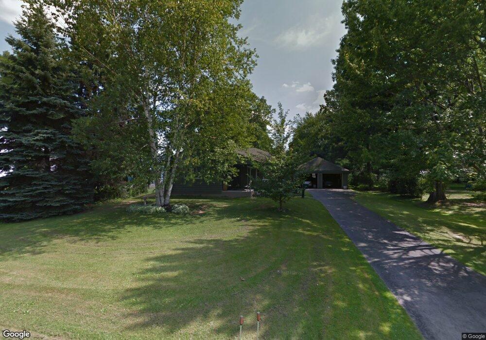
123 Massachusetts Ave Youngstown, OH 44514
Estimated Value: $169,678 - $195,000
3
Beds
1
Bath
1,244
Sq Ft
$147/Sq Ft
Est. Value
About This Home
This home is located at 123 Massachusetts Ave, Youngstown, OH 44514 and is currently estimated at $182,420, approximately $146 per square foot. 123 Massachusetts Ave is a home located in Mahoning County with nearby schools including Poland Union Elementary School, Poland Middle School, and Poland Seminary High School.
Ownership History
Date
Name
Owned For
Owner Type
Purchase Details
Closed on
Dec 7, 2022
Bought by
Brian T Miller
Current Estimated Value
Purchase Details
Closed on
Oct 25, 1994
Sold by
Garrett Jack E
Bought by
Miller Brian J and Miller Susan Jo
Home Financials for this Owner
Home Financials are based on the most recent Mortgage that was taken out on this home.
Original Mortgage
$17,000
Interest Rate
8.09%
Mortgage Type
New Conventional
Purchase Details
Closed on
Apr 14, 1980
Bought by
Garrett Jack E and Garrett Margt M
Create a Home Valuation Report for This Property
The Home Valuation Report is an in-depth analysis detailing your home's value as well as a comparison with similar homes in the area
Home Values in the Area
Average Home Value in this Area
Purchase History
| Date | Buyer | Sale Price | Title Company |
|---|---|---|---|
| Brian T Miller | -- | -- | |
| Miller Brian J | $72,000 | -- | |
| Garrett Jack E | -- | -- |
Source: Public Records
Mortgage History
| Date | Status | Borrower | Loan Amount |
|---|---|---|---|
| Previous Owner | Miller Brian J | $17,000 |
Source: Public Records
Tax History Compared to Growth
Tax History
| Year | Tax Paid | Tax Assessment Tax Assessment Total Assessment is a certain percentage of the fair market value that is determined by local assessors to be the total taxable value of land and additions on the property. | Land | Improvement |
|---|---|---|---|---|
| 2024 | $2,298 | $42,710 | $4,960 | $37,750 |
| 2023 | $2,272 | $42,710 | $4,960 | $37,750 |
| 2022 | $2,000 | $32,970 | $4,750 | $28,220 |
| 2021 | $1,913 | $32,970 | $4,750 | $28,220 |
| 2020 | $1,921 | $32,970 | $4,750 | $28,220 |
| 2019 | $1,775 | $28,260 | $4,750 | $23,510 |
| 2018 | $1,720 | $28,260 | $4,750 | $23,510 |
| 2017 | $1,717 | $28,260 | $4,750 | $23,510 |
| 2016 | $1,772 | $27,740 | $4,320 | $23,420 |
| 2015 | $1,682 | $27,740 | $4,320 | $23,420 |
| 2014 | $1,687 | $27,740 | $4,320 | $23,420 |
| 2013 | $1,667 | $27,740 | $4,320 | $23,420 |
Source: Public Records
Map
Nearby Homes
- 1827 Alverne Dr
- 1804 Alverne Dr
- 1738 Island Dr
- 1 Michigan Ave
- 43 Venloe Dr
- 34 Venloe Dr
- 2035 Woodward Ave
- 1894 Lealand Ave
- 2295 Bel Aire Ln
- 2379 Clyde St
- 1859 Mathews Rd
- 8360 South Ave
- 1890 Mathews Rd
- 2153 Lyon Blvd
- 2307 Hamilton Ave
- 2128 Lyon Blvd
- 0 Mathews Rd Unit 5149232
- 0 Mathews Rd Unit 5143059
- 5710 Youngstown Poland Rd
- 6074 Frontier Dr
- 121 Massachusetts Ave
- 133 Massachusetts Ave
- 1928 Cover Dr
- 1922 Cover Dr
- 1916 Cover Dr
- 1936 Cover Dr
- 119 Massachusetts Ave
- 124 Massachusetts Ave
- 122 Massachusetts Ave
- 1910 Cover Dr
- 126 Massachusetts Ave
- 1942 Cover Dr
- 120 Massachusetts Ave
- 115 Massachusetts Ave
- 128 Massachusetts Ave
- 1948 Cover Dr
- 1904 Cover Dr
- 118 Massachusetts Ave
- 130 Massachusetts Ave
- 113 Massachusetts Ave