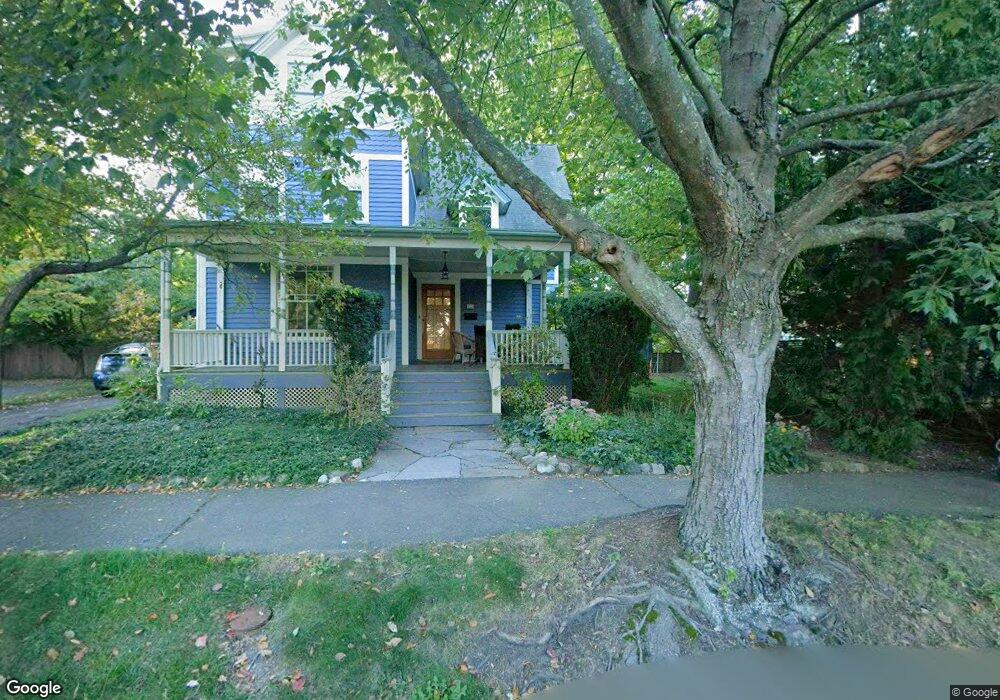
123 Massasoit St Northampton, MA 01060
Estimated Value: $697,000 - $830,000
3
Beds
2
Baths
1,922
Sq Ft
$402/Sq Ft
Est. Value
About This Home
This home is located at 123 Massasoit St, Northampton, MA 01060 and is currently estimated at $772,302, approximately $401 per square foot. 123 Massasoit St is a home located in Hampshire County with nearby schools including Northampton High School, The Montessori School of Northampton, and Lander Grinspoon Academy.
Ownership History
Date
Name
Owned For
Owner Type
Purchase Details
Closed on
Aug 6, 1999
Sold by
Putnam Linda B
Bought by
Hill Shawn and Putnam Amy B
Current Estimated Value
Home Financials for this Owner
Home Financials are based on the most recent Mortgage that was taken out on this home.
Original Mortgage
$187,306
Interest Rate
7.54%
Mortgage Type
Purchase Money Mortgage
Purchase Details
Closed on
Aug 15, 1997
Sold by
Wadkins Burrell O and Wadkins Sarah E
Bought by
Putnam Linda B
Create a Home Valuation Report for This Property
The Home Valuation Report is an in-depth analysis detailing your home's value as well as a comparison with similar homes in the area
Home Values in the Area
Average Home Value in this Area
Purchase History
| Date | Buyer | Sale Price | Title Company |
|---|---|---|---|
| Hill Shawn | $108,000 | -- | |
| Putnam Linda B | $108,000 | -- |
Source: Public Records
Mortgage History
| Date | Status | Borrower | Loan Amount |
|---|---|---|---|
| Open | Putnam Linda B | $40,000 | |
| Open | Putnam Linda B | $213,500 | |
| Closed | Putnam Linda B | $187,306 |
Source: Public Records
Tax History Compared to Growth
Tax History
| Year | Tax Paid | Tax Assessment Tax Assessment Total Assessment is a certain percentage of the fair market value that is determined by local assessors to be the total taxable value of land and additions on the property. | Land | Improvement |
|---|---|---|---|---|
| 2025 | $9,216 | $661,600 | $188,600 | $473,000 |
| 2024 | $8,913 | $586,800 | $171,500 | $415,300 |
| 2023 | $8,040 | $507,600 | $156,000 | $351,600 |
| 2022 | $7,555 | $422,300 | $145,800 | $276,500 |
| 2021 | $6,550 | $377,100 | $136,800 | $240,300 |
| 2020 | $6,335 | $377,100 | $136,800 | $240,300 |
| 2019 | $6,338 | $364,900 | $136,800 | $228,100 |
| 2018 | $6,358 | $373,100 | $136,800 | $236,300 |
| 2017 | $6,227 | $373,100 | $136,800 | $236,300 |
| 2016 | $6,029 | $373,100 | $136,800 | $236,300 |
| 2015 | $5,697 | $360,600 | $122,300 | $238,300 |
| 2014 | $5,173 | $336,100 | $122,300 | $213,800 |
Source: Public Records
Map
Nearby Homes
- 61 Woodlawn Ave
- 14 Arlington St
- 153 Round Hill Rd
- 74 Barrett St Unit 105
- 37 Finn St
- 218 Elm St
- 215 State St
- 49 Kensington Ave
- 0 Terrace Ln
- 63 Riverside Dr
- 8 View Ave Unit A
- 8 View Ave Unit B
- 9 Walnut St Unit B
- 30 Cherry St
- 30 Cherry St Unit A
- 30 Cherry St Unit B
- 76 Cooke Ave
- 43 Center St Unit K
- 50 Union St Unit 18
- 30 Graves Ave Unit B