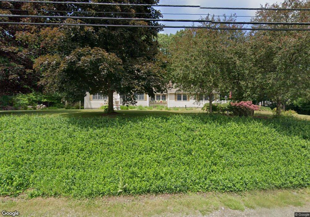
123 Riverlin St Unit A Millbury, MA 01527
Estimated Value: $641,000 - $666,926
1
Bed
1
Bath
900
Sq Ft
$724/Sq Ft
Est. Value
About This Home
This home is located at 123 Riverlin St Unit A, Millbury, MA 01527 and is currently estimated at $651,482, approximately $723 per square foot. 123 Riverlin St Unit A is a home located in Worcester County with nearby schools including Elmwood Street Elementary School, Raymond E. Shaw Elementary School, and Millbury Junior/Senior High School.
Ownership History
Date
Name
Owned For
Owner Type
Purchase Details
Closed on
Jan 26, 2026
Sold by
Green Richard A and Snyder Jeffery G
Bought by
Raeke Realty Trust-2023 and Raeke
Current Estimated Value
Purchase Details
Closed on
May 7, 2018
Sold by
Green Richard A
Bought by
Green Richard A and Snyder Jeffery G
Purchase Details
Closed on
Jun 20, 2005
Sold by
Green Richard A
Bought by
Fox Peter and Fox Sheila
Home Financials for this Owner
Home Financials are based on the most recent Mortgage that was taken out on this home.
Original Mortgage
$590,000
Interest Rate
5.78%
Mortgage Type
Purchase Money Mortgage
Create a Home Valuation Report for This Property
The Home Valuation Report is an in-depth analysis detailing your home's value as well as a comparison with similar homes in the area
Home Values in the Area
Average Home Value in this Area
Purchase History
| Date | Buyer | Sale Price | Title Company |
|---|---|---|---|
| Raeke Realty Trust-2023 | $660,000 | -- | |
| Green Richard A | -- | -- | |
| Fox Peter | $320,000 | -- |
Source: Public Records
Mortgage History
| Date | Status | Borrower | Loan Amount |
|---|---|---|---|
| Previous Owner | Fox Peter | $590,000 |
Source: Public Records
Tax History
| Year | Tax Paid | Tax Assessment Tax Assessment Total Assessment is a certain percentage of the fair market value that is determined by local assessors to be the total taxable value of land and additions on the property. | Land | Improvement |
|---|---|---|---|---|
| 2025 | $7,484 | $558,900 | $126,700 | $432,200 |
| 2024 | $6,275 | $474,300 | $117,200 | $357,100 |
| 2023 | $5,964 | $412,700 | $81,800 | $330,900 |
| 2022 | $5,333 | $355,500 | $81,800 | $273,700 |
| 2021 | $5,073 | $328,800 | $81,800 | $247,000 |
| 2020 | $0 | $324,000 | $81,800 | $242,200 |
| 2019 | $4,964 | $313,200 | $74,300 | $238,900 |
| 2018 | $0 | $281,300 | $74,300 | $207,000 |
| 2017 | $4,595 | $279,700 | $74,300 | $205,400 |
| 2016 | $4,719 | $265,300 | $74,300 | $191,000 |
| 2015 | $4,230 | $257,000 | $78,800 | $178,200 |
| 2014 | $4,003 | $234,100 | $78,800 | $155,300 |
Source: Public Records
Map
Nearby Homes
- 2 Riverlin Pkwy
- 8 Lincoln Ave
- 17 Lincoln Ave
- 2 Wilson Rd Unit B
- 2 Wilson Rd Unit A
- 7 Canal St
- 37-39 Main St
- 20 Woodridge Rd
- 46 Lexington Rd
- Lot 1 Cooper Rd
- 8 Autumn Gate Cir
- 8 Sycamore Cir
- 25 Upton St
- 0 Worcester Providence Turnpike
- 2 Diane St
- 38 W Main St
- 2 Jessica j Dr
- 300 Millbury Ave
- 4 Jessica j Dr
- 5 Mogren Dr
- 123 Riverlin St Unit 123A
- 127 Riverlin St
- 127 Riverlin St Unit 127
- 127 Riverlin St Unit 1
- 119 Riverlin St
- 117 Riverlin St
- 124 Riverlin St
- 129 Riverlin St
- 130 Riverlin St
- 10 Railroad Ave
- 115 Riverlin St
- 8 Railroad Ave
- 132 Riverlin St
- 6 Railroad Ave
- 113 Riverlin St
- 40 Millbury Ave
- 4 Railroad Ave
- 136 Riverlin St
- 138 Riverlin St
- 107 Riverlin St
Your Personal Tour Guide
Ask me questions while you tour the home.