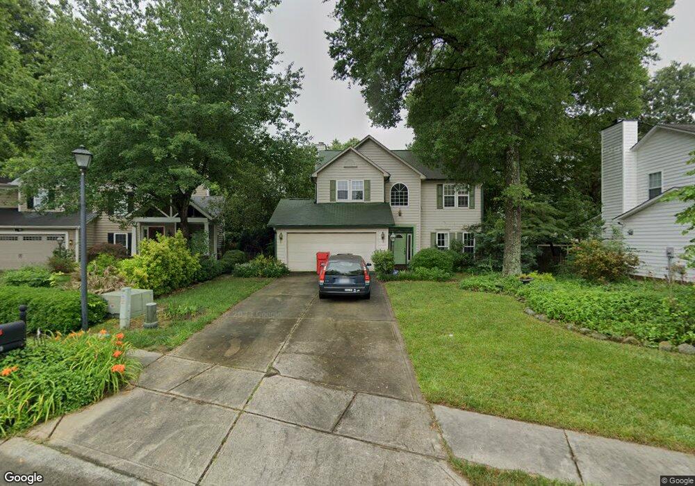
123 Shorecrest Dr Davidson, NC 28036
Estimated Value: $644,359 - $802,000
4
Beds
3
Baths
2,071
Sq Ft
$340/Sq Ft
Est. Value
About This Home
This home is located at 123 Shorecrest Dr, Davidson, NC 28036 and is currently estimated at $704,590, approximately $340 per square foot. 123 Shorecrest Dr is a home located in Mecklenburg County with nearby schools including Davidson Elementary School, William Amos Hough High School, and Davidson Day School.
Ownership History
Date
Name
Owned For
Owner Type
Purchase Details
Closed on
Feb 25, 2002
Sold by
Harris John G and Harris Julieann C
Bought by
Gratz David and Gratz Alice
Current Estimated Value
Home Financials for this Owner
Home Financials are based on the most recent Mortgage that was taken out on this home.
Original Mortgage
$152,800
Outstanding Balance
$63,649
Interest Rate
7.02%
Estimated Equity
$640,941
Create a Home Valuation Report for This Property
The Home Valuation Report is an in-depth analysis detailing your home's value as well as a comparison with similar homes in the area
Home Values in the Area
Average Home Value in this Area
Purchase History
| Date | Buyer | Sale Price | Title Company |
|---|---|---|---|
| Gratz David | $191,000 | -- |
Source: Public Records
Mortgage History
| Date | Status | Borrower | Loan Amount |
|---|---|---|---|
| Open | Gratz David | $152,800 | |
| Closed | Gratz David | $28,650 |
Source: Public Records
Tax History Compared to Growth
Tax History
| Year | Tax Paid | Tax Assessment Tax Assessment Total Assessment is a certain percentage of the fair market value that is determined by local assessors to be the total taxable value of land and additions on the property. | Land | Improvement |
|---|---|---|---|---|
| 2025 | -- | $505,600 | $235,000 | $270,600 |
| 2024 | -- | $505,600 | $235,000 | $270,600 |
| 2023 | $3,781 | $505,600 | $235,000 | $270,600 |
| 2022 | $3,118 | $326,800 | $150,000 | $176,800 |
| 2021 | $3,204 | $326,800 | $150,000 | $176,800 |
| 2020 | $2,964 | $326,800 | $150,000 | $176,800 |
| 2019 | $3,198 | $326,800 | $150,000 | $176,800 |
| 2018 | $2,768 | $216,500 | $90,000 | $126,500 |
| 2017 | $2,749 | $216,500 | $90,000 | $126,500 |
| 2016 | $2,745 | $216,500 | $90,000 | $126,500 |
| 2015 | $2,742 | $216,500 | $90,000 | $126,500 |
| 2014 | $2,740 | $0 | $0 | $0 |
Source: Public Records
Map
Nearby Homes
- 129 Shorecrest Dr
- 126 Lake Davidson Cir
- 729 Naramore St
- 415 Magnolia St
- 756 Naramore St
- 405 Armour St
- 748 Amalfi Dr
- 310 Magnolia St
- 330 Armour St Unit 46
- 620 Amalfi Dr
- 546 Amalfi Dr
- 215 Junaluska Dr
- 530 Amalfi Dr
- 711 Beaty St
- 708 Amalfi Dr
- 216 Wesser St Unit 6
- 122 Wesser St Unit 14
- 911 Naples Dr
- 831 Naples Dr
- 827 Naples Dr
- 117 Shorecrest Dr
- 418 Delburg St
- 412 Delburg St
- 135 Shorecrest Dr
- 424 Delburg St
- 430 Delburg St
- 406 Delburg St
- 442 Delburg St
- 112 Shorecrest Dr
- 130 Shorecrest Dr
- 124 Shorecrest Dr
- 429 Delburg Mill Alley Dr
- 106 Shorecrest Dr
- 101 Kinderston Dr
- 421 Delburg Mill Alley Dr
- 102 Kinderston Dr
- 102 Lake Davidson Cir
- 425 Delburg Mill Alley Dr
- 520 Delburg St
- 382 Delburg St