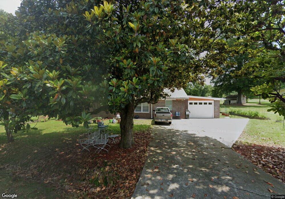
123 W Summit Dr SW Adairsville, GA 30103
Estimated Value: $179,000 - $217,000
4
Beds
2
Baths
1,284
Sq Ft
$152/Sq Ft
Est. Value
About This Home
This home is located at 123 W Summit Dr SW, Adairsville, GA 30103 and is currently estimated at $195,601, approximately $152 per square foot. 123 W Summit Dr SW is a home located in Gordon County with nearby schools including Swain Elementary School, Ashworth Middle School, and Gordon Central High School.
Ownership History
Date
Name
Owned For
Owner Type
Purchase Details
Closed on
Feb 26, 2019
Sold by
Holbert John William
Bought by
Mccollum J M and The Mccollum Rev Trust
Current Estimated Value
Purchase Details
Closed on
Mar 20, 2018
Sold by
Holbert Kristie Cross
Bought by
Holbert John William
Purchase Details
Closed on
Dec 21, 2006
Sold by
Holbert John W
Bought by
Cross Holbert John W and Cross Holbert Kristie
Home Financials for this Owner
Home Financials are based on the most recent Mortgage that was taken out on this home.
Original Mortgage
$83,400
Interest Rate
6.1%
Mortgage Type
New Conventional
Purchase Details
Closed on
Apr 21, 2004
Sold by
Ross Eula R
Bought by
Warren Cheryl
Purchase Details
Closed on
Aug 13, 1998
Sold by
Ross Willie F and Ross Eula R
Bought by
Ross Eula R
Create a Home Valuation Report for This Property
The Home Valuation Report is an in-depth analysis detailing your home's value as well as a comparison with similar homes in the area
Home Values in the Area
Average Home Value in this Area
Purchase History
| Date | Buyer | Sale Price | Title Company |
|---|---|---|---|
| Mccollum J M | $67,950 | -- | |
| Holbert John William | -- | -- | |
| Cross Holbert John W | -- | -- | |
| Holbert John W | $83,400 | -- | |
| Warren Cheryl | -- | -- | |
| Ross Eula R | -- | -- |
Source: Public Records
Mortgage History
| Date | Status | Borrower | Loan Amount |
|---|---|---|---|
| Previous Owner | Holbert John W | $83,400 |
Source: Public Records
Tax History Compared to Growth
Tax History
| Year | Tax Paid | Tax Assessment Tax Assessment Total Assessment is a certain percentage of the fair market value that is determined by local assessors to be the total taxable value of land and additions on the property. | Land | Improvement |
|---|---|---|---|---|
| 2024 | $385 | $44,600 | $3,520 | $41,080 |
| 2023 | $360 | $41,800 | $3,520 | $38,280 |
| 2022 | $1,058 | $39,160 | $3,520 | $35,640 |
| 2021 | $873 | $31,160 | $2,880 | $28,280 |
| 2020 | $779 | $31,640 | $2,880 | $28,760 |
| 2019 | $854 | $31,640 | $2,880 | $28,760 |
| 2018 | $789 | $29,400 | $2,880 | $26,520 |
| 2017 | $763 | $27,760 | $2,880 | $24,880 |
| 2016 | $765 | $27,760 | $2,880 | $24,880 |
| 2015 | $745 | $26,840 | $2,880 | $23,960 |
| 2014 | $693 | $25,782 | $2,891 | $22,890 |
Source: Public Records
Map
Nearby Homes
- 3610 Rome Rd SW
- 154 Honeysuckle Dr SW
- 180 Honeysuckle Vine Rd
- 221 Hardin Rd SW
- 3293 Rome Rd SW
- 332 Old Calhoun Rd SW
- 1211 Franklin Rd SW
- 2857 McDaniel Station Rd SW
- 159 Moores Ferry Rd SW
- 187 Cantrell Dr SW
- 356 W Oak Grove Rd NW
- 241 River Bend Rd SW
- 241 Riverbend Rd SW
- 0 Woody Rd NW Unit 10634615
- 39 N Ridge Dr NW
- 102 W Summit Dr SW
- 211 Parkway Dr SW
- W E Summit Dr
- 129 W Summit Dr SW
- 174 Parkway Dr SW
- 215 Parkway Dr SW
- 107 W Summit Dr SW
- 103 W Summit Dr SW
- 118 W Summit Dr SW
- 205 Parkway Dr SW
- 210 Parkway Dr SW
- 201 Parkway Dr SW
- 189 Parkway Dr SW
- 112 E Summit Dr SW
- 248 Brownlee Mountain Rd SW
- 171 Parkway Dr SW
- 222 Parkway Dr SW
- 204 Parkway Dr SW
- 213 Parkway Dr SW
- 234 Brownlee Mountain Rd SW