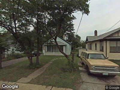
123 W Thornton Ave Saint Louis, MO 63119
Estimated Value: $138,000 - $159,336
2
Beds
1
Bath
840
Sq Ft
$176/Sq Ft
Est. Value
About This Home
This home is located at 123 W Thornton Ave, Saint Louis, MO 63119 and is currently estimated at $148,084, approximately $176 per square foot. 123 W Thornton Ave is a home located in St. Louis County with nearby schools including Bristol Elementary School, Hixson Middle School, and Webster Groves High School.
Ownership History
Date
Name
Owned For
Owner Type
Purchase Details
Closed on
Jul 26, 2017
Sold by
Mccabe Myles and Mccabe Margaret Ann
Bought by
Mccabe Myles and Mccabe Margaret Ann
Current Estimated Value
Purchase Details
Closed on
Feb 24, 2011
Sold by
Federal National Mortgage Association
Bought by
Mccabe Myles and Mccabe Margaret Ann
Purchase Details
Closed on
Jul 26, 2010
Sold by
Odom David
Bought by
Federal National Mortgage Association
Purchase Details
Closed on
Apr 13, 2006
Sold by
Fronick Catherine
Bought by
Odom David
Home Financials for this Owner
Home Financials are based on the most recent Mortgage that was taken out on this home.
Original Mortgage
$63,474
Interest Rate
6.33%
Mortgage Type
Purchase Money Mortgage
Purchase Details
Closed on
Mar 17, 2005
Sold by
Citifinancial Mortgage
Bought by
Fronick Catherine
Home Financials for this Owner
Home Financials are based on the most recent Mortgage that was taken out on this home.
Original Mortgage
$48,150
Interest Rate
8.1%
Mortgage Type
Purchase Money Mortgage
Purchase Details
Closed on
Aug 11, 2004
Sold by
Fleming Phil
Bought by
Citifinancial Mortgage and Associates Home Equity Services Inc
Create a Home Valuation Report for This Property
The Home Valuation Report is an in-depth analysis detailing your home's value as well as a comparison with similar homes in the area
Home Values in the Area
Average Home Value in this Area
Purchase History
| Date | Buyer | Sale Price | Title Company |
|---|---|---|---|
| Mccabe Myles | -- | None Available | |
| Mccabe Myles | $27,500 | Ctc | |
| Federal National Mortgage Association | $74,464 | None Available | |
| Odom David | $60,000 | Abstar Title Company | |
| Fronick Catherine | $53,500 | -- | |
| Citifinancial Mortgage | $59,900 | -- |
Source: Public Records
Mortgage History
| Date | Status | Borrower | Loan Amount |
|---|---|---|---|
| Previous Owner | David | $69,000 | |
| Previous Owner | Odom David | $63,474 | |
| Previous Owner | Fronick Catherine | $48,150 |
Source: Public Records
Tax History Compared to Growth
Tax History
| Year | Tax Paid | Tax Assessment Tax Assessment Total Assessment is a certain percentage of the fair market value that is determined by local assessors to be the total taxable value of land and additions on the property. | Land | Improvement |
|---|---|---|---|---|
| 2023 | $1,404 | $19,740 | $13,030 | $6,710 |
| 2022 | $1,320 | $17,200 | $10,870 | $6,330 |
| 2021 | $1,316 | $17,200 | $10,870 | $6,330 |
| 2020 | $1,251 | $15,200 | $8,700 | $6,500 |
| 2019 | $1,242 | $15,200 | $8,700 | $6,500 |
| 2018 | $998 | $10,740 | $6,730 | $4,010 |
| 2017 | $992 | $10,740 | $6,730 | $4,010 |
| 2016 | $1,001 | $10,450 | $5,780 | $4,670 |
| 2015 | $994 | $10,450 | $5,780 | $4,670 |
| 2014 | -- | $10,450 | $5,810 | $4,640 |
Source: Public Records
Map
Nearby Homes
- 120 W Thornton Ave
- 133 Lithia Ave
- 125 Lithia Ave
- 901 Cornell Ave
- 712 Cornell Ave
- 126 E Waymire Ave
- 724 N Rock Hill Rd
- 2831 Dunkirk Dr
- 218 Euclid Ave
- 3 Douglass Manor Ct
- 2854 Lawndell Dr
- 9239 Merritt Ave
- 2904 Collier Ave
- 9235 Merritt Ave
- 9227 Merritt Ave
- 1033 N Rock Hill Rd
- 301 Dawson Ct
- 1035 N Rock Hill Rd
- 1232 Charlane Ct
- 420 Lee Ave
- 123 W Thornton Ave
- 121 W Thornton Ave
- 127 W Thornton Ave
- 124 W Thornton Ave
- 126 W Thornton Ave
- 130 W Thornton Ave
- 802 Ennis Ave
- 116 W Thornton Ave
- 808 Ennis Ave
- 134 W Thornton Ave
- 112 W Thornton Ave
- 812 Ennis Ave
- 140 W Thornton Ave
- 108 W Thornton Ave
- 129 Lithia Ave
- 139 Lithia Ave
- 900 Ennis Ave
- 203 Lithia Ave
- 121 Lithia Ave
- 104 W Thornton Ave