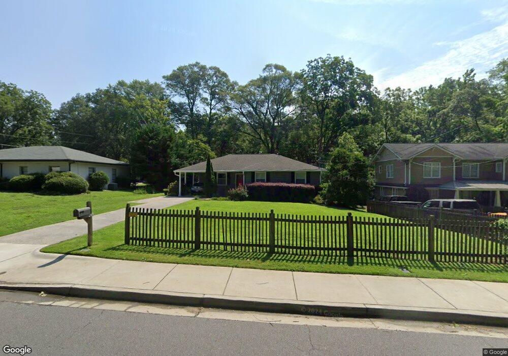
123 Whitlock Dr SW Marietta, GA 30064
Estimated Value: $393,219 - $494,000
3
Beds
1
Bath
1,208
Sq Ft
$370/Sq Ft
Est. Value
About This Home
This home is located at 123 Whitlock Dr SW, Marietta, GA 30064 and is currently estimated at $447,305, approximately $370 per square foot. 123 Whitlock Dr SW is a home located in Cobb County with nearby schools including A.L. Burruss Elementary School, Marietta Sixth Grade Academy, and Marietta Middle School.
Ownership History
Date
Name
Owned For
Owner Type
Purchase Details
Closed on
Jul 2, 2025
Sold by
Woodstock Family Living Trust and Woodstock Thomas Edward
Bought by
Woodstock Thomas Edward and Woodstock Alicia Reid
Current Estimated Value
Purchase Details
Closed on
Aug 26, 2022
Sold by
Thomas Woodstock
Bought by
Woodstock Family Living Trust
Purchase Details
Closed on
Dec 15, 2020
Sold by
Woodstock Thomas
Bought by
Woodstock Thomas and Bottone Brenda H
Purchase Details
Closed on
Dec 6, 2018
Sold by
Woodstock Thomas
Bought by
Woodstock Thomas and Bottone Brenda H
Purchase Details
Closed on
May 7, 2018
Sold by
Denney Mark E
Bought by
Woodstock Thomas
Home Financials for this Owner
Home Financials are based on the most recent Mortgage that was taken out on this home.
Original Mortgage
$228,650
Interest Rate
4.4%
Mortgage Type
New Conventional
Purchase Details
Closed on
Jan 31, 2007
Sold by
Denney Mark E
Bought by
Denney Mark E and Denney Elizabeth A
Home Financials for this Owner
Home Financials are based on the most recent Mortgage that was taken out on this home.
Original Mortgage
$183,200
Interest Rate
6.14%
Mortgage Type
New Conventional
Purchase Details
Closed on
Aug 19, 1999
Sold by
Vail Ruth A
Bought by
Couch Robin E and Couch Karen M
Home Financials for this Owner
Home Financials are based on the most recent Mortgage that was taken out on this home.
Original Mortgage
$159,018
Interest Rate
7.65%
Mortgage Type
VA
Purchase Details
Closed on
Nov 25, 1996
Sold by
Rechsteiner Lynn Ray
Bought by
Sanders Ruth A
Create a Home Valuation Report for This Property
The Home Valuation Report is an in-depth analysis detailing your home's value as well as a comparison with similar homes in the area
Home Values in the Area
Average Home Value in this Area
Purchase History
| Date | Buyer | Sale Price | Title Company |
|---|---|---|---|
| Woodstock Thomas Edward | -- | None Listed On Document | |
| Woodstock Thomas Edward | -- | None Listed On Document | |
| Woodstock Family Living Trust | -- | -- | |
| Woodstock Thomas | -- | None Available | |
| Woodstock Thomas | -- | -- | |
| Woodstock Thomas | $269,000 | -- | |
| Denney Mark E | -- | -- | |
| Denney Mark E | $229,000 | -- | |
| Couch Robin E | $155,900 | -- | |
| Sanders Ruth A | $127,000 | -- |
Source: Public Records
Mortgage History
| Date | Status | Borrower | Loan Amount |
|---|---|---|---|
| Previous Owner | Woodstock Thomas | $228,650 | |
| Previous Owner | Denney Mark E | $183,200 | |
| Previous Owner | Couch Robin E | $159,018 | |
| Closed | Sanders Ruth A | $0 |
Source: Public Records
Tax History Compared to Growth
Tax History
| Year | Tax Paid | Tax Assessment Tax Assessment Total Assessment is a certain percentage of the fair market value that is determined by local assessors to be the total taxable value of land and additions on the property. | Land | Improvement |
|---|---|---|---|---|
| 2024 | $1,375 | $162,572 | $60,000 | $102,572 |
| 2023 | $1,214 | $143,456 | $52,000 | $91,456 |
| 2022 | $920 | $149,516 | $52,000 | $97,516 |
| 2021 | $936 | $127,100 | $52,000 | $75,100 |
| 2020 | $1,020 | $118,720 | $52,000 | $66,720 |
| 2019 | $924 | $107,600 | $46,240 | $61,360 |
| 2018 | $665 | $77,364 | $44,000 | $33,364 |
| 2017 | $533 | $77,364 | $44,000 | $33,364 |
| 2016 | $515 | $74,760 | $44,000 | $30,760 |
| 2015 | $531 | $70,760 | $40,000 | $30,760 |
| 2014 | $568 | $73,320 | $0 | $0 |
Source: Public Records
Map
Nearby Homes
- 21 Whitlock Dr SW
- 132 Northcutt St SW
- 32 Durham St SW
- 131 Brookwood Dr SW
- 96 McDonald St SW
- 25 Whitlock Square SW
- 157 Normandy Dr SW
- 325 Polk St NW
- 221 Wright St SW
- 59 Trammell St SW
- 195 Wright St SW
- 415 S Woodland Dr SW
- 563 Hillandale Cir SW
- 305 Brookwood Dr SW
- 61 Griggs St SW
- 80 Lindley Ave NW Unit 1
- 255 Maple Ave NW
- 236 Ridge Ave NW
- 272 Cascade Dr NW
- 600 Applewood Ln NW
- 113 Whitlock Dr SW
- 0 Whitlock Dr SW Unit 7519214
- 0 Whitlock Dr SW Unit 7077469
- 0 Whitlock Dr SW Unit 8416054
- 0 Whitlock Dr SW Unit 8521158
- 0 Whitlock Dr SW Unit 8117119
- 0 Whitlock Dr SW Unit 8797370
- 0 Whitlock Dr SW Unit 8826696
- 133 Whitlock Dr SW
- 95 Whitlock Dr SW
- 112 Whitlock Dr SW
- 261 Maxwell Ave SW
- 310 N Woodland Dr SW
- 153 Whitlock Dr SW
- 85 Whitlock Dr SW
- 94 Whitlock Dr SW
- 289 N Hillcrest Dr SW
- 266 Maxwell Ave SW
- 247 Maxwell Ave SW
- 327 Maxwell Ave SW