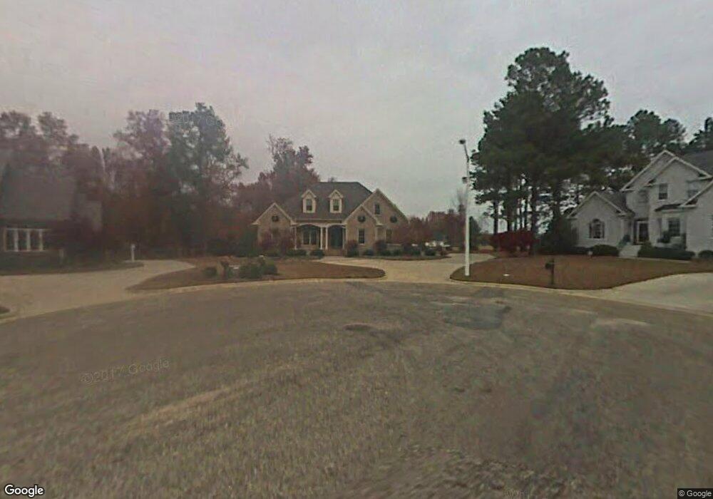
123 Woodside Ln Benson, NC 27504
Estimated Value: $398,000 - $453,000
3
Beds
3
Baths
2,593
Sq Ft
$166/Sq Ft
Est. Value
About This Home
This home is located at 123 Woodside Ln, Benson, NC 27504 and is currently estimated at $430,297, approximately $165 per square foot. 123 Woodside Ln is a home located in Johnston County with nearby schools including Benson Elementary School, Benson Middle School, and South Johnston High School.
Ownership History
Date
Name
Owned For
Owner Type
Purchase Details
Closed on
Jun 9, 2021
Sold by
Bryant Joshua Dale and Joyce Smith Bryant
Bought by
Royal Charles Kenneth and Tart Lindsay
Current Estimated Value
Purchase Details
Closed on
Oct 7, 2004
Sold by
Bryant Joyce S
Bought by
Rhodes Gary M
Purchase Details
Closed on
Apr 26, 2002
Sold by
Rhodes Gary M
Bought by
Rhodes Gary M
Create a Home Valuation Report for This Property
The Home Valuation Report is an in-depth analysis detailing your home's value as well as a comparison with similar homes in the area
Home Values in the Area
Average Home Value in this Area
Purchase History
| Date | Buyer | Sale Price | Title Company |
|---|---|---|---|
| Royal Charles Kenneth | $300,000 | Keystone Title | |
| Rhodes Gary M | $280,000 | -- | |
| Rhodes Gary M | -- | -- |
Source: Public Records
Tax History Compared to Growth
Tax History
| Year | Tax Paid | Tax Assessment Tax Assessment Total Assessment is a certain percentage of the fair market value that is determined by local assessors to be the total taxable value of land and additions on the property. | Land | Improvement |
|---|---|---|---|---|
| 2025 | $5,184 | $458,740 | $44,000 | $414,740 |
| 2024 | $3,324 | $259,660 | $44,000 | $215,660 |
| 2023 | $3,324 | $259,660 | $44,000 | $215,660 |
| 2022 | $3,324 | $259,660 | $44,000 | $215,660 |
| 2021 | $3,198 | $249,830 | $44,000 | $205,830 |
| 2020 | $3,223 | $249,830 | $44,000 | $205,830 |
| 2019 | $3,223 | $249,830 | $44,000 | $205,830 |
| 2018 | $3,588 | $271,790 | $27,000 | $244,790 |
| 2017 | $3,588 | $271,790 | $27,000 | $244,790 |
| 2016 | $3,560 | $271,790 | $27,000 | $244,790 |
| 2015 | $3,560 | $271,790 | $27,000 | $244,790 |
| 2014 | $3,560 | $271,790 | $27,000 | $244,790 |
Source: Public Records
Map
Nearby Homes
- 802 N Lincoln St
- 14 Atlantic Ave
- 704 N Lincoln St
- 1039 N Lincoln St
- Tract 1 Benson Hardee Rd
- Tract 4 Benson Hardee Rd
- Tract 3 Benson Hardee Rd
- 116 Colonade Ct
- 1372 N Carolina 50
- 0 Benson Hardee Rd Unit 10069689
- 416 W Martin St
- 205 N Augusta Ave
- 110 Oak Park Dr
- 107 Oak Park Dr
- 702 W Main St
- 301 W Hill St
- 0 W Church St
- 204 W Hill St
- 208 W Church St
- 300 S Pine St
- 127 Woodside Ln
- 119 Woodside Ln
- 120 Woodside Ln
- 115 Lake Shore Dr
- 116 Woodside Ln
- 133 Woodside Ln
- 9 Park Place
- 137 Lake Shore Dr
- 118 Lake Shore Dr
- 11 Park Place Rd
- 145 Lake Shore Dr
- 7 Park Place
- 136 Lake Shore Dr
- 122 Lake Shore Dr
- 4 Park Place
- 149 Lake Shore Dr
- 0 Lake Shore Ct Unit 981072
- 0 Lakeshore Dr Unit 1686208
- 0 Lakeshore Dr Unit 981051
- 0 Lakeshore Dr Unit 981088