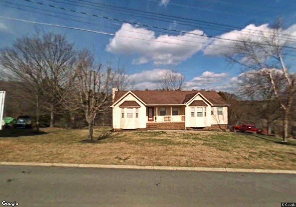
1230 Appalachian Trace Morristown, TN 37814
Estimated Value: $309,415 - $418,000
--
Bed
3
Baths
1,636
Sq Ft
$222/Sq Ft
Est. Value
About This Home
This home is located at 1230 Appalachian Trace, Morristown, TN 37814 and is currently estimated at $363,604, approximately $222 per square foot. 1230 Appalachian Trace is a home located in Hamblen County with nearby schools including West Elementary School, Lincoln Heights Middle School, and Morristown West High School.
Ownership History
Date
Name
Owned For
Owner Type
Purchase Details
Closed on
Sep 30, 2022
Sold by
Cantwell Lisa D
Bought by
Yount Floyd A and Yount Erika Izamar
Current Estimated Value
Home Financials for this Owner
Home Financials are based on the most recent Mortgage that was taken out on this home.
Original Mortgage
$265,821
Outstanding Balance
$254,077
Interest Rate
5.13%
Mortgage Type
FHA
Estimated Equity
$109,527
Purchase Details
Closed on
Aug 10, 1993
Bought by
Cantwell Lisa D
Purchase Details
Closed on
Jan 3, 1990
Bought by
Wertheimer Edgar B and Wertheimer Kimberly J
Purchase Details
Closed on
Jan 17, 1989
Bought by
Berg Industries Inc
Purchase Details
Closed on
Jul 6, 1988
Bought by
Rines Scotty
Purchase Details
Closed on
Oct 12, 1982
Bought by
Wohlwend James H and Wohlwend Janet
Create a Home Valuation Report for This Property
The Home Valuation Report is an in-depth analysis detailing your home's value as well as a comparison with similar homes in the area
Home Values in the Area
Average Home Value in this Area
Purchase History
| Date | Buyer | Sale Price | Title Company |
|---|---|---|---|
| Yount Floyd A | $275,000 | Lakeway Title Services | |
| Cantwell Lisa D | $124,900 | -- | |
| Wertheimer Edgar B | $113,900 | -- | |
| Berg Industries Inc | $109,900 | -- | |
| Rines Scotty | $11,500 | -- | |
| Wohlwend James H | -- | -- |
Source: Public Records
Mortgage History
| Date | Status | Borrower | Loan Amount |
|---|---|---|---|
| Open | Yount Floyd A | $265,821 |
Source: Public Records
Tax History Compared to Growth
Tax History
| Year | Tax Paid | Tax Assessment Tax Assessment Total Assessment is a certain percentage of the fair market value that is determined by local assessors to be the total taxable value of land and additions on the property. | Land | Improvement |
|---|---|---|---|---|
| 2024 | $902 | $51,250 | $8,300 | $42,950 |
| 2023 | $902 | $51,250 | $0 | $0 |
| 2022 | $1,620 | $51,250 | $8,300 | $42,950 |
| 2021 | $1,620 | $51,250 | $8,300 | $42,950 |
| 2020 | $1,617 | $51,250 | $8,300 | $42,950 |
| 2019 | $1,490 | $43,825 | $8,400 | $35,425 |
| 2018 | $1,381 | $43,825 | $8,400 | $35,425 |
| 2017 | $1,359 | $43,825 | $8,400 | $35,425 |
| 2016 | $1,297 | $43,825 | $8,400 | $35,425 |
| 2015 | $1,207 | $43,825 | $8,400 | $35,425 |
| 2014 | -- | $43,825 | $8,400 | $35,425 |
| 2013 | -- | $49,150 | $0 | $0 |
Source: Public Records
Map
Nearby Homes
- 1225 Appalachian Trace
- 1361 Appalachian Trace
- 509 Windridge Ln
- 1230 Mcfarland St Unit 37
- 1230 Mcfarland St Unit 3
- 1770 Walters Dr
- Lot 267 Waterview Way
- Lot 295 Inlet Cove
- 1626 Cardinal Dr
- 1318 Secretariat Dr
- 1613 Cardinal Dr
- 1171 Pine Haven Dr
- 877 Pine Haven Dr
- 1033 Walters Dr
- 145 Virginia Ave
- 506 Katerina Dr
- 235 Gilbert St
- 137 Morton St
- 941 Heykoop Dr
- 1442 Darbee Dr
- 1226 Appalachian Trace
- 1236 Appalachian Trace
- 1231 Appalachian Trace
- 1242 Appalachian Trace
- 1218 Appalachian Trace
- 1237 Appalachian Trace
- 1290 Daniel Boone Dr
- 1304 Daniel Boone Dr
- 1194 Daniel Boone Dr
- 1256 Appalachian Trace
- 1350 Daniel Boone Dr
- 1255 Appalachian Trace
- 1296 Appalachian Trace
- 1372 Daniel Boone Dr
- 1730 Wiley Blount Dr
- 2001 Vantage View Dr
- 1303 Daniel Boone Dr
- 1289 Daniel Boone Dr
- 1307 Appalachian Trace
- 1325 Daniel Boone Dr