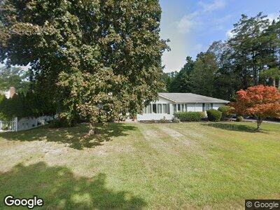
1230 Crittens Ln Southold, NY 11971
North Fork NeighborhoodEstimated Value: $1,092,719 - $1,392,000
4
Beds
2
Baths
2,100
Sq Ft
$582/Sq Ft
Est. Value
About This Home
This home is located at 1230 Crittens Ln, Southold, NY 11971 and is currently estimated at $1,221,180, approximately $581 per square foot. 1230 Crittens Ln is a home located in Suffolk County with nearby schools including Southold Elementary School and Southold Junior/Senior High School.
Ownership History
Date
Name
Owned For
Owner Type
Purchase Details
Closed on
Apr 16, 2021
Sold by
Caggiano Kathryn and Melita Dianne
Bought by
Guidice Frank and Guidice Kathleen
Current Estimated Value
Home Financials for this Owner
Home Financials are based on the most recent Mortgage that was taken out on this home.
Original Mortgage
$430,000
Interest Rate
2.9%
Mortgage Type
Stand Alone Refi Refinance Of Original Loan
Purchase Details
Closed on
Jan 8, 1998
Sold by
Polatnick Jerome and Polatnick Selma A
Bought by
Caggiano Rudolph J and Caggiano Dorothy M
Create a Home Valuation Report for This Property
The Home Valuation Report is an in-depth analysis detailing your home's value as well as a comparison with similar homes in the area
Home Values in the Area
Average Home Value in this Area
Purchase History
| Date | Buyer | Sale Price | Title Company |
|---|---|---|---|
| Guidice Frank | -- | None Available | |
| Caggiano Rudolph J | $215,000 | Ticor Title Guarantee Compan | |
| Caggiano Rudolph J | $215,000 | Ticor Title Guarantee Compan |
Source: Public Records
Mortgage History
| Date | Status | Borrower | Loan Amount |
|---|---|---|---|
| Previous Owner | Guidice Frank | $430,000 |
Source: Public Records
Tax History Compared to Growth
Tax History
| Year | Tax Paid | Tax Assessment Tax Assessment Total Assessment is a certain percentage of the fair market value that is determined by local assessors to be the total taxable value of land and additions on the property. | Land | Improvement |
|---|---|---|---|---|
| 2023 | $9,553 | $6,500 | $900 | $5,600 |
| 2022 | $9,095 | $6,500 | $900 | $5,600 |
| 2021 | $3,307 | $5,700 | $900 | $4,800 |
| 2020 | $3,260 | $5,700 | $900 | $4,800 |
| 2019 | $3,260 | $0 | $0 | $0 |
| 2018 | $4,138 | $5,700 | $900 | $4,800 |
| 2017 | $2,994 | $5,700 | $900 | $4,800 |
| 2016 | $2,953 | $5,700 | $900 | $4,800 |
| 2015 | -- | $5,700 | $900 | $4,800 |
| 2014 | -- | $6,500 | $900 | $5,600 |
Source: Public Records
Map
Nearby Homes
- 555 Oakwood Dr
- 860 N Bayview Rd
- 2575 Oaklawn Ave
- 265 Custer Ave
- 900 Pine Ave
- 633 Pine Neck Rd
- 875 Oak Ave
- 465 Ripple Water Ln
- 1750 Hobart Rd
- 950 Main Bayview Rd
- 11200 N Bayview Rd
- 11535 N Bayview Rd
- 45 Smith Dr N
- 155 Shepard Dr
- 600 Glenn Rd
- 4077 Main Bayview Rd
- 500 Summer Ln
- 150 Hobart Rd
- 55075 Route 25 Unit 1
- 55075 Main Rd Unit 1