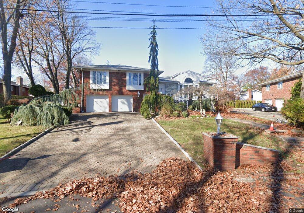
1230 Duncan Rd Fort Lee, NJ 07024
Estimated Value: $904,038 - $1,603,000
--
Bed
--
Bath
1,966
Sq Ft
$553/Sq Ft
Est. Value
About This Home
This home is located at 1230 Duncan Rd, Fort Lee, NJ 07024 and is currently estimated at $1,087,760, approximately $553 per square foot. 1230 Duncan Rd is a home located in Bergen County with nearby schools including Fort Lee High School, Christ the Teacher Academy, and Notre Dame Academy.
Ownership History
Date
Name
Owned For
Owner Type
Purchase Details
Closed on
Jul 1, 1996
Sold by
Kelpin Ronald and Kelpin Susan
Bought by
Morrissey Daniel
Current Estimated Value
Home Financials for this Owner
Home Financials are based on the most recent Mortgage that was taken out on this home.
Original Mortgage
$185,000
Outstanding Balance
$13,066
Interest Rate
7.98%
Estimated Equity
$1,074,694
Create a Home Valuation Report for This Property
The Home Valuation Report is an in-depth analysis detailing your home's value as well as a comparison with similar homes in the area
Home Values in the Area
Average Home Value in this Area
Purchase History
| Date | Buyer | Sale Price | Title Company |
|---|---|---|---|
| Morrissey Daniel | $207,000 | -- |
Source: Public Records
Mortgage History
| Date | Status | Borrower | Loan Amount |
|---|---|---|---|
| Open | Morrissey Daniel | $185,000 |
Source: Public Records
Tax History Compared to Growth
Tax History
| Year | Tax Paid | Tax Assessment Tax Assessment Total Assessment is a certain percentage of the fair market value that is determined by local assessors to be the total taxable value of land and additions on the property. | Land | Improvement |
|---|---|---|---|---|
| 2025 | $13,439 | $631,900 | $363,100 | $268,800 |
| 2024 | $12,981 | $584,300 | $326,000 | $258,300 |
| 2023 | $12,668 | $559,300 | $308,500 | $250,800 |
| 2022 | $12,668 | $526,300 | $285,900 | $240,400 |
| 2021 | $12,486 | $511,300 | $278,400 | $232,900 |
| 2020 | $12,141 | $499,200 | $269,900 | $229,300 |
| 2019 | $11,842 | $492,000 | $266,400 | $225,600 |
| 2018 | $8,207 | $486,800 | $263,400 | $223,400 |
| 2017 | $11,136 | $409,100 | $211,200 | $197,900 |
| 2016 | $10,804 | $409,100 | $211,200 | $197,900 |
| 2015 | $10,469 | $409,100 | $211,200 | $197,900 |
| 2014 | $10,154 | $406,400 | $211,200 | $195,200 |
Source: Public Records
Map
Nearby Homes
- 2 Euclid Rd
- 1 Euclid Rd
- 2 Horizon Rd Unit 627
- 2 Horizon Rd Unit 626
- 2 Horizon Rd Unit G9
- 2 Horizon Rd Unit 1422
- 2 Horizon Rd Unit 1418
- 2 Horizon Rd Unit 404
- 2 Horizon Rd Unit 1423
- 1 Horizon Rd Unit 1426
- 1 Horizon Rd Unit PH1
- 1 Horizon Rd Unit 609
- 1 Horizon Rd Unit G2
- 1 Horizon Rd Unit 817
- 1115 Buckingham Rd
- 6 Horizon Rd Unit 2106
- 6 Horizon Rd Unit 2301
- 6 Horizon Rd Unit 310
- 6 Horizon Rd Unit 604
- 6 Horizon Rd Unit 1706
- 36 Virginia Ave
- 1221 Duncan Rd
- 25 Euclid Rd
- 29 Euclid Rd
- 40 Virginia Ave
- 1200 Duncan Rd
- 1223 Duncan Rd
- 35 Virginia Ave
- 45 Euclid Rd
- 44 Virginia Ave
- 1212 Duncan Rd
- 43 Virginia Ave
- 1175 Crescent Way
- 46 Virginia Ave
- 1180 Crescent Way
- 1222 Duncan Rd
- 1216 Duncan Rd
- 47 Euclid Rd
- 47 Virginia Ave
- 1176 Buckingham Rd