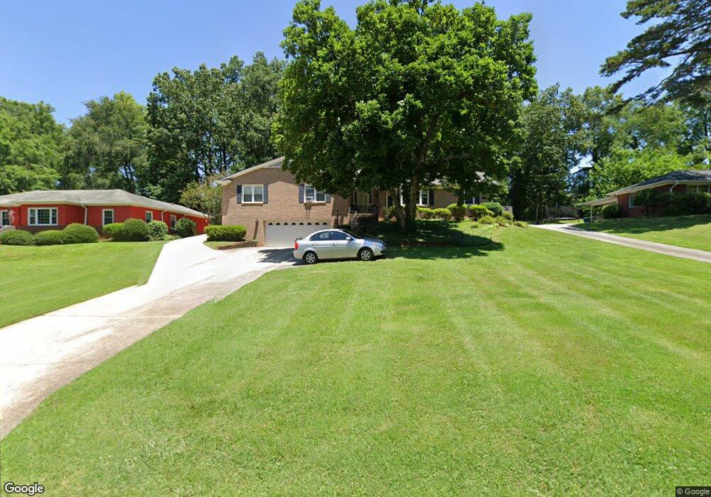
1230 Maxwell St Salisbury, NC 28144
Estimated Value: $380,939 - $542,000
3
Beds
3
Baths
2,740
Sq Ft
$157/Sq Ft
Est. Value
About This Home
This home is located at 1230 Maxwell St, Salisbury, NC 28144 and is currently estimated at $431,485, approximately $157 per square foot. 1230 Maxwell St is a home located in Rowan County with nearby schools including Carroll T Overton Elementary School, North Rowan Middle School, and Salisbury High School.
Ownership History
Date
Name
Owned For
Owner Type
Purchase Details
Closed on
Jun 24, 2009
Sold by
Estate Of Christine B Littleton
Bought by
Dews Edwin W and Dews Kathryn
Current Estimated Value
Home Financials for this Owner
Home Financials are based on the most recent Mortgage that was taken out on this home.
Original Mortgage
$175,000
Outstanding Balance
$110,687
Interest Rate
4.79%
Mortgage Type
VA
Estimated Equity
$320,798
Create a Home Valuation Report for This Property
The Home Valuation Report is an in-depth analysis detailing your home's value as well as a comparison with similar homes in the area
Home Values in the Area
Average Home Value in this Area
Purchase History
| Date | Buyer | Sale Price | Title Company |
|---|---|---|---|
| Dews Edwin W | $197,500 | None Available |
Source: Public Records
Mortgage History
| Date | Status | Borrower | Loan Amount |
|---|---|---|---|
| Open | Dews Edwin W | $175,000 |
Source: Public Records
Tax History
| Year | Tax Paid | Tax Assessment Tax Assessment Total Assessment is a certain percentage of the fair market value that is determined by local assessors to be the total taxable value of land and additions on the property. | Land | Improvement |
|---|---|---|---|---|
| 2025 | $4,946 | $413,513 | $43,200 | $370,313 |
| 2024 | $4,946 | $413,513 | $43,200 | $370,313 |
| 2023 | $4,946 | $413,513 | $43,200 | $370,313 |
| 2022 | $3,288 | $238,749 | $43,200 | $195,549 |
| 2021 | $3,288 | $238,749 | $43,200 | $195,549 |
| 2020 | $3,288 | $238,749 | $43,200 | $195,549 |
| 2019 | $3,288 | $238,749 | $43,200 | $195,549 |
| 2018 | $2,729 | $200,873 | $43,200 | $157,673 |
| 2017 | $2,715 | $200,873 | $43,200 | $157,673 |
| 2016 | $2,640 | $200,873 | $43,200 | $157,673 |
| 2015 | $2,657 | $200,873 | $43,200 | $157,673 |
| 2014 | $2,692 | $205,959 | $43,200 | $162,759 |
Source: Public Records
Map
Nearby Homes
- 1329 Maxwell St
- 921 Confederate Ave
- 1460 N Jackson St
- 1111 N Jackson St
- 321 W 14th St
- 1201 N Church St
- 961 Confederate Ave
- 1008 N Main St
- 127 E 11th St
- 233 Annandale Ave
- 113 E Miller St
- 0 W Henderson St
- 1121 Richard St
- 8 N Road Cir
- 10 North Rd
- 107 W 17th St
- 115 E Steele St
- 200 W Lafayette St
- 224 E Steele St
- 0 S Yadkin Ave Unit CAR4338761
- 1228 Maxwell St
- 1232 Maxwell St
- 125 Richmond Rd
- 1216 Maxwell St
- 1236 Maxwell St
- 1221 Maxwell St
- 131 Richmond Rd
- 119 Richmond Rd
- 1233 Maxwell St
- 1208 Maxwell St
- 1238 Maxwell St
- 1215 Maxwell St
- 1237 Maxwell St
- 638 Brownrigg Rd
- 1240 Maxwell St
- 201 Richmond Rd
- 521 Confederate Ave
- 120 Richmond Rd
- 634 Brownrigg Rd
- 130 Richmond Rd
Your Personal Tour Guide
Ask me questions while you tour the home.