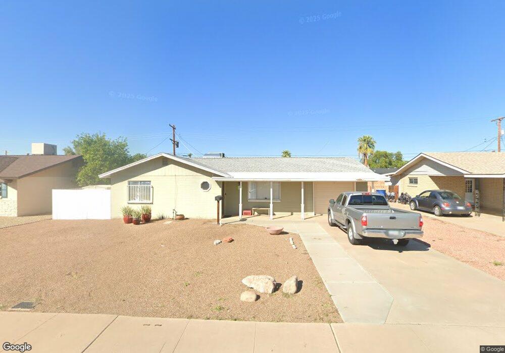
1230 W 10th St Tempe, AZ 85281
Gililland NeighborhoodEstimated Value: $371,593 - $447,000
2
Beds
2
Baths
1,163
Sq Ft
$358/Sq Ft
Est. Value
About This Home
This home is located at 1230 W 10th St, Tempe, AZ 85281 and is currently estimated at $415,898, approximately $357 per square foot. 1230 W 10th St is a home located in Maricopa County with nearby schools including Geneva Epps Mosley Middle School, Tempe High School, and Phoenix International Academy.
Ownership History
Date
Name
Owned For
Owner Type
Purchase Details
Closed on
Jul 20, 2004
Sold by
Petrucci James S and Petrucci Leah F
Bought by
Dickson David A
Current Estimated Value
Home Financials for this Owner
Home Financials are based on the most recent Mortgage that was taken out on this home.
Original Mortgage
$110,000
Outstanding Balance
$55,206
Interest Rate
6.29%
Mortgage Type
New Conventional
Estimated Equity
$360,692
Purchase Details
Closed on
Mar 4, 1996
Sold by
Sanginario Smith Dorothy M and Sanginario Dorothy M
Bought by
Petrucci James S and Sloan Leah F
Home Financials for this Owner
Home Financials are based on the most recent Mortgage that was taken out on this home.
Original Mortgage
$70,200
Interest Rate
6.98%
Mortgage Type
New Conventional
Create a Home Valuation Report for This Property
The Home Valuation Report is an in-depth analysis detailing your home's value as well as a comparison with similar homes in the area
Home Values in the Area
Average Home Value in this Area
Purchase History
| Date | Buyer | Sale Price | Title Company |
|---|---|---|---|
| Dickson David A | $137,500 | First American Title Ins Co | |
| Petrucci James S | $78,000 | United Title Agency |
Source: Public Records
Mortgage History
| Date | Status | Borrower | Loan Amount |
|---|---|---|---|
| Open | Dickson David A | $110,000 | |
| Previous Owner | Petrucci James S | $70,200 |
Source: Public Records
Tax History Compared to Growth
Tax History
| Year | Tax Paid | Tax Assessment Tax Assessment Total Assessment is a certain percentage of the fair market value that is determined by local assessors to be the total taxable value of land and additions on the property. | Land | Improvement |
|---|---|---|---|---|
| 2025 | $1,530 | $14,675 | -- | -- |
| 2024 | $1,404 | $13,976 | -- | -- |
| 2023 | $1,404 | $32,660 | $6,530 | $26,130 |
| 2022 | $1,341 | $24,970 | $4,990 | $19,980 |
| 2021 | $1,367 | $23,370 | $4,670 | $18,700 |
| 2020 | $1,322 | $20,650 | $4,130 | $16,520 |
| 2019 | $1,296 | $18,530 | $3,700 | $14,830 |
| 2018 | $1,261 | $15,820 | $3,160 | $12,660 |
| 2017 | $1,222 | $14,380 | $2,870 | $11,510 |
| 2016 | $1,216 | $13,320 | $2,660 | $10,660 |
| 2015 | $1,176 | $12,260 | $2,450 | $9,810 |
Source: Public Records
Map
Nearby Homes
- 1323 W 10th Place
- 1310 W Romo Jones St
- 1111 W University Dr Unit 3012
- 1111 W University Dr Unit 2026
- 754 S Beck Ave
- 734 S Beck Ave
- 708 S Beck Ave
- 702 S Beck Ave
- 1360 W 15th St
- 1533 W 7th St
- 1061 W 5th St Unit 3
- 919 W Parkway Blvd
- 1064 W 5th St
- 901 W 16th St
- 700 W University Dr Unit 122
- 700 W University Dr Unit 253
- 415 S Robert Rd
- 620 W Howe St
- 1539 W 5th St
- 330 S Beck Ave Unit 211
- 1236 W 10th St
- 1224 W 10th St
- 1227 W Elna Rae St
- 1233 W Elna Rae St
- 1218 W 10th St
- 1229 W 10th St
- 1235 W 10th St
- 1223 W 10th St
- 1215 W Elna Rae St
- 1239 W Elna Rae St
- 1241 W 10th St
- 1217 W 10th St
- 1212 W 10th St
- 1246 W 10th St
- 1246 W 10th St
- 1246 W 10th St Unit 63
- 1209 W Elna Rae St
- 1245 W Elna Rae St
- 1211 W 10th St
- 1247 W 10th St