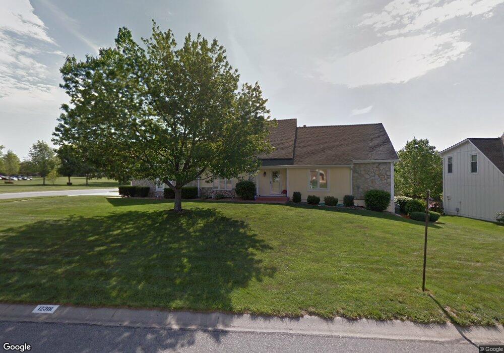
12301 Riggs Rd Leawood, KS 66209
Central Overland Park NeighborhoodEstimated Value: $561,000 - $581,000
4
Beds
5
Baths
2,580
Sq Ft
$222/Sq Ft
Est. Value
About This Home
This home is located at 12301 Riggs Rd, Leawood, KS 66209 and is currently estimated at $572,115, approximately $221 per square foot. 12301 Riggs Rd is a home located in Johnson County with nearby schools including Valley Park Elementary School, Overland Trail Middle School, and Blue Valley North High School.
Ownership History
Date
Name
Owned For
Owner Type
Purchase Details
Closed on
Jul 16, 2013
Sold by
Mitchell Deborah A
Bought by
Mitchell Deborah A and Mitchell Edwin T
Current Estimated Value
Purchase Details
Closed on
Feb 12, 2013
Sold by
Mitchell Deborah A
Bought by
Mitchell Deborah A
Purchase Details
Closed on
May 26, 2006
Sold by
Mitchell James E and Mitchell Deborah A
Bought by
Mitchell James E and Mitchell Deborah A
Create a Home Valuation Report for This Property
The Home Valuation Report is an in-depth analysis detailing your home's value as well as a comparison with similar homes in the area
Home Values in the Area
Average Home Value in this Area
Purchase History
| Date | Buyer | Sale Price | Title Company |
|---|---|---|---|
| Mitchell Deborah A | -- | None Available | |
| Mitchell Deborah A | -- | None Available | |
| Mitchell Deborah A | -- | None Available | |
| Mitchell Deborah A | -- | None Available | |
| Mitchell Deborah A | -- | None Available | |
| Mitchell Deborah A | -- | None Available | |
| Mitchell James E | -- | None Available |
Source: Public Records
Tax History Compared to Growth
Tax History
| Year | Tax Paid | Tax Assessment Tax Assessment Total Assessment is a certain percentage of the fair market value that is determined by local assessors to be the total taxable value of land and additions on the property. | Land | Improvement |
|---|---|---|---|---|
| 2024 | $6,384 | $62,204 | $12,019 | $50,185 |
| 2023 | $6,098 | $58,501 | $12,019 | $46,482 |
| 2022 | $5,282 | $49,818 | $12,019 | $37,799 |
| 2021 | $5,000 | $44,758 | $10,013 | $34,745 |
| 2020 | $4,894 | $43,516 | $8,007 | $35,509 |
| 2019 | $4,792 | $41,710 | $6,157 | $35,553 |
| 2018 | $4,802 | $40,963 | $6,157 | $34,806 |
| 2017 | $4,484 | $37,582 | $6,157 | $31,425 |
| 2016 | $4,413 | $36,961 | $6,157 | $30,804 |
| 2015 | $4,260 | $35,535 | $6,157 | $29,378 |
| 2013 | -- | $31,567 | $6,157 | $25,410 |
Source: Public Records
Map
Nearby Homes
- 12449 Barkley St
- 6800 W 125th St
- 12543 Glenwood St
- 12605 Glenwood St
- 6001 W 123rd St
- 12585 Broadmoor St
- 6019 W 124th St
- 12656 Barkley St
- 6009 W 128th St
- 12650 Sherwood Dr
- 5239 W 121st St
- 12642 Sherwood Dr
- 5708 W 129th St
- 5448 W 128th Terrace
- 12812 Birch St
- 5204 W 128th St
- 12635 Juniper Cir
- 12034 Juniper St
- 12909 Maple St
- 8031 W 122nd Terrace
- 12305 Riggs Rd
- 12300 Walmer St
- 12304 Walmer St
- 12300 Riggs Rd
- 12309 Riggs Rd
- 12304 Riggs Rd
- 12310 Walmer St
- 12308 Riggs Rd
- 12313 Riggs Rd
- 12314 Walmer St
- 6605 W 123rd St
- 12312 Riggs Rd
- 12301 Walmer St
- 6613 W 123rd St
- 12318 Walmer St
- 12305 Walmer St
- 12317 Riggs Rd
- 12309 Walmer St
- 12322 Walmer St
- 12316 Riggs Rd