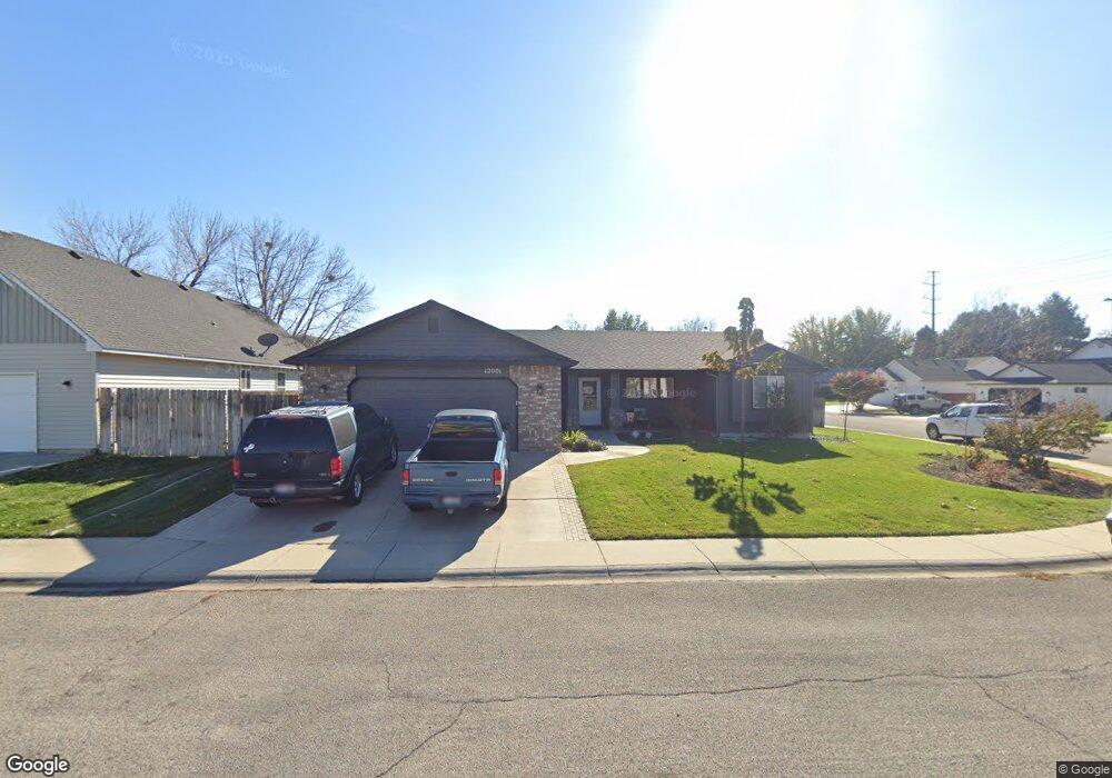
12303 W Armga Dr Boise, ID 83709
Southwest Boise NeighborhoodEstimated Value: $672,000 - $699,000
5
Beds
4
Baths
2,650
Sq Ft
$260/Sq Ft
Est. Value
About This Home
This home is located at 12303 W Armga Dr, Boise, ID 83709 and is currently estimated at $689,527, approximately $260 per square foot. 12303 W Armga Dr is a home located in Ada County with nearby schools including Pepper Ridge Elementary, Lewis & Clark Middle School, and Mountain View High School.
Ownership History
Date
Name
Owned For
Owner Type
Purchase Details
Closed on
Mar 7, 2000
Sold by
Lucero Silvano A and Lucero Tammy L
Bought by
Brown Brent F and Brown Carol Ann
Current Estimated Value
Purchase Details
Closed on
Mar 4, 2000
Sold by
Lucero Silvano A and Lucero Tammy L
Bought by
Brown Brent F and Brown Carol Ann
Purchase Details
Closed on
Jan 6, 1997
Sold by
Allen Charles W and Allen Shauna
Bought by
Lucero Silvano A and Lucero Tammy L
Home Financials for this Owner
Home Financials are based on the most recent Mortgage that was taken out on this home.
Original Mortgage
$127,800
Interest Rate
7.53%
Mortgage Type
Purchase Money Mortgage
Create a Home Valuation Report for This Property
The Home Valuation Report is an in-depth analysis detailing your home's value as well as a comparison with similar homes in the area
Home Values in the Area
Average Home Value in this Area
Purchase History
| Date | Buyer | Sale Price | Title Company |
|---|---|---|---|
| Brown Brent F | -- | First American Title Co | |
| Brown Brent F | -- | First American Title Co | |
| Lucero Silvano A | -- | Stewart Title Company |
Source: Public Records
Mortgage History
| Date | Status | Borrower | Loan Amount |
|---|---|---|---|
| Previous Owner | Lucero Silvano A | $127,800 |
Source: Public Records
Tax History Compared to Growth
Tax History
| Year | Tax Paid | Tax Assessment Tax Assessment Total Assessment is a certain percentage of the fair market value that is determined by local assessors to be the total taxable value of land and additions on the property. | Land | Improvement |
|---|---|---|---|---|
| 2025 | $2,895 | $592,000 | -- | -- |
| 2024 | $2,872 | $561,000 | -- | -- |
| 2023 | $2,872 | $535,800 | $0 | $0 |
| 2022 | $3,512 | $643,400 | $0 | $0 |
| 2021 | $2,678 | $429,300 | $0 | $0 |
| 2020 | $2,745 | $374,200 | $0 | $0 |
| 2019 | $3,142 | $344,700 | $0 | $0 |
| 2018 | $2,786 | $295,600 | $0 | $0 |
| 2017 | $2,497 | $264,000 | $0 | $0 |
| 2016 | $2,300 | $242,100 | $0 | $0 |
| 2015 | $2,059 | $232,800 | $0 | $0 |
| 2012 | -- | $169,400 | $0 | $0 |
Source: Public Records
Map
Nearby Homes
- 12158 W Silverking Ct
- 4216 Woodmurra St
- 11899 W Blueberry Ct
- 4202 Woodmurra St
- 4187 E Blueberry St
- 4498 E Goldstone Dr
- 4132 E Silverking Ln
- 12152 W Lewisburg Ct
- 12410 W Lewisburg Dr
- 4140 E Goldstone Dr
- 4535 E Copper Point Dr
- 3970 E Overland Rd
- 11829 W Camas St
- 11505 W Baserri Dr
- 3820 E Overland Rd
- 2359 S Rushmore Ct
- 1400 S Jade Ave
- 2679 S Tristram Way
- 1340 Jade Ave
- 11712 W Annalee Ln
- 12306 W Armga Dr
- 1865 S Mayflower Way
- 12251 W Armga Dr
- 12342 W Armga Dr
- 12258 W Armga Dr
- 1905 S Mayflower Way
- 12209 W Armga Dr
- 1945 S Mayflower Way
- 1820 S Mayflower Way
- 12535 & 12319 W Overland Rd
- 1723 S Cloverdale Rd
- 1860 S Mayflower Way
- 12200 W Armga Dr
- 1740 S Mayflower Way
- 12352 W Silverking St
- 12324 W Silverking St
- 12376 W Silverking St
- 12298 W Silverking St
- 12400 W Silverking St
- 12272 W Silverking St