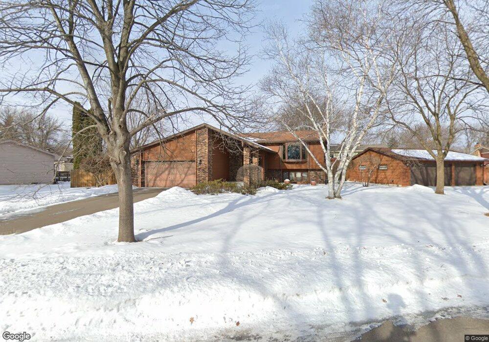
12308 Allen Dr Burnsville, MN 55337
Estimated Value: $401,000 - $443,000
4
Beds
2
Baths
1,204
Sq Ft
$346/Sq Ft
Est. Value
About This Home
This home is located at 12308 Allen Dr, Burnsville, MN 55337 and is currently estimated at $416,188, approximately $345 per square foot. 12308 Allen Dr is a home located in Dakota County with nearby schools including William Byrne Elementary School, Burnsville High School, and Gateway STEM Academy.
Ownership History
Date
Name
Owned For
Owner Type
Purchase Details
Closed on
Sep 2, 2008
Sold by
Kaarto Richard D and Kaarto Lynn M
Bought by
Flynn John R and Flynn Abigail M
Current Estimated Value
Home Financials for this Owner
Home Financials are based on the most recent Mortgage that was taken out on this home.
Original Mortgage
$183,400
Outstanding Balance
$122,103
Interest Rate
6.54%
Mortgage Type
New Conventional
Estimated Equity
$294,085
Purchase Details
Closed on
Jul 31, 1997
Sold by
Barta Robert E and Barta Brenda L B
Bought by
Kaarto Richard D and Kaarto Lynn M
Create a Home Valuation Report for This Property
The Home Valuation Report is an in-depth analysis detailing your home's value as well as a comparison with similar homes in the area
Home Values in the Area
Average Home Value in this Area
Purchase History
| Date | Buyer | Sale Price | Title Company |
|---|---|---|---|
| Flynn John R | $262,000 | -- | |
| Kaarto Richard D | $133,900 | -- |
Source: Public Records
Mortgage History
| Date | Status | Borrower | Loan Amount |
|---|---|---|---|
| Open | Flynn John R | $183,400 |
Source: Public Records
Tax History Compared to Growth
Tax History
| Year | Tax Paid | Tax Assessment Tax Assessment Total Assessment is a certain percentage of the fair market value that is determined by local assessors to be the total taxable value of land and additions on the property. | Land | Improvement |
|---|---|---|---|---|
| 2024 | $4,148 | $393,000 | $88,900 | $304,100 |
| 2023 | $4,148 | $395,400 | $89,000 | $306,400 |
| 2022 | $3,316 | $381,900 | $88,800 | $293,100 |
| 2021 | $3,392 | $315,100 | $77,200 | $237,900 |
| 2020 | $3,310 | $306,100 | $69,300 | $236,800 |
| 2019 | $3,334 | $289,300 | $66,000 | $223,300 |
| 2018 | $3,263 | $277,900 | $62,900 | $215,000 |
| 2017 | $3,193 | $265,100 | $59,900 | $205,200 |
| 2016 | $2,953 | $255,800 | $57,100 | $198,700 |
| 2015 | $2,808 | $213,569 | $51,420 | $162,149 |
| 2014 | -- | $212,043 | $50,438 | $161,605 |
| 2013 | -- | $202,996 | $45,868 | $157,128 |
Source: Public Records
Map
Nearby Homes
- 72 River Woods Ln
- 2300 Villaburne Ct W
- 2400 E 125th St
- 55 River Woods Ln
- 145 River Woods Ln
- 146 River Woods Ln
- 12232 Oak Leaf Cir
- 188 River Woods Ln
- 2005 E 122nd St Unit A7
- 2005 E 122nd St Unit A14
- 2005 E 122nd St Unit A23
- 2011 E 122nd St Unit D24
- 2007 E 122nd St Unit B15
- 319 River Woods Ln
- 221 River Woods Ln
- 11921 Baypoint Dr
- 247 River Woods Ln
- 11900 Highland View Cir
- 12625 Sable Dr
- 12316 Michelle Cir
- 12312 Allen Dr
- 12305 Villaburne Dr
- 12309 Villaburne Dr
- 12301 Villaburne Dr
- 12313 Allen Dr
- 12313 Villaburne Dr
- 12317 Allen Dr
- 12316 Allen Dr
- 12325 Allen Dr
- 12309 Allen Dr
- 12321 Allen Dr
- 12305 Allen Dr
- 12329 Allen Dr
- 12317 Villaburne Dr
- 12320 Allen Dr
- 12304 Villaburne Dr
- 12221 Villaburne Dr
- 12240 Allen Dr
- 12308 Villaburne Dr
- 12401 Allen Dr