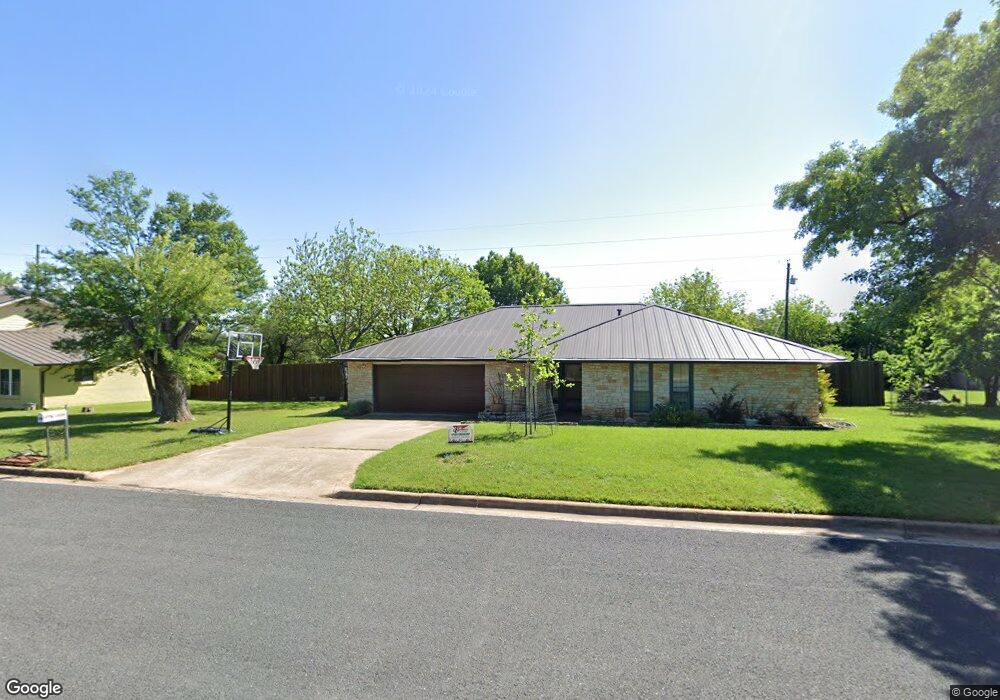
12309 Black Angus Dr Austin, TX 78727
Angus Ranch NeighborhoodEstimated Value: $518,849 - $616,000
3
Beds
2
Baths
1,631
Sq Ft
$343/Sq Ft
Est. Value
About This Home
This home is located at 12309 Black Angus Dr, Austin, TX 78727 and is currently estimated at $560,212, approximately $343 per square foot. 12309 Black Angus Dr is a home located in Travis County with nearby schools including Davis Elementary School, Murchison Middle School, and Anderson High School.
Ownership History
Date
Name
Owned For
Owner Type
Purchase Details
Closed on
May 4, 2021
Sold by
Beaty Neal L
Bought by
Beaty Kathryn L
Current Estimated Value
Home Financials for this Owner
Home Financials are based on the most recent Mortgage that was taken out on this home.
Original Mortgage
$178,800
Outstanding Balance
$162,037
Interest Rate
3.1%
Mortgage Type
Purchase Money Mortgage
Estimated Equity
$398,175
Purchase Details
Closed on
Apr 7, 2010
Sold by
Randolph & Viola Greene Family Trust
Bought by
Beaty Kathryn and Beaty Neal L
Home Financials for this Owner
Home Financials are based on the most recent Mortgage that was taken out on this home.
Original Mortgage
$178,800
Interest Rate
4.96%
Mortgage Type
New Conventional
Purchase Details
Closed on
Nov 6, 1997
Sold by
Greene Randolph H and Greene Viola B
Bought by
Greene Randolph H and Greene Viola B
Purchase Details
Closed on
Oct 30, 1995
Sold by
The Lower Colorado River Authority
Bought by
Greene Randolph H and Greene Viola
Create a Home Valuation Report for This Property
The Home Valuation Report is an in-depth analysis detailing your home's value as well as a comparison with similar homes in the area
Home Values in the Area
Average Home Value in this Area
Purchase History
| Date | Buyer | Sale Price | Title Company |
|---|---|---|---|
| Beaty Kathryn L | -- | None Available | |
| Beaty Kathryn | -- | Itc | |
| Greene Randolph H | -- | -- | |
| Greene Randolph H | -- | -- |
Source: Public Records
Mortgage History
| Date | Status | Borrower | Loan Amount |
|---|---|---|---|
| Open | Beaty Kathryn L | $178,800 | |
| Previous Owner | Beaty Kathryn | $178,800 |
Source: Public Records
Tax History Compared to Growth
Tax History
| Year | Tax Paid | Tax Assessment Tax Assessment Total Assessment is a certain percentage of the fair market value that is determined by local assessors to be the total taxable value of land and additions on the property. | Land | Improvement |
|---|---|---|---|---|
| 2025 | $7,976 | $471,764 | $196,372 | $275,392 |
| 2023 | $7,976 | $460,658 | $0 | $0 |
| 2022 | $8,271 | $418,780 | $0 | $0 |
| 2021 | $8,287 | $380,709 | $171,000 | $256,040 |
| 2020 | $7,423 | $346,099 | $171,000 | $175,099 |
| 2018 | $6,521 | $294,539 | $171,000 | $151,724 |
| 2017 | $5,971 | $267,763 | $90,000 | $177,763 |
| 2016 | $5,562 | $249,405 | $90,000 | $177,763 |
| 2015 | $4,477 | $226,732 | $49,500 | $205,112 |
| 2014 | $4,477 | $206,120 | $0 | $0 |
Source: Public Records
Map
Nearby Homes
- 4812 Pelham Dr
- 12404 Sceptre Cove
- 12319 Wycliff Ln
- 12203 Arrowwood Dr
- 5126 Ganymede Dr
- 4612 Ganymede Dr
- 12223 Antoinette Place
- 12005 Mustang Chase
- 12103 Wycliff Ln
- 4513 Sidereal Dr
- 12508 Terra Nova Ln
- 4317 Ganymede Dr
- 4400 Switch Willo Unit 21
- 4006 Eton Ln
- 4508 Duval Rd Unit 6602
- 5001 Dull Knife Dr
- 3901 Skipton Dr
- 4700 Destinys Gate Dr
- 11718 Running Fox Trail
- 11716 Running Fox Trail
- 12307 Black Angus Dr
- 12311 Black Angus Dr
- 12309 Bar x Dr
- 4900 Black Angus Cove
- 12305 Black Angus Dr
- 4911 Pelham Dr
- 4913 Pelham Dr
- 12310 Bar x Dr
- 4909 Pelham Dr
- 4901 Black Angus Cove
- 4909 Hawkhaven Ln
- 4907 Pelham Dr
- 4902 Black Angus Cove
- 12307 Bar x Dr
- 12303 Black Angus Dr
- 4907 Hawkhaven Ln
- 4905 Pelham Dr
- 4903 Black Angus Cove
- 4903 Pelham Dr
- 4900 Smokey Mountain Dr