

12309 Old Highway 71 Fort Smith, AR 72916
Estimated payment $1,086/month
Total Views
12,312
0.8
Acre
$249,875
Price per Acre
34,848
Sq Ft Lot
Highlights
- 0.8 Acre Lot
- Corner Lot
- Commercial or Retail Space
- Westwood Elementary School Rated A
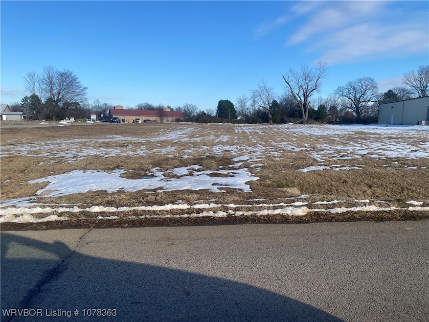
About This Lot
Great location for any type of business venture. Located directly behind Boondocks between Old Highway 71 and Highway 71 south. Also located very close to Casey's Convenience store. Tons of traffic in the area which will result in high visibility for potential customers.
Property Details
Property Type
- Land
Est. Annual Taxes
- $317
Lot Details
- 0.8 Acre Lot
- Lot Dimensions are 261x144x231x142
- Property fronts a highway
- Corner Lot
- Level Lot
- Cleared Lot
- Zoning described as Commercial
Home Design
- Commercial or Retail Space
Schools
- Greenwood Elementary And Middle School
- Greenwood High School
Utilities
- Not Connected to Sewer
Community Details
- Blythe Comm Park Subdivision
Listing and Financial Details
- Tax Lot 2
- Assessor Parcel Number 11924-0002-00000-00
Map
Create a Home Valuation Report for This Property
The Home Valuation Report is an in-depth analysis detailing your home's value as well as a comparison with similar homes in the area
Home Values in the Area
Average Home Value in this Area
Tax History
| Year | Tax Paid | Tax Assessment Tax Assessment Total Assessment is a certain percentage of the fair market value that is determined by local assessors to be the total taxable value of land and additions on the property. | Land | Improvement |
|---|---|---|---|---|
| 2024 | $306 | $5,600 | $5,600 | $0 |
| 2023 | $317 | $5,600 | $5,600 | $0 |
| 2022 | $317 | $5,600 | $5,600 | $0 |
| 2021 | $317 | $5,600 | $5,600 | $0 |
| 2020 | $317 | $5,600 | $5,600 | $0 |
| 2019 | $317 | $5,600 | $5,600 | $0 |
| 2018 | $317 | $5,600 | $5,600 | $0 |
Source: Public Records
Property History
| Date | Event | Price | Change | Sq Ft Price |
|---|---|---|---|---|
| 01/14/2025 01/14/25 | For Sale | $199,900 | -- | -- |
Source: Western River Valley Board of REALTORS®
Source: Western River Valley Board of REALTORS®
MLS Number: 1078363
APN: 11924-0002-00000-00
Nearby Homes
- 12201 Old Hwy 71
- 12200 Stonechase Dr
- 6300 Southfield Dr
- 21525 U S 71
- 5612 Thomas Rd
- 6408 Southfield Dr
- 5601 Rye Bend
- 5808 Meadow Brook Dr
- Tbd Riley Park Dr
- 5805 Meadow Brook Dr
- 6607 Howard Hill Rd
- 5804 Cedar Break Dr
- 6705 Hunter Crossing Dr
- 6604 Riley Park Dr
- 6906 Southfield Dr
- 6812 Deerfield Dr
- 4.8 Ac U S Highway 71
- 7.45 Ac U S Highway 71
- 2.4 Ac U S Highway 71
- 5800 Rye Hill Rd
- 11626 Maplewood Dr
- 8900 Cambria Cir
- 8909 Cambria Cir
- 8916 Cambria Cir
- 8809 Bainbridge Ct
- 9207 Highway 71 S Unit 10
- 9207 Highway 71 S Unit 11
- 8612 Cantera Dr
- 8912 Preston Wood Dr
- 8818 Cantera Dr
- 8701 Cantera Dr
- 8912 Cantera Dr
- 8808 Bainbridge Ct
- 8620 Cantera Dr
- 9505 Chad Colley Blvd
- 2300 Brigadoon Dr
- 9000 Massard Rd
- 2881 Oakview Rd
- 8409 S 35th Terrace
- 8817 S 28th St
