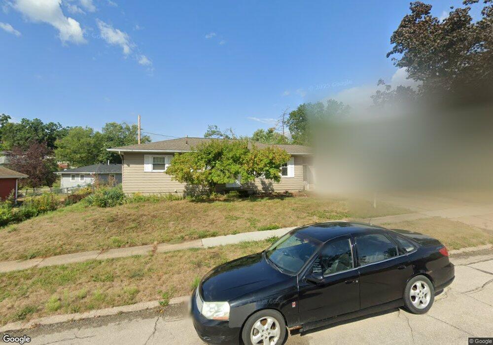
1231 Brockman Dr SE Cedar Rapids, IA 52403
Estimated Value: $164,000 - $188,000
3
Beds
2
Baths
972
Sq Ft
$181/Sq Ft
Est. Value
About This Home
This home is located at 1231 Brockman Dr SE, Cedar Rapids, IA 52403 and is currently estimated at $175,727, approximately $180 per square foot. 1231 Brockman Dr SE is a home located in Linn County with nearby schools including Summit Elementary School, Erskine Elementary School, and McKinley STEAM Academy.
Ownership History
Date
Name
Owned For
Owner Type
Purchase Details
Closed on
May 31, 2003
Sold by
Breitfelder Christopher J and Breitfelder Leisa
Bought by
Kuchenbaker Matthew J
Current Estimated Value
Home Financials for this Owner
Home Financials are based on the most recent Mortgage that was taken out on this home.
Original Mortgage
$110,670
Outstanding Balance
$48,830
Interest Rate
5.88%
Mortgage Type
VA
Estimated Equity
$126,897
Purchase Details
Closed on
Jan 4, 2001
Sold by
Daniel Dennis D
Bought by
Breitfelder Christopher J
Home Financials for this Owner
Home Financials are based on the most recent Mortgage that was taken out on this home.
Original Mortgage
$99,960
Interest Rate
7.77%
Mortgage Type
FHA
Create a Home Valuation Report for This Property
The Home Valuation Report is an in-depth analysis detailing your home's value as well as a comparison with similar homes in the area
Home Values in the Area
Average Home Value in this Area
Purchase History
| Date | Buyer | Sale Price | Title Company |
|---|---|---|---|
| Kuchenbaker Matthew J | $108,000 | -- | |
| Breitfelder Christopher J | $100,500 | -- |
Source: Public Records
Mortgage History
| Date | Status | Borrower | Loan Amount |
|---|---|---|---|
| Open | Kuchenbaker Matthew J | $110,670 | |
| Previous Owner | Breitfelder Christopher J | $99,960 |
Source: Public Records
Tax History Compared to Growth
Tax History
| Year | Tax Paid | Tax Assessment Tax Assessment Total Assessment is a certain percentage of the fair market value that is determined by local assessors to be the total taxable value of land and additions on the property. | Land | Improvement |
|---|---|---|---|---|
| 2025 | $2,356 | $168,000 | $34,100 | $133,900 |
| 2024 | $2,628 | $164,900 | $34,100 | $130,800 |
| 2023 | $2,628 | $152,200 | $31,000 | $121,200 |
| 2022 | $2,466 | $136,900 | $27,900 | $109,000 |
| 2021 | $2,462 | $131,400 | $27,900 | $103,500 |
| 2020 | $2,462 | $123,500 | $21,700 | $101,800 |
| 2019 | $2,294 | $118,200 | $21,700 | $96,500 |
| 2018 | $2,116 | $118,200 | $21,700 | $96,500 |
| 2017 | $2,203 | $108,800 | $21,700 | $87,100 |
| 2016 | $2,203 | $107,000 | $21,700 | $85,300 |
| 2015 | $2,217 | $107,548 | $21,672 | $85,876 |
| 2014 | $2,032 | $107,548 | $21,672 | $85,876 |
| 2013 | $1,982 | $107,548 | $21,672 | $85,876 |
Source: Public Records
Map
Nearby Homes
- 1241 38th St SE
- 1111 Brockman Dr SE
- 1401 Harold Dr SE
- 3600 Bel Air Dr SE
- 1331 34th St SE
- 1013 36th St SE
- 3510 Pioneer Ave SE
- 3630 Mt Vernon Rd SE Unit 6
- 3535 Pioneer Ave SE
- TBD 42nd St SE
- 1310 42nd St SE
- 1310 42nd St SE Unit LotWP001
- 1425 42nd St SE
- 707 40th St SE
- Tbd 42nd St SE
- 654 34th St SE
- Tbd 42nd St SE
- 1521 Oak Ridge Ln SE Unit 3
- 651 34th St SE
- 2861 Seely Ave SE
- 1225 Brockman Dr SE
- 3628 14th Ave SE
- 1219 Brockman Dr SE
- 1226 Harold Dr SE
- 1232 Harold Dr SE
- 1220 Harold Dr SE
- 1215 Brockman Dr SE
- 1232 Brockman Dr SE
- 1214 Harold Dr SE
- 1242 Brockman Dr SE
- 3625 14th Ave SE
- 1209 Brockman Dr SE
- 3629 14th Ave SE
- 1248 Brockman Dr SE
- 1208 Harold Dr SE
- 1231 Harold Dr SE
- 1225 Harold Dr SE
- 1201 Brockman Dr SE
- 3633 14th Ave SE
- 1217 Harold Dr SE