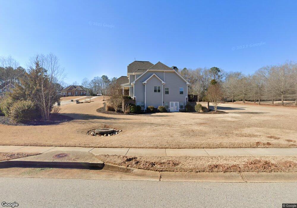
1231 Highpoint Ln Bogart, GA 30622
Estimated Value: $720,199 - $921,000
--
Bed
--
Bath
2,527
Sq Ft
$320/Sq Ft
Est. Value
About This Home
This home is located at 1231 Highpoint Ln, Bogart, GA 30622 and is currently estimated at $807,550, approximately $319 per square foot. 1231 Highpoint Ln is a home with nearby schools including Rocky Branch Elementary School, Malcom Bridge Middle School, and North Oconee High School.
Ownership History
Date
Name
Owned For
Owner Type
Purchase Details
Closed on
May 31, 2017
Sold by
Stawicki Robert J
Bought by
Stewart Kevin Patrick and Stewart Krista Leigh
Current Estimated Value
Home Financials for this Owner
Home Financials are based on the most recent Mortgage that was taken out on this home.
Original Mortgage
$337,500
Outstanding Balance
$265,095
Interest Rate
4.02%
Mortgage Type
Commercial
Estimated Equity
$542,455
Purchase Details
Closed on
Apr 28, 2016
Sold by
Mcelhannon Construction
Bought by
Stawicki Robert J and Stawicki Corie L
Home Financials for this Owner
Home Financials are based on the most recent Mortgage that was taken out on this home.
Original Mortgage
$362,012
Interest Rate
3.71%
Mortgage Type
Commercial
Purchase Details
Closed on
Aug 25, 2015
Sold by
Rwj Inc
Bought by
Mcelhannon Construction & Grad
Create a Home Valuation Report for This Property
The Home Valuation Report is an in-depth analysis detailing your home's value as well as a comparison with similar homes in the area
Home Values in the Area
Average Home Value in this Area
Purchase History
| Date | Buyer | Sale Price | Title Company |
|---|---|---|---|
| Stewart Kevin Patrick | $437,500 | -- | |
| Stawicki Robert J | $381,066 | -- | |
| Mcelhannon Construction & Grad | $450,000 | -- |
Source: Public Records
Mortgage History
| Date | Status | Borrower | Loan Amount |
|---|---|---|---|
| Open | Stewart Kevin Patrick | $337,500 | |
| Previous Owner | Stawicki Robert J | $362,012 |
Source: Public Records
Tax History Compared to Growth
Tax History
| Year | Tax Paid | Tax Assessment Tax Assessment Total Assessment is a certain percentage of the fair market value that is determined by local assessors to be the total taxable value of land and additions on the property. | Land | Improvement |
|---|---|---|---|---|
| 2024 | $5,012 | $265,644 | $36,000 | $229,644 |
| 2023 | $4,970 | $250,281 | $34,000 | $216,281 |
| 2022 | $4,999 | $232,976 | $34,000 | $198,976 |
| 2021 | $4,775 | $206,384 | $34,000 | $172,384 |
| 2020 | $4,571 | $197,247 | $34,000 | $163,247 |
| 2019 | $4,270 | $184,287 | $28,000 | $156,287 |
| 2018 | $4,094 | $172,990 | $28,000 | $144,990 |
| 2017 | $3,607 | $157,488 | $28,000 | $129,488 |
| 2016 | $707 | $28,000 | $28,000 | $0 |
| 2015 | $391 | $14,640 | $14,640 | $0 |
| 2014 | $262 | $9,000 | $9,000 | $0 |
| 2013 | -- | $6,800 | $6,800 | $0 |
Source: Public Records
Map
Nearby Homes
- 0 Clotfelter Rd Unit 1025303
- 2163 Heather Ln
- 2082 Wade Dr
- 1491 Virgil Langford Rd
- 4322 Heather Ln
- 2548 E Princeton Dr
- 2934 Horseshoe Bend Ln
- 1224 Malcom Estates Point Lot: 67
- 0 Ruth Jackson Rd Unit 10582108
- 00 Ruth Jackson Rd
- 2165 Harperfield Dr
- 1496 Malcom Estates Dr
- 1224 Malcom Estates Point Unit Lot 67
- 1105 Harperfield Dr
- 1640 Madison Ct
- 1021 Bedford Trail
- 1111 Highpoint Ln
- 1381 Field Ln
- 1051 Highpoint Ln Unit 37
- 1051 Highpoint Ln
- 1246 Highpoint Ln
- 1527 Highpoint Ln
- 1141 Field Ln Unit 18
- 1370 Highpoint Ln
- 1110 Highpoint Ln
- 1110 Highpoint Ln Unit 34
- 1001 Highpoint Ln
- 1640 Clotfelter Rd
- 1635 Highpoint Ln Unit 21
- 1635 Highpoint Ln
- 1000 Highpoint Ln
- 1788 Oldfield Dr
- 1441 Oldfield Dr
- 1600 Clotfelter Rd
- 1661 Oldfield Dr
- 1735 Highpoint Ln