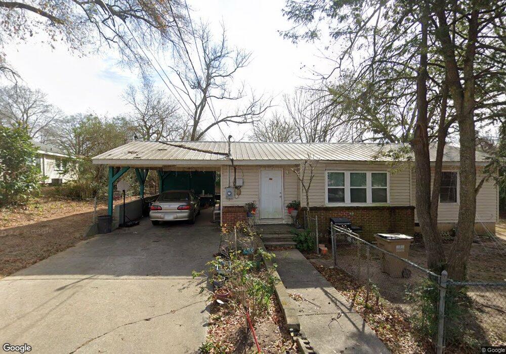
1231 Holland St Gainesville, GA 30501
West Side NeighborhoodEstimated Value: $169,000 - $247,000
3
Beds
1
Bath
968
Sq Ft
$207/Sq Ft
Est. Value
About This Home
This home is located at 1231 Holland St, Gainesville, GA 30501 and is currently estimated at $200,133, approximately $206 per square foot. 1231 Holland St is a home located in Hall County with nearby schools including Lyman Hall Elementary School, West Hall Middle School, and West Hall High School.
Ownership History
Date
Name
Owned For
Owner Type
Purchase Details
Closed on
Jun 14, 2018
Sold by
Nater Llc
Bought by
Jaramillo Edwin
Current Estimated Value
Home Financials for this Owner
Home Financials are based on the most recent Mortgage that was taken out on this home.
Original Mortgage
$82,625
Outstanding Balance
$71,617
Interest Rate
4.6%
Mortgage Type
New Conventional
Estimated Equity
$128,516
Purchase Details
Closed on
Jun 3, 2014
Sold by
Winkler Clenn
Bought by
Nater Llc
Create a Home Valuation Report for This Property
The Home Valuation Report is an in-depth analysis detailing your home's value as well as a comparison with similar homes in the area
Home Values in the Area
Average Home Value in this Area
Purchase History
| Date | Buyer | Sale Price | Title Company |
|---|---|---|---|
| Jaramillo Edwin | $82,625 | -- | |
| Nater Llc | -- | -- |
Source: Public Records
Mortgage History
| Date | Status | Borrower | Loan Amount |
|---|---|---|---|
| Open | Jaramillo Edwin | $82,625 |
Source: Public Records
Tax History Compared to Growth
Tax History
| Year | Tax Paid | Tax Assessment Tax Assessment Total Assessment is a certain percentage of the fair market value that is determined by local assessors to be the total taxable value of land and additions on the property. | Land | Improvement |
|---|---|---|---|---|
| 2024 | $1,707 | $66,160 | $9,160 | $57,000 |
| 2023 | $1,614 | $62,400 | $9,160 | $53,240 |
| 2022 | $1,322 | $48,480 | $8,000 | $40,480 |
| 2021 | $1,192 | $42,600 | $4,880 | $37,720 |
| 2020 | $1,168 | $40,480 | $4,880 | $35,600 |
| 2019 | $971 | $32,880 | $4,880 | $28,000 |
| 2018 | $853 | $27,640 | $4,440 | $23,200 |
| 2017 | $767 | $24,840 | $4,440 | $20,400 |
| 2016 | $660 | $21,520 | $4,440 | $17,080 |
| 2015 | $608 | $19,120 | $3,520 | $15,600 |
| 2014 | $608 | $19,447 | $3,520 | $15,927 |
Source: Public Records
Map
Nearby Homes
- 593 Shallowford Rd NW
- 0 Hilton Dr Unit 7585721
- 0 Hilton Dr Unit 10529633
- 105 Dogwood Cir
- 43 Dean St
- 724 Bradford St SW
- 720 Bradford St SW
- 110 Summit St SE
- 1220 Harmony St
- 474 Martin Alley
- 2129 Dixie Dr
- 2054 Spring Rd
- 1636 Atlanta Hwy
- 2340 Ridgeway Dr
- 775 Ridgewood Ave
- 652 Wilshire Place
- 650 Blueridge Ave
- 601 Ridgewood Ave
- 0 Holland St
- 1004 Airport Dr
- 0 Rider Dr Unit 7239577
- 0 Rider Dr Unit 7183786
- 0 Rider Dr Unit 7086790
- 0 Rider Dr Unit 3261169
- 0 Rider Dr Unit 8586416
- 0 Rider Dr
- 1230 Holland St
- 1225 Holland St
- 7 Rider Dr
- 1005 Airport Dr
- 1002 Airport Dr
- 1226 Holland St
- 917 Airport Dr
- 1 Rider Dr
- 1224 Holland St
- 2 Richardson St
- 1223 Holland St
- 1226 Erskine Ave