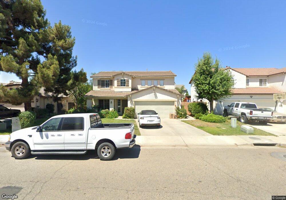
1231 N Mathew St Porterville, CA 93257
Porterville Northwest NeighborhoodEstimated Value: $394,000 - $474,000
4
Beds
3
Baths
1,970
Sq Ft
$213/Sq Ft
Est. Value
About This Home
This home is located at 1231 N Mathew St, Porterville, CA 93257 and is currently estimated at $419,906, approximately $213 per square foot. 1231 N Mathew St is a home located in Tulare County with nearby schools including Oak Grove Elementary School, Burton Middle School, and Monache High School.
Ownership History
Date
Name
Owned For
Owner Type
Purchase Details
Closed on
Jul 10, 2001
Sold by
Centex Homes
Bought by
Bryant James K and Debryant Silvia Rodriguez
Current Estimated Value
Home Financials for this Owner
Home Financials are based on the most recent Mortgage that was taken out on this home.
Original Mortgage
$127,751
Interest Rate
6.99%
Mortgage Type
FHA
Create a Home Valuation Report for This Property
The Home Valuation Report is an in-depth analysis detailing your home's value as well as a comparison with similar homes in the area
Home Values in the Area
Average Home Value in this Area
Purchase History
| Date | Buyer | Sale Price | Title Company |
|---|---|---|---|
| Bryant James K | $129,500 | Benefit Land Title Company |
Source: Public Records
Mortgage History
| Date | Status | Borrower | Loan Amount |
|---|---|---|---|
| Previous Owner | Bryant James K | $127,751 |
Source: Public Records
Tax History Compared to Growth
Tax History
| Year | Tax Paid | Tax Assessment Tax Assessment Total Assessment is a certain percentage of the fair market value that is determined by local assessors to be the total taxable value of land and additions on the property. | Land | Improvement |
|---|---|---|---|---|
| 2025 | $2,002 | $190,575 | $44,321 | $146,254 |
| 2024 | $2,002 | $186,839 | $43,452 | $143,387 |
| 2023 | $2,008 | $183,176 | $42,600 | $140,576 |
| 2022 | $1,930 | $179,585 | $41,765 | $137,820 |
| 2021 | $1,901 | $176,064 | $40,946 | $135,118 |
| 2020 | $1,866 | $174,259 | $40,526 | $133,733 |
| 2019 | $1,865 | $170,842 | $39,731 | $131,111 |
| 2018 | $1,782 | $167,492 | $38,952 | $128,540 |
| 2017 | $1,754 | $164,208 | $38,188 | $126,020 |
| 2016 | $1,671 | $160,988 | $37,439 | $123,549 |
| 2015 | $1,612 | $158,570 | $36,877 | $121,693 |
| 2014 | $1,612 | $155,464 | $36,155 | $119,309 |
Source: Public Records
Map
Nearby Homes
- 1926 W Nancy Ave
- 1857 W Westfield Ave
- 2164 W San Lucia Ct
- Lot 30 2184 W Pioneer Ave
- 1370 Camelot St
- 1681 W Wall Ln
- 0 Pioneer Ave Unit 233651
- 1555 Verdugo Place
- 1750 W Terry Cir
- 2269 Pioneer Ave
- 2261 W San Lucia Ct
- 1041 Greenfield Dr
- 1691 Terry Ct
- Sydney Plan at Laurelwood
- Carlton Plan at Laurelwood
- Carmel Plan at Laurelwood
- Aspen with Loft Plan at Laurelwood
- Aspen Plan at Laurelwood
- Hawthorne Plan at Brookside
- Walden Plan at Brookside
- 1231 W Mathew
- 1221 N Mathew St
- 1241 N Mathew St
- 2019 W Cheryll Ct
- 1241 W Mathew
- 1211 N Mathew St
- 1255 N Mathew St
- 2029 W Cheryll Ct
- 1999 W Cheryll Ave
- 1242 N Mathew St
- 1201 N Mathew St
- 1265 N Mathew St
- 2014 W Westfield Ave
- 2022 W Cheryll Ct
- 1256 N Mathew St
- 1989 W Cheryll Ave
- 1994 W Westfield Ave
- 2024 W Westfield Ave
- 1275 N Mathew St
- 1266 N Mathew St