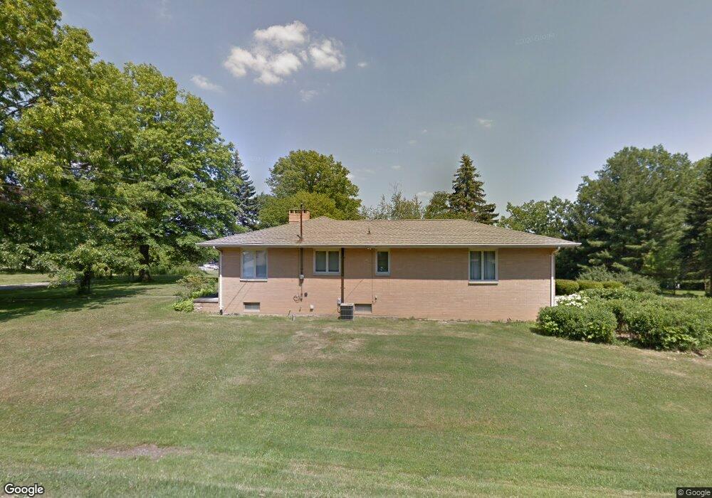
1231 Silver Ln Mansfield, OH 44906
Estimated Value: $185,247 - $210,000
3
Beds
2
Baths
1,648
Sq Ft
$121/Sq Ft
Est. Value
About This Home
This home is located at 1231 Silver Ln, Mansfield, OH 44906 and is currently estimated at $200,062, approximately $121 per square foot. 1231 Silver Ln is a home located in Richland County with nearby schools including The Richland School of Academic Arts, Mansfield Elective Academy, and Goal Digital Academy.
Ownership History
Date
Name
Owned For
Owner Type
Purchase Details
Closed on
May 8, 2018
Sold by
Parker Carolyn J
Bought by
Beasley James and Beasley Tashia R
Current Estimated Value
Home Financials for this Owner
Home Financials are based on the most recent Mortgage that was taken out on this home.
Original Mortgage
$92,787
Outstanding Balance
$80,076
Interest Rate
4.5%
Mortgage Type
FHA
Estimated Equity
$119,986
Purchase Details
Closed on
Feb 18, 2016
Sold by
Estate Of Roosevelt Parker Jr
Bought by
Parker Carolyn J
Purchase Details
Closed on
Oct 7, 1994
Sold by
Est Robert H Benzin
Bought by
Parker Roosevelt and Parker Carolyn J
Home Financials for this Owner
Home Financials are based on the most recent Mortgage that was taken out on this home.
Original Mortgage
$84,650
Interest Rate
8.64%
Mortgage Type
VA
Create a Home Valuation Report for This Property
The Home Valuation Report is an in-depth analysis detailing your home's value as well as a comparison with similar homes in the area
Home Values in the Area
Average Home Value in this Area
Purchase History
| Date | Buyer | Sale Price | Title Company |
|---|---|---|---|
| Beasley James | $94,500 | Southern Title | |
| Parker Carolyn J | -- | Attorney | |
| Parker Roosevelt | $83,000 | -- |
Source: Public Records
Mortgage History
| Date | Status | Borrower | Loan Amount |
|---|---|---|---|
| Open | Beasley James | $92,787 | |
| Previous Owner | Parker Roosevelt | $84,650 |
Source: Public Records
Tax History
| Year | Tax Paid | Tax Assessment Tax Assessment Total Assessment is a certain percentage of the fair market value that is determined by local assessors to be the total taxable value of land and additions on the property. | Land | Improvement |
|---|---|---|---|---|
| 2024 | $2,042 | $44,600 | $6,250 | $38,350 |
| 2023 | $2,088 | $44,600 | $6,250 | $38,350 |
| 2022 | $1,970 | $35,250 | $5,680 | $29,570 |
| 2021 | $1,983 | $35,250 | $5,680 | $29,570 |
| 2020 | $2,028 | $35,250 | $5,680 | $29,570 |
| 2019 | $2,248 | $35,250 | $5,680 | $29,570 |
| 2018 | $1,666 | $35,250 | $5,680 | $29,570 |
| 2017 | $1,622 | $35,250 | $5,680 | $29,570 |
| 2016 | $1,607 | $34,220 | $8,700 | $25,520 |
| 2015 | $1,535 | $34,220 | $8,700 | $25,520 |
| 2014 | $1,515 | $34,220 | $8,700 | $25,520 |
| 2012 | $1,155 | $34,220 | $9,160 | $25,060 |
Source: Public Records
Map
Nearby Homes
- 143 Buckeye Ave
- 173 Brookwood Way N
- 339 Buckeye Ave
- 0 W Fourth St - Trimble Lenox
- 340 Boston Ave
- 1496 W 4th St
- 988 Kentland Dr
- 1665 Olive Dr
- 64 Maple Ln
- 175 Maple Ln
- 799 Mcpherson St
- 129 Fairlawn Ave
- 135 Fairlawn Ave
- 143 Fairlawn Ave
- 1861 August Dr
- 370 Home Rd S
- 0 Lemley Ave Unit 9070540
- 1113 Wyandotte Ave
- 356 S Linden Rd
- 31 Parkwood Blvd
- 146 Wimbledon Dr
- 155 Wimbledon Dr
- 169 Wimbledon Dr
- 1232 Silver Ln
- 110 Wimbledon Dr
- 185 Wimbledon Dr
- 0 Tonawanda Dr
- 129 Wimbledon Dr
- 197 Wimbledon Dr
- 1277 Silver Ln
- 198 Wimbledon Dr Unit 200
- 1276 Clark Ct
- 204 Wimbledon Dr
- 0 Sloboda Ave 14 5 + -
- 1275 Clark Ct
- 1287 Tonawanda Dr
- 209 Wimbledon Dr
- 140 Lasalle St
- 130 Lasalle St
- 146 Lasalle St
Your Personal Tour Guide
Ask me questions while you tour the home.