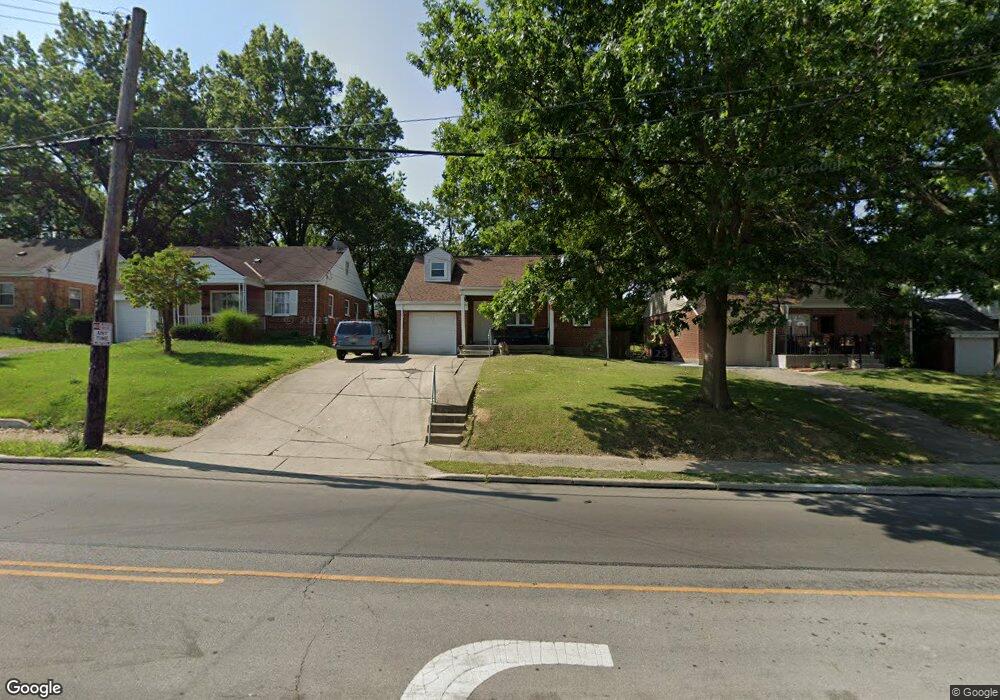
1231 W Galbraith Rd Cincinnati, OH 45231
College Hill NeighborhoodEstimated Value: $129,000 - $208,000
4
Beds
1
Bath
864
Sq Ft
$203/Sq Ft
Est. Value
About This Home
This home is located at 1231 W Galbraith Rd, Cincinnati, OH 45231 and is currently estimated at $175,179, approximately $202 per square foot. 1231 W Galbraith Rd is a home located in Hamilton County with nearby schools including Pleasant Hill Elementary School, Western Hills High School, and Gilbert A. Dater High School.
Ownership History
Date
Name
Owned For
Owner Type
Purchase Details
Closed on
Jun 22, 2011
Sold by
Isaac Lisa I and Isaac Bret T
Bought by
Isaac Bret T
Current Estimated Value
Home Financials for this Owner
Home Financials are based on the most recent Mortgage that was taken out on this home.
Original Mortgage
$48,000
Outstanding Balance
$33,644
Interest Rate
4.99%
Mortgage Type
New Conventional
Estimated Equity
$141,535
Purchase Details
Closed on
Aug 14, 2002
Sold by
Contimortgage Corp
Bought by
Meyer Martin R and 1231 W Galbraith Land Trust
Home Financials for this Owner
Home Financials are based on the most recent Mortgage that was taken out on this home.
Original Mortgage
$80,000
Outstanding Balance
$34,938
Interest Rate
7%
Estimated Equity
$140,241
Purchase Details
Closed on
Jun 9, 2002
Sold by
Rosalind Lancaster
Bought by
Contimortgage Corp
Create a Home Valuation Report for This Property
The Home Valuation Report is an in-depth analysis detailing your home's value as well as a comparison with similar homes in the area
Home Values in the Area
Average Home Value in this Area
Purchase History
| Date | Buyer | Sale Price | Title Company |
|---|---|---|---|
| Isaac Bret T | -- | Attorney | |
| Meyer Martin R | $66,000 | -- | |
| Contimortgage Corp | $62,000 | -- |
Source: Public Records
Mortgage History
| Date | Status | Borrower | Loan Amount |
|---|---|---|---|
| Open | Isaac Bret T | $48,000 | |
| Open | Meyer Martin R | $80,000 |
Source: Public Records
Tax History Compared to Growth
Tax History
| Year | Tax Paid | Tax Assessment Tax Assessment Total Assessment is a certain percentage of the fair market value that is determined by local assessors to be the total taxable value of land and additions on the property. | Land | Improvement |
|---|---|---|---|---|
| 2024 | $2,905 | $45,717 | $9,898 | $35,819 |
| 2023 | $2,910 | $45,717 | $9,898 | $35,819 |
| 2022 | $2,053 | $28,949 | $8,061 | $20,888 |
| 2021 | $2,014 | $28,949 | $8,061 | $20,888 |
| 2020 | $2,020 | $28,949 | $8,061 | $20,888 |
| 2019 | $1,946 | $25,393 | $7,070 | $18,323 |
| 2018 | $1,948 | $25,393 | $7,070 | $18,323 |
| 2017 | $1,876 | $25,393 | $7,070 | $18,323 |
| 2016 | $1,391 | $18,334 | $7,543 | $10,791 |
| 2015 | $1,244 | $18,334 | $7,543 | $10,791 |
| 2014 | $1,250 | $18,334 | $7,543 | $10,791 |
| 2013 | $1,311 | $18,900 | $7,777 | $11,123 |
Source: Public Records
Map
Nearby Homes
- 7923 Bobolink Dr
- 1280 Brushwood Ave
- 7929 Cherrywood Ct
- 6596 S Oak Knoll Dr
- 6586 S Oak Knoll Dr
- 6765 Richard Ave
- 6642 Plantation Way
- 6832 Tarawa Dr
- 6785 Marvin Ave
- 6538 S Oak Knoll Dr
- 8579 Daly Rd
- 1148 Hollywood Ave
- 1140 Hollywood Ave
- 8543 Foxcroft Dr
- 1544 W Galbraith Rd
- 1025 Eastgate Dr
- 8681 Desoto Dr
- 1006 Hearthstone Dr
- 984 W Galbraith Rd
- 1029 Bluejay Dr
- 1233 W Galbraith Rd
- 1229 W Galbraith Rd
- 1227 W Galbraith Rd
- 1235 W Galbraith Rd
- 8081 Knollwood Ln
- 1225 W Galbraith Rd
- 8080 Knollwood Ln
- 8061 Knollwood Ln
- 8144 Bobolink Dr
- 1223 W Galbraith Rd
- 8060 Knollwood Ln
- 1221 W Galbraith Rd
- 8041 Knollwood Ln
- 8061 Granville Ln
- 8140 Bobolink Dr
- 8040 Knollwood Ln
- 8134 Bobolink Dr
- 1219 W Galbraith Rd
- 8013 Knollwood Ln
- 8081 Granville Ln