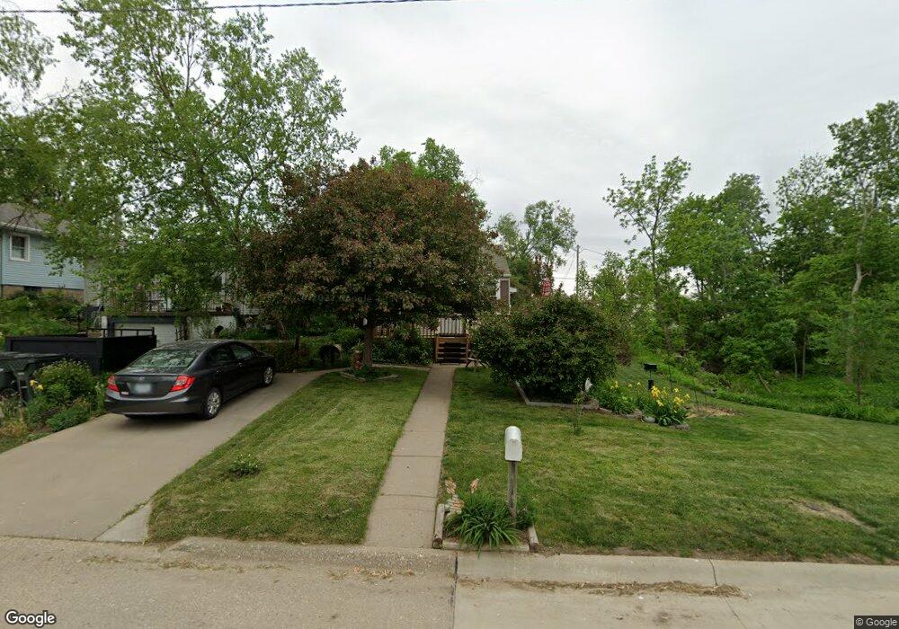
1232 20th Ave SW Cedar Rapids, IA 52404
Southwest Area NeighborhoodEstimated Value: $63,000 - $144,290
1
Bed
2
Baths
650
Sq Ft
$168/Sq Ft
Est. Value
About This Home
This home is located at 1232 20th Ave SW, Cedar Rapids, IA 52404 and is currently estimated at $109,323, approximately $168 per square foot. 1232 20th Ave SW is a home located in Linn County with nearby schools including Junction City Elementary School, Grant Elementary School, and Bruce Hall Day Treatment Center.
Ownership History
Date
Name
Owned For
Owner Type
Purchase Details
Closed on
Feb 10, 2022
Sold by
Lorenc Dora M
Bought by
Gosenberg Christopher W and Mouchka Dorine K
Current Estimated Value
Purchase Details
Closed on
Sep 17, 2003
Sold by
Lorenc Anthony and Lorenc Dora M
Bought by
Lorenc Anthony and Lorenc Dora M
Purchase Details
Closed on
Jun 21, 2002
Sold by
Russell Anthony C
Bought by
Mulholland Dorothy M
Home Financials for this Owner
Home Financials are based on the most recent Mortgage that was taken out on this home.
Original Mortgage
$35,000
Interest Rate
6.25%
Purchase Details
Closed on
Jun 20, 2002
Sold by
Hootman Virginia R and Mulholland Kevin R
Bought by
Swehla Dora M
Home Financials for this Owner
Home Financials are based on the most recent Mortgage that was taken out on this home.
Original Mortgage
$35,000
Interest Rate
6.25%
Purchase Details
Closed on
Oct 28, 2001
Sold by
Russell Anthony C
Bought by
Mulholland Dorothy M
Create a Home Valuation Report for This Property
The Home Valuation Report is an in-depth analysis detailing your home's value as well as a comparison with similar homes in the area
Home Values in the Area
Average Home Value in this Area
Purchase History
| Date | Buyer | Sale Price | Title Company |
|---|---|---|---|
| Gosenberg Christopher W | -- | None Listed On Document | |
| Lorenc Anthony | -- | -- | |
| Mulholland Dorothy M | -- | -- | |
| Swehla Dora M | $39,500 | -- | |
| Mulholland Dorothy M | $19,000 | -- |
Source: Public Records
Mortgage History
| Date | Status | Borrower | Loan Amount |
|---|---|---|---|
| Previous Owner | Swehla Dora M | $35,000 |
Source: Public Records
Tax History Compared to Growth
Tax History
| Year | Tax Paid | Tax Assessment Tax Assessment Total Assessment is a certain percentage of the fair market value that is determined by local assessors to be the total taxable value of land and additions on the property. | Land | Improvement |
|---|---|---|---|---|
| 2025 | $1,374 | $111,700 | $23,000 | $88,700 |
| 2024 | $1,684 | $103,800 | $21,000 | $82,800 |
| 2023 | $1,684 | $103,800 | $21,000 | $82,800 |
| 2022 | $1,460 | $92,100 | $21,000 | $71,100 |
| 2021 | $1,468 | $82,900 | $18,000 | $64,900 |
| 2020 | $1,468 | $78,400 | $17,000 | $61,400 |
| 2019 | $1,334 | $73,700 | $17,000 | $56,700 |
| 2018 | $1,292 | $73,700 | $17,000 | $56,700 |
| 2017 | $1,433 | $70,800 | $17,000 | $53,800 |
| 2016 | $1,433 | $70,800 | $17,000 | $53,800 |
| 2015 | $1,431 | $70,586 | $17,000 | $53,586 |
| 2014 | $1,246 | $70,344 | $17,000 | $53,344 |
| 2013 | $1,208 | $70,344 | $17,000 | $53,344 |
Source: Public Records
Map
Nearby Homes
- 1227 19th Ave SW
- 1132 21st Ave SW
- 1318 22nd Ave SW
- 1312 Wilson Ave SW
- 1332 Wilson Ave SW
- 1121 15th Ave SW
- 1424 11th St SW
- 826 21st Ave SW
- 1621 9th St SW
- 1617 9th St SW
- 1424 9th St SW
- 815 15th Ave SW
- 657 16th Ave SW
- 648 22nd Ave SW
- 2150 Rockford Rd SW
- 1960 Rockford Rd SW Unit 45
- 2025 18th St SW
- 1801 Shady Grove Rd SW
- 1806 Holly Meadow Ave SW
- 1812 Holly Meadow Ave SW
- 1236 20th Ave SW
- 1248 20th Ave SW
- 1222 20th Ave SW
- 1235 19th Ave SW
- 1231 19th Ave SW
- 1245 19th Ave SW
- 1223 19th Ave SW
- 1212 20th Ave SW
- 1252 20th Ave SW
- 1229 20th Ave SW
- 1249 19th Ave SW
- 1217 19th Ave SW
- 1227 20th Ave SW
- 1227 20th Ave SW Unit SW
- 1210 20th Ave SW
- 1253 19th Ave SW
- 1245 20th Ave SW
- 1215 19th Ave SW
- 1219 20th Ave SW
- 1258 20th Ave SW