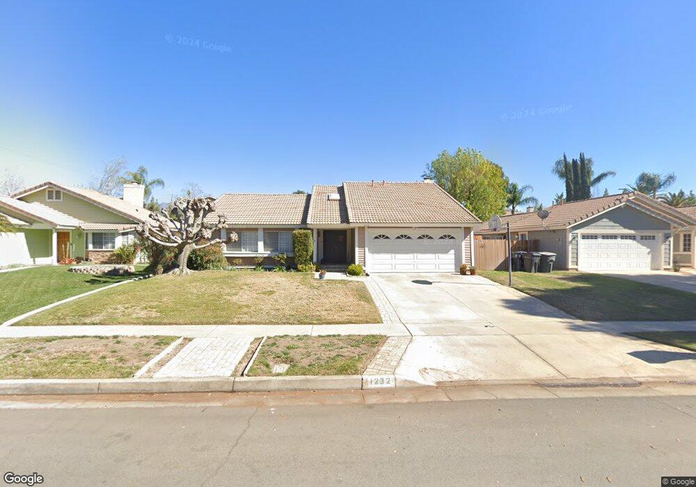
1232 Anthony St Redlands, CA 92374
North Redlands NeighborhoodEstimated Value: $600,618 - $643,000
3
Beds
2
Baths
1,509
Sq Ft
$413/Sq Ft
Est. Value
About This Home
This home is located at 1232 Anthony St, Redlands, CA 92374 and is currently estimated at $622,905, approximately $412 per square foot. 1232 Anthony St is a home located in San Bernardino County with nearby schools including Judson & Brown Elementary School, Clement Middle School, and Redlands East Valley High School.
Ownership History
Date
Name
Owned For
Owner Type
Purchase Details
Closed on
Jul 28, 2005
Sold by
Vander Tuig Bryan D and Vander Tuig Kathy L
Bought by
Falgout Marianne
Current Estimated Value
Home Financials for this Owner
Home Financials are based on the most recent Mortgage that was taken out on this home.
Original Mortgage
$87,500
Outstanding Balance
$45,817
Interest Rate
5.61%
Mortgage Type
Fannie Mae Freddie Mac
Estimated Equity
$577,088
Purchase Details
Closed on
Feb 8, 1996
Sold by
Filbert John P and Filbert Laura M
Bought by
Vandertuig Bryan D and Vandertuig Kathy L
Home Financials for this Owner
Home Financials are based on the most recent Mortgage that was taken out on this home.
Original Mortgage
$130,931
Interest Rate
6.98%
Mortgage Type
FHA
Create a Home Valuation Report for This Property
The Home Valuation Report is an in-depth analysis detailing your home's value as well as a comparison with similar homes in the area
Home Values in the Area
Average Home Value in this Area
Purchase History
| Date | Buyer | Sale Price | Title Company |
|---|---|---|---|
| Falgout Marianne | $387,500 | Chicago Title Company | |
| Vandertuig Bryan D | $132,500 | Fidelity National Title |
Source: Public Records
Mortgage History
| Date | Status | Borrower | Loan Amount |
|---|---|---|---|
| Open | Falgout Marianne | $87,500 | |
| Previous Owner | Vandertuig Bryan D | $130,931 |
Source: Public Records
Tax History
| Year | Tax Paid | Tax Assessment Tax Assessment Total Assessment is a certain percentage of the fair market value that is determined by local assessors to be the total taxable value of land and additions on the property. | Land | Improvement |
|---|---|---|---|---|
| 2025 | $6,495 | $529,553 | $132,388 | $397,165 |
| 2024 | $6,062 | $519,169 | $129,792 | $389,377 |
| 2023 | $6,053 | $508,989 | $127,247 | $381,742 |
| 2022 | $5,964 | $499,009 | $124,752 | $374,257 |
| 2021 | $5,256 | $424,000 | $127,000 | $297,000 |
| 2020 | $4,861 | $394,200 | $118,300 | $275,900 |
| 2019 | $4,678 | $382,800 | $114,900 | $267,900 |
| 2018 | $4,651 | $382,800 | $114,900 | $267,900 |
| 2017 | $4,543 | $369,800 | $111,000 | $258,800 |
| 2016 | $4,278 | $345,600 | $103,700 | $241,900 |
| 2015 | $3,988 | $320,000 | $96,000 | $224,000 |
| 2014 | $3,842 | $308,000 | $92,000 | $216,000 |
Source: Public Records
Map
Nearby Homes
- 1226 Via Palermo
- 1160 Via Ravenna
- 1617 Waterford Ave
- 1574 Foothill Way
- 616 N Lincoln St
- 1721 E Colton Ave Unit 33
- 1721 E Colton Ave Unit 106
- 0 E Lugonia Ave
- 0 E Colton Ave
- 1653 Lucas Ln
- 1700 Sandpiper Ave
- 1537 Carmel Ct
- 1528 Laramie Ave
- 1701 Wren Ave
- 1713 Wren Ave
- 450 Judson St Unit 94
- 1251 E Lugonia Ave Unit 48
- 1251 E Lugonia Ave Unit 18
- 626 N Dearborn St Unit 150
- 626 N Dearborn St Unit 7
- 1236 Anthony St
- 1228 Anthony St
- 1240 Anthony St
- 1224 Anthony St
- 1231 Darlene Ct
- 1235 Darlene Ct
- 1227 Darlene Ct
- 1239 Darlene Ct
- 1223 Darlene Ct
- 1233 Anthony St
- 1220 Anthony St
- 1244 Anthony St
- 1229 Anthony St
- 1237 Anthony St
- 1225 Anthony St
- 1241 Anthony St
- 1219 Darlene Ct
- 1243 Darlene Ct
- 1216 Anthony St
- 1221 Anthony St
Your Personal Tour Guide
Ask me questions while you tour the home.