T
Seller's Agent in 2025
Todd Fatino
Modern Realty
(515) 710-0994
4 in this area
33 Total Sales

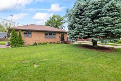
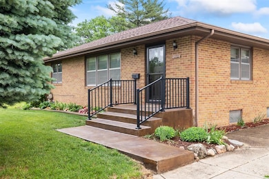
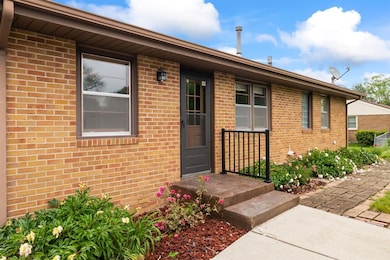
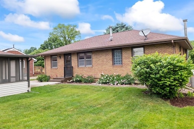
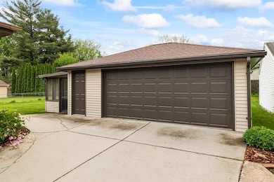
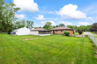
Charming three-bedroom house in the heart of Des Moines Southwest side. Brick exterior adds to the charm of this southside staple ranch plan. The foyer offers access to the dining area and the living room. The kitchen has access to the back door, stairs and a door to the third bedroom that can be used as an additional dining space or office. The finish in the lower level is partial and ready for your finishing touches. Property has been well maintained and updated over the years with minimal deferred maintenance. Plenty of recent updates within the past 30 days.
| Date | Type | Sale Price | Title Company |
|---|---|---|---|
| Warranty Deed | $229,000 | None Listed On Document | |
| Warranty Deed | $229,000 | None Listed On Document | |
| Interfamily Deed Transfer | -- | None Available | |
| Warranty Deed | $131,500 | -- |
| Date | Status | Loan Amount | Loan Type |
|---|---|---|---|
| Open | $183,200 | New Conventional | |
| Closed | $183,200 | New Conventional | |
| Previous Owner | $112,200 | Purchase Money Mortgage |
| Date | Event | Price | List to Sale | Price per Sq Ft |
|---|---|---|---|---|
| 08/29/2025 08/29/25 | Sold | $229,000 | -1.5% | $223 / Sq Ft |
| 07/20/2025 07/20/25 | Pending | -- | -- | -- |
| 07/07/2025 07/07/25 | For Sale | $232,500 | -- | $227 / Sq Ft |
| Year | Tax Paid | Tax Assessment Tax Assessment Total Assessment is a certain percentage of the fair market value that is determined by local assessors to be the total taxable value of land and additions on the property. | Land | Improvement |
|---|---|---|---|---|
| 2025 | $3,734 | $223,300 | $44,300 | $179,000 |
| 2024 | $3,734 | $200,300 | $39,100 | $161,200 |
| 2023 | $3,602 | $200,300 | $39,100 | $161,200 |
| 2022 | $3,572 | $161,700 | $32,900 | $128,800 |
| 2021 | $3,556 | $161,700 | $32,900 | $128,800 |
| 2020 | $3,688 | $151,100 | $30,700 | $120,400 |
| 2019 | $3,564 | $151,100 | $30,700 | $120,400 |
| 2018 | $3,522 | $141,100 | $28,000 | $113,100 |
| 2017 | $3,156 | $141,100 | $28,000 | $113,100 |
| 2016 | $3,070 | $125,200 | $24,600 | $100,600 |
| 2015 | $3,070 | $125,200 | $24,600 | $100,600 |
| 2014 | $3,060 | $123,900 | $23,900 | $100,000 |
T
Seller's Agent in 2025
Todd Fatino
Modern Realty
(515) 710-0994
4 in this area
33 Total Sales

Buyer's Agent in 2025
Katie Bloom
LPT Realty, LLC
(515) 360-1292
4 in this area
79 Total Sales
Source: Des Moines Area Association of REALTORS®
MLS Number: 721697
APN: 120-01722000000
Disclaimer: Certain information contained herein is derived from information provided by parties other than Homes.com. All information provided is deemed reliable, but is not guaranteed to be accurate and should be independently verified.
![]() IDX information is provided exclusively for personal, non-commercial use, and may not be used for any purpose other than to identify prospective properties consumers may be interested in purchasing. Information is deemed reliable but not guaranteed.
IDX information is provided exclusively for personal, non-commercial use, and may not be used for any purpose other than to identify prospective properties consumers may be interested in purchasing. Information is deemed reliable but not guaranteed.